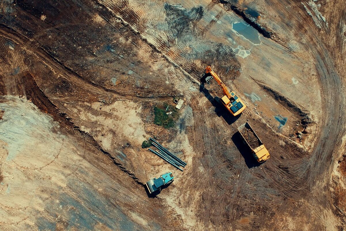
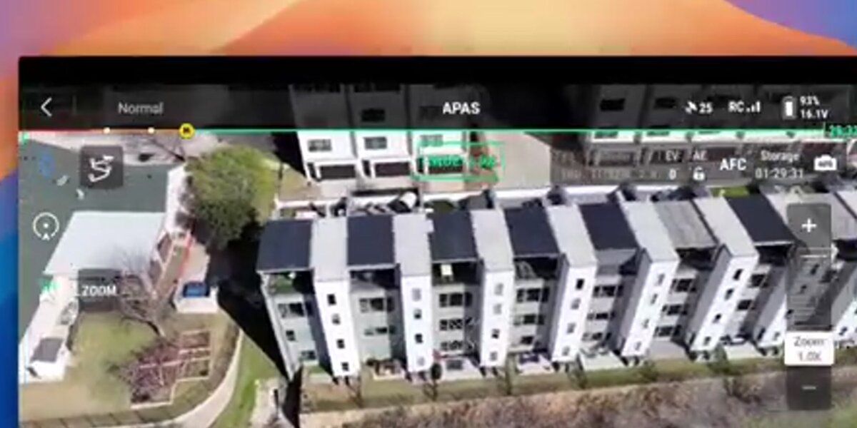
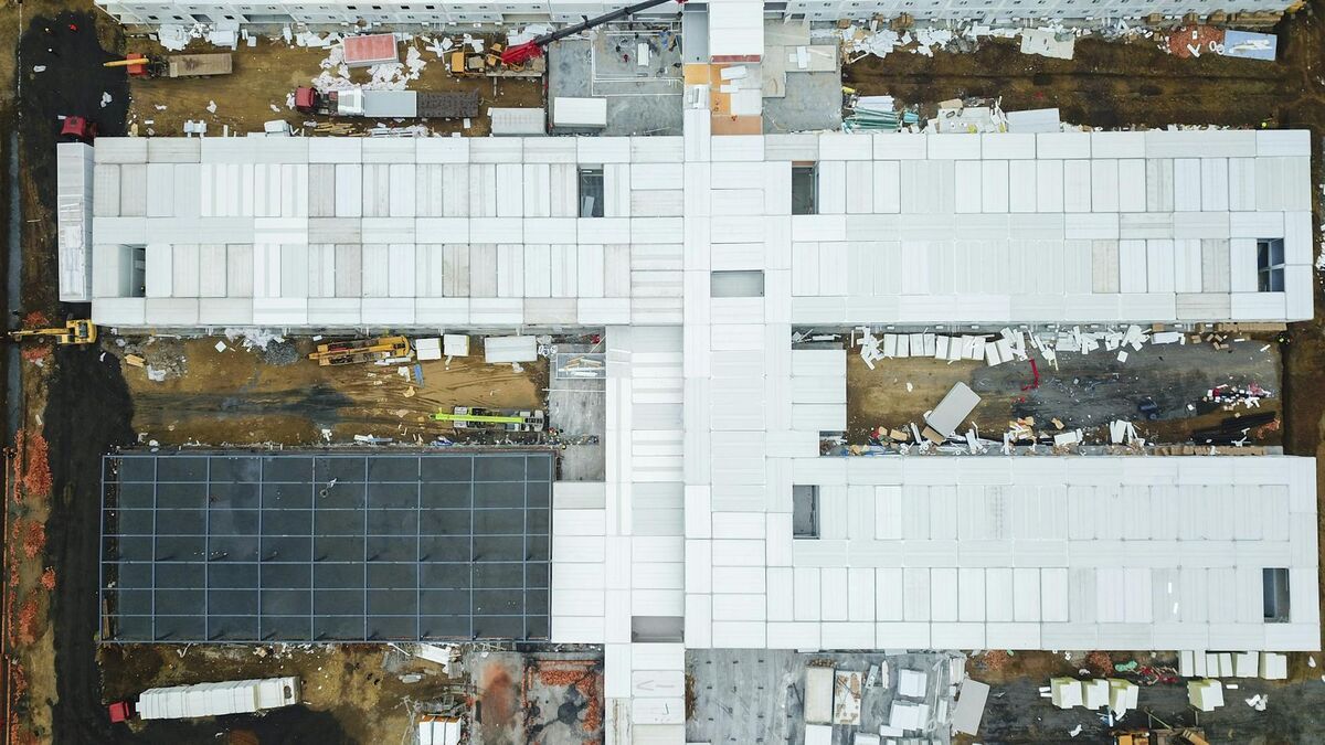
A construction drone is an unmanned aircraft that general contractors, owners, and surveyors fly over job sites to map terrain, track progress, inspect structures, and document what was built. Using a drone for construction replaces hours of walking, tape measuring, and survey crew visits with a 10 to 20 minute flight. This guide covers how drones are used in construction, which drones work best, the rules that apply on a job site, and when to hire construction drone services versus flying in-house. It also explains how videogrammetry (building a measurable 3D model from continuous video) turns ordinary drone footage into site maps and CAD deliverables the same day.
Key Takeaways
- Construction drones cover surveying and mapping, progress records, inspections, stockpile and earthwork volumes, as-built drawings, and owner updates from one flight.
- A good drone for construction records stable 4K video and GPS telemetry; you do not need a specialized mapping aircraft to produce measurable 3D models.
- Every commercial flight in the US needs a Part 107 pilot, Remote ID, and airspace authorization near airports, and flights over workers follow the FAA operations-over-people rules.
- In-house programs pay per model in SkyeBrowse ($24.99 Commercial, $49.99 Pro), while construction drone services make sense for one-off surveys or teams without a pilot.
- Accuracy scales with capture distance: Commercial and Pro models resolve to 0.5 inch and Public Safety & Enterprise to 0.1 inch.
Contents
- What is a construction drone?
- How are drones used in construction?
- What is a good drone for construction work?
- Is it legal to fly a drone over a construction site?
- Should you hire construction drone services or fly in-house?
- How do you turn construction drone footage into deliverables?
- How accurate is construction drone data?
- FAQ
What is a construction drone?
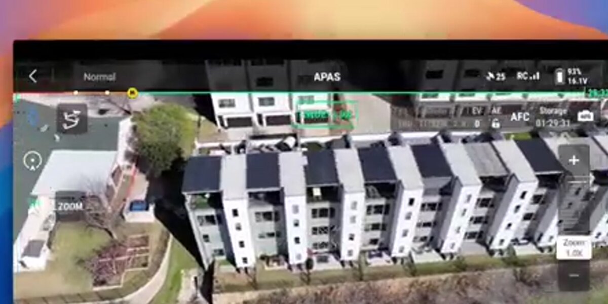
A construction drone is an unmanned aircraft with a high-resolution camera, and often RTK GPS or a thermal sensor, used to capture aerial data on a job site. The footage becomes orthomosaic maps, 3D models, volume measurements, and inspection records that project teams review in a browser instead of walking the site.
Most construction drones are compact multirotors that fold into a truck toolbox and fly for 30 to 45 minutes per battery. Larger enterprise aircraft carry interchangeable payloads such as zoom, thermal, or lidar sensors, and fixed-wing VTOL drones cover hundreds of acres for highway and pipeline corridors. The aircraft is only half of the system. The other half is the processing software that turns photos or video into measurable maps and models.
That second half has changed more than the hardware. Traditional photogrammetry needs a planned grid of overlapping still photos and hours of processing. Video-based platforms accept a simple orbit or manual flight and return a measurable model in minutes, which is why a superintendent with a Part 107 certificate can now run a drone program without a GIS department.
How are drones used in construction?
Drones are used in construction for site surveying and mapping, progress tracking, structural and roof inspections, stockpile and earthwork volumes, as-built documentation, safety audits, and owner or marketing updates. One flight can serve several of these at once because the same model holds the map, the measurements, and the visual record.
The most common uses, in roughly the order a project encounters them:
- Pre-construction site survey. Map existing conditions, drainage, access roads, and neighboring structures before design is final. An orthomosaic gives the design team a current, scale-correct base map.
- Earthwork and stockpiles. Calculate stockpile volumes and cut-and-fill quantities to verify hauling and grading against the estimate.
- Progress tracking. Fly the same path weekly so the owner, lender, and subcontractors see dated conditions side by side. The full workflow is covered in our construction progress monitoring guide.
- Inspections. Check roofs, facades, and high work without lifts or scaffolding; see drone facade inspection.
- As-built documentation. Turn a closeout flight and an interior phone walk-through into site plans, floor plans, and wall elevations; see how to create as-built drawings from a drone scan.
- Safety and logistics. Review laydown areas, crane swing zones, fall hazards, and traffic routes from above before a toolbox talk.
- Owner and marketing updates. Share a 3D model link or flythrough video instead of a folder of photos.
For teams focused on site models, volumes, and survey replacement specifically, our 3D mapping for construction guide goes deeper on that workflow.
What is a good drone for construction work?
A good drone for construction records stable 4K video, logs GPS telemetry for georeferencing, flies long enough to cover the site on one or two batteries, and is allowed on your projects. For most contractors that means a DJI Mavic 3 Enterprise or Matrice 4E class aircraft; small sites can start with a Mini 4 Pro.
| Drone class | Examples | Best for | SkyeBrowse capture |
|---|---|---|---|
| Compact mapping drone | DJI Mavic 3 Enterprise (M3E), Matrice 4E | Weekly mapping, volumes, as-builts on most sites | Flight App Orbit and WideBrowse (DJI RC Pro required) |
| Heavy-lift enterprise | DJI Matrice 350 RTK, Matrice 400 | Large sites, interchangeable payloads, high wind | Flight App Orbit and WideBrowse |
| Small consumer drone | DJI Mini 4 Pro | Single buildings, residential, budget programs | Flight App with the required controller, or Universal Upload |
| US-made enterprise | Skydio X10 | Projects that prohibit Chinese-made aircraft | Manual flight plus Universal Upload |
| Autel | EVO II series | Mixed fleets | Flight App on iOS for EVO II V1/V2, otherwise Universal Upload |
Check the current supported drones list before buying, since automated mission support depends on the drone and controller. Any drone that records .MP4 or .MOV video works through Universal Upload when flown manually.
Two buying considerations come up on most commercial projects. First, some federal, state, and owner contracts restrict Chinese-made aircraft, so confirm the policy before standardizing a fleet. Second, the FCC added foreign-made drones to its Covered List in December 2025, which blocks equipment authorization for new models; aircraft authorized before then remain legal to own and fly.
You do not need lidar for most construction documentation. Lidar payloads are mainly bought for bare-earth mapping under heavy vegetation, and they add significant cost. RTK is worth it when deliverables must sit on certified survey coordinates.
Is it legal to fly a drone over a construction site?
Yes, flying a drone over a construction site is legal when the flight follows FAA rules. The pilot needs a Part 107 certificate, the aircraft must broadcast Remote ID, and controlled airspace requires LAANC or FAA authorization. Flights over workers who are not part of the operation must meet the FAA operations-over-people requirements.
Commercial flights, including documenting your own company's project, fall under FAA Part 107. The key rules for job sites:
- Pilot certification: a Part 107 remote pilot certificate, renewed with recurrent training every 24 months.
- Remote ID: the aircraft must broadcast Remote ID, built in or through a broadcast module.
- Airspace: sites near airports need LAANC authorization, which approved apps issue in minutes for most locations.
- People below: routine flight over crews requires an aircraft that meets one of the operations over people categories, or a flight plan that keeps the drone off to the side of active work.
- Permission: get written approval from the site owner and general contractor, and follow the site-specific safety plan and any local ordinances.
Many general contractors also require proof of drone liability insurance before a pilot can fly on their site.
Should you hire construction drone services or fly in-house?
Hire construction drone services for one-off surveys, certified survey deliverables, or when no one on the team holds a Part 107 certificate. Fly in-house when you need frequent flights across several sites, because a trained superintendent with a drone and pay-per-model software costs far less per flight than repeated service visits.
Construction drone services are usually priced per visit or per acre, plus mobilization, and the price climbs with deliverable complexity, travel distance, and turnaround. A good provider will specify the deliverable formats, accuracy method, delivery time, and data ownership in writing. Ask whether they use ground control or RTK when you need survey coordinates, and whether you can open the models without buying their software.
An in-house program changes the math once flights become regular. In SkyeBrowse, a Commercial model costs $24.99 and stays available for three months with measuring and sharing, and a Pro model costs $49.99 ($39.99 with annual billing) for a year of storage plus exports and AI CAD tools. Commercial plans include up to five users with no seat fees, so the superintendent, project manager, and owner's rep all work from the same models.
Many firms mix both: they fly weekly in-house for progress and volumes, and bring in a licensed surveyor for certified topographic or as-built surveys. Our best construction progress monitoring tools comparison covers the software side of that decision.
How do you turn construction drone footage into deliverables?
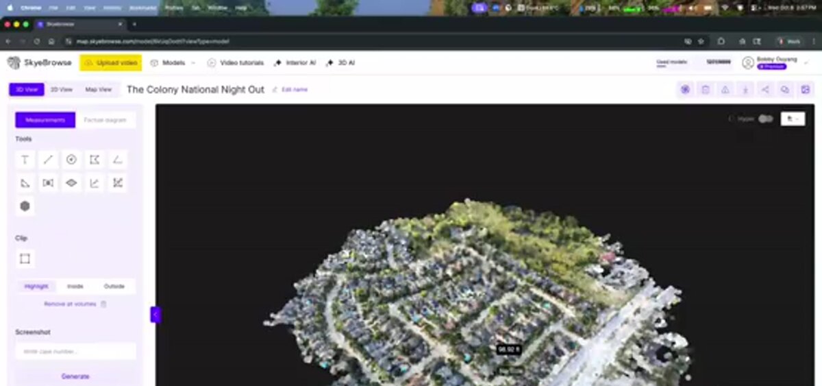
Upload the drone video to a cloud processing platform, which builds a 3D model and orthomosaic you can measure, annotate, and share. With SkyeBrowse, a .MP4 or .MOV file and its GPS telemetry become a georeferenced model in minutes, ready for volumes, measurements, CAD site plans, and exports.
The SkyeBrowse workflow has four steps:
- Fly. Use the SkyeBrowse Flight App's Orbit mode for a building or small site, or WideBrowse grid missions for sites over an acre. Manual flights from any drone work too.
- Upload. Send the video and its .SRT (DJI) or .ASS (Autel) telemetry file through Universal Upload at app.skyebrowse.com so the model is georeferenced.
- Process. Cloud processing runs at roughly one minute per minute of video, so a morning flight is reviewable before the afternoon coordination meeting.
- Use the model. Measure distances, areas, and volumes, annotate issues, and share a link with anyone on the project.
Pro models and Public Safety & Enterprise add exports and AI CAD tools: point clouds (LAZ), meshes (GLB, OBJ, USDZ), GeoTIFF orthomosaics, and AI Site Plan, AI Floor Plans, and AI Wall Elevation exported as DXF or GeoJSON for AutoCAD, Civil 3D, Revit, and GIS. Commercial models cover viewing, measuring, and sharing for three months without exports.
How accurate is construction drone data?
Construction drone data accuracy depends on how close the drone captures the subject and how the model is tied to coordinates. SkyeBrowse Commercial and Pro models resolve to 0.5 inch and Public Safety & Enterprise to 0.1 inch, which is survey-grade detail for progress, volumes, and as-builts. In an independent accuracy study by AirBorne Works, SkyeBrowse video models came closest to Leica BLK360 laser-scan ground truth on 8 of 9 measurements, outperforming photo-based Pix4D Mapper and Leica BLK3D. RTK or ground control adds certified coordinates.
Two numbers matter. Relative accuracy describes measurements inside the model, such as wall lengths, slab dimensions, and stockpile volumes. Absolute accuracy describes where the model sits on the earth. Videogrammetry delivers relative accuracy that improves the closer you fly, so lower orbits around a structure capture finer detail than a high grid pass. Drone GPS telemetry georeferences the model automatically; an RTK drone or a few ground control points tie it to state-plane survey coordinates when a deliverable must match the civil plans exactly.
For quantity verification, most teams compare each new model against the previous flight on the same coordinates, which keeps week-to-week changes consistent even before survey control is added.
FAQ
What is a good drone for construction work?
A good drone for construction records stable 4K video, logs GPS telemetry, and is allowed on your projects. Common choices are the DJI Mavic 3 Enterprise and Matrice 4E for mapping, Matrice 350 or 400 class aircraft for heavy payloads, and the Mini 4 Pro for small sites. Check the supported drones list for automated mission support.
Is it illegal to fly a drone over a construction site?
No, as long as the flight follows FAA rules: a Part 107 certificate, Remote ID, and airspace authorization near airports. Flying over people who are not part of the operation is limited to aircraft that meet the FAA operations-over-people categories. Get the site owner's and general contractor's permission and check local rules.
Are DJI drones banned for construction use in the US?
No. In December 2025 the FCC added foreign-made drones to its Covered List, which blocks new equipment authorizations for future models. Drones authorized before that date can still be owned, flown, and sold. Some federal, state, and owner contracts prohibit Chinese-made aircraft, so check the project's requirements.
How much do construction drone services cost?
Construction drone services are usually priced per site visit or per acre, plus mobilization, and the price rises with deliverable complexity and flight frequency. Teams that fly in-house and process video in SkyeBrowse pay per model: $24.99 for a Commercial model or $49.99 for a Pro model with exports and AI CAD tools. See current pricing.
Do I need a Part 107 license to fly a drone for construction?
Yes. Any drone flight for a business purpose in the US, including documenting your own job site, requires an FAA Part 107 remote pilot certificate. The pilot must also register the aircraft, broadcast Remote ID, and get LAANC or FAA authorization in controlled airspace.
Upload your first video free. Create a free SkyeBrowse account, upload a drone video, and get a 3D model processed in the cloud. Freemium organizations that have never had a paid plan can get their first full model for $5 (normally $24.99), with every Pro tool and export and 90-day storage.