Photogrammetry software converts overlapping photographs or drone video into measurable 3D models and 2D maps, and by 2026 the category spans desktop research tools, enterprise cloud platforms, drone-specific apps, and mobile scanning apps. Choosing the right photogrammetry software means matching input type (photos vs. video), processing environment (cloud vs. desktop), accuracy tier, and price to the job at hand. This guide compares eight leading photogrammetry software platforms, Pix4D, DroneDeploy, Agisoft Metashape, RealityScan (formerly RealityCapture), 3DF Zephyr, Meshroom, OpenDroneMap, and SkyeBrowse, side by side so you can make that call in minutes. Prices were re-verified on each vendor's site in October 2026.
Already know which slice of the market you need? Jump straight to the option that matches your budget or hardware: our guide to free photogrammetry software covers the no-cost tools, best photogrammetry app covers mobile-first capture, and drone photogrammetry software covers dedicated drone mapping platforms. The comparison below spans the full category, desktop, cloud, drone, and mobile, in one place.
Key Takeaways
- This comparison spans the full photogrammetry software category, desktop research tools, enterprise cloud platforms, drone-specific apps, and mobile scanning apps, not one narrow slice.
- Pix4D and DroneDeploy are the strongest all-around platforms for large-scale survey and construction workflows requiring ground control point (GCP) precision.
- Agisoft Metashape remains the top choice for research and offline processing where full algorithmic control and offline processing are required.
- SkyeBrowse is the only videogrammetry platform in this comparison: it accepts drone video instead of photos, cutting field capture time and delivering a model in minutes at survey-grade accuracy (0.1 inch on Public Safety & Enterprise) without ground control points.
- Free options are viable for limited projects: OpenDroneMap (self-hosted, unlimited), Meshroom (open source, NVIDIA GPU), RealityScan (free under $1 million revenue), and 3DF Zephyr Free (up to 50 photos) are the strongest no-cost entries, alongside SkyeBrowse's free tier for basic video uploads.
Contents
- What is the best photogrammetry software?
- What is photogrammetry software and how does it work?
- How do the top platforms compare?
- How do you choose photogrammetry software?
- Which photogrammetry software is best for drones?
- What is the best free photogrammetry software?
- How does SkyeBrowse differ from traditional photogrammetry tools?
- FAQ
What is the best photogrammetry software?
Photogrammetry software selection depends on your use case and workflow: no single platform wins every metric. For large-scale survey and construction projects requiring ground control point precision, Pix4D and DroneDeploy are the industry-leading choices. For research-grade desktop processing with maximum algorithmic control, Agisoft Metashape is unmatched. SkyeBrowse is the fastest option for public safety, insurance, and rapid-response teams: it accepts drone video rather than photos, producing a georeferenced 3D model in minutes without a desktop GPU.
The decision typically comes down to four variables: input type (photos vs. video), processing environment (cloud vs. desktop), required accuracy tier, and mission tempo. A highway crash investigator who needs a defensible 3D model before the road reopens has entirely different requirements from a geospatial engineer producing survey-grade deliverables for a land boundary dispute. Unlike guides that focus on a single slice of the market, this comparison covers desktop, cloud, drone, and mobile photogrammetry software side by side, because most buyers are choosing across categories, not just within one.
For teams new to aerial mapping, our overview of what is photogrammetry explains the underlying science for those building a foundational understanding before committing to a platform. Buyers weighing tools beyond pure photogrammetry can also compare the broader 3D mapping software landscape, which spans surveying, construction, and reality-capture platforms alongside the drone-focused options here.
What is photogrammetry software and how does it work?
Photogrammetry software reconstructs 3D geometry from sets of overlapping 2D images using a computational technique called structure-from-motion (SfM). The software identifies matching features across hundreds or thousands of photos, calculates the position and orientation of each camera at the moment of capture, and builds a dense point cloud that is then converted into a textured 3D mesh or an orthomosaic, a geometrically corrected 2D map. Accuracy depends on image overlap, camera calibration, and the use of ground control points (GCPs).
The American Society for Photogrammetry and Remote Sensing (ASPRS) defines photogrammetric mapping accuracy standards in its Positional Accuracy Standards for Digital Geospatial Data, which set the benchmarks most professional survey workflows are designed to meet. The ASPRS Positional Accuracy Standards define horizontal accuracy classes by RMSE, giving project managers a framework for specifying deliverable requirements before selecting software.
Modern drone mapping software has made photogrammetric workflows accessible to non-surveyors. Platforms like DroneDeploy and Pix4D automate most of the SfM pipeline (flight planning, image alignment, and export) so operators without photogrammetry backgrounds can produce georeferenced outputs. The USGS 3D Elevation Program relies on similar lidar-and-photogrammetry hybrid workflows to maintain national elevation datasets, illustrating how deeply photogrammetry is now embedded in core infrastructure mapping.
How do the top platforms compare?
The eight major photogrammetry and videogrammetry platforms each occupy a distinct niche defined by input type, processing environment, output formats, and price. Pix4D and DroneDeploy dominate enterprise drone workflows; Agisoft Metashape leads for offline processing with full parameter control; RealityScan excels at speed for large datasets; OpenDroneMap, Meshroom, and 3DF Zephyr cover the free and low-cost tier; and SkyeBrowse stands alone as a video-input platform built for speed, survey-grade accuracy, and rapid deployment.
The table below summarizes the key decision variables across all eight platforms, spanning desktop, cloud, drone, and mobile options in a single view. Because this comparison spans every deployment model, check the Processing and Output Formats columns closely: a desktop GPU requirement or a missing export format can rule out a platform before price ever becomes the deciding factor.
| Platform | Price | Input Type | Processing | Output Formats | Accuracy | Best For | Free Tier |
|---|---|---|---|---|---|---|---|
| Pix4D | PIX4Dmatic from $2,290/yr; PIX4Dmapper from $333/mo | Photos | Cloud or desktop | GeoTIFF, LAS/LAZ, OBJ, PDF report | Survey-grade with GCPs | Large-scale survey, agriculture, construction | No (trial only) |
| DroneDeploy | From $4,188/yr (Flight & Analysis); team plans by quote | Photos | Cloud | GeoTIFF, LAS/LAZ, OBJ | High (GCP support) | Construction progress, enterprise AEC | No (14-day trial) |
| Agisoft Metashape | $179 Standard / $3,499 Professional (perpetual) | Photos | Desktop (GPU) | OBJ, PLY, LAS/LAZ, GeoTIFF | Survey-grade with GCPs | Research, archaeology, forensics | 30-day trial |
| RealityScan (formerly RealityCapture) | Free under $1M revenue; $1,250/seat/yr above | Photos + laser | Desktop (GPU) | OBJ, PLY, LAS/LAZ, FBX | Survey-grade with GCPs | Large datasets, VFX, cultural heritage | Yes (under $1M revenue) |
| 3DF Zephyr | Free to €4,200 (Pro perpetual) | Photos | Desktop | OBJ, PLY, LAS | High | Small to mid projects, education | Yes (50 photos) |
| Meshroom | Free (open source) | Photos | Desktop (NVIDIA CUDA) | OBJ, PLY, textured mesh | High for objects and scenes | Hobbyists, research, 3D assets | Yes (unlimited) |
| OpenDroneMap | Free (self-hosted) | Photos | Self-hosted | GeoTIFF, LAS/LAZ, OBJ, MBTiles | Survey-grade | Budget-conscious, open-source workflows | Yes (unlimited) |
| SkyeBrowse | Free; $24.99 to $199 per model | Video | Cloud | LAZ, GLB, OBJ, USDZ, GeoTIFF | 0.5 inch (Commercial and Pro) to 0.1 inch (Public Safety & Enterprise) | Public safety, insurance, rapid response | Yes (basic) |

Prices re-verified on each vendor's site in October 2026.
How do you choose photogrammetry software?
Choose photogrammetry software by scoring six things against the job: accuracy you can document, processing speed from capture to deliverable, output formats your GIS or CAD tools accept, where processing runs (desktop GPU or cloud), security and compliance for sensitive data, and the pricing unit (per model, per seat, or perpetual). The platform that wins on the two or three criteria your deliverable depends on is the right one.
| Criterion | What to check | Where platforms differ |
|---|---|---|
| Accuracy | Published accuracy figures, GCP or RTK requirements, scale verification | Pix4D, DroneDeploy, and Metashape reach survey-grade with GCPs; SkyeBrowse reaches 0.1 inch on Public Safety & Enterprise without GCPs |
| Processing speed | Time from landing to a measurable model | Desktop tools take hours on large photo sets; SkyeBrowse processes about 1 minute per minute of video in the cloud |
| Output formats | LAS/LAZ point clouds, GeoTIFF orthomosaics, OBJ/GLB meshes, DSMs | Meshroom outputs meshes only; drone platforms add georeferenced orthomosaics |
| GIS and CAD integration | Import into ArcGIS, QGIS, AutoCAD, Civil 3D | Any tool exporting LAZ and GeoTIFF works; Pix4D and DroneDeploy add direct integrations |
| Security and compliance | Hosting, chain of custody, CJIS for law enforcement | Desktop tools keep data local; SkyeBrowse runs on AWS GovCloud (US) with full CJIS compliance on Public Safety & Enterprise |
| Pricing unit | Per model, annual seat, subscription, or perpetual | SkyeBrowse prices per model; Pix4D and DroneDeploy sell annual plans; Metashape and 3DF Zephyr sell perpetual licenses |
For large-scale aerial surveys with dense point clouds, prioritize LAZ export, GCP or RTK support, and processing that does not stall on thousands of images. For construction site documentation with enterprise security requirements, weigh where the data is hosted and who can access it as heavily as accuracy. For teams comparing 3D photogrammetry software for objects and assets rather than terrain, mesh quality and texture resolution matter more than georeferencing.
Which photogrammetry software is best for drones?
For drone-based photogrammetry, the best platform depends on output type and mission tempo. Pix4D offers the deepest integration with DJI enterprise hardware and supports the most rigorous GCP and oblique flight workflows. DroneDeploy provides the most polished end-to-end cloud experience for construction teams. SkyeBrowse is the fastest option for teams that want a 3D model within minutes of landing, by capturing video instead of individual stills, operators avoid the time-consuming photo sorting and alignment setup that other platforms require.
Pix4D's strength lies in its comprehensive flight-planning app (Pix4Dcapture) and deep integration with the entire SfM pipeline, from GCP placement through orthomosaic export. It handles oblique imagery well and supports multi-spectral inputs for agriculture use cases, a major differentiator. Combined with RTK drone hardware and properly placed GCPs, it produces survey-grade deliverables that teams validate against the ASPRS positional accuracy classes.
DroneDeploy's cloud-first model means no desktop GPU is required, and its progress-monitoring dashboards are purpose-built for construction project managers who want side-by-side comparison of site conditions across weeks or months. Its automated flight app covers most commercial DJI hardware natively.
For teams operating under time pressure (crash investigators, fire scene analysts, insurance adjusters reaching a loss site), neither platform's photo-based workflow is fast enough. That gap is where SkyeBrowse's video-input approach becomes decisive. Our overview of photogrammetry software for drones covers the free end of this category in depth for budget-constrained teams.
What is the best free photogrammetry software?
OpenDroneMap (ODM) is the most capable free photogrammetry option available. Self-hosted through its WebODM interface, it processes unlimited photos and produces point clouds, orthomosaics, and digital surface models with no per-model fees. 3DF Zephyr Free is the easiest free desktop option for beginners, capped at 50 source photos. Meshroom is the strongest free open-source option for object and scene meshing, and RealityScan is free for individuals and businesses under $1 million in annual revenue.
For teams that want truly unlimited free drone mapping software without recurring fees, OpenDroneMap is the clear winner, but it requires a machine with a capable CPU or GPU and some comfort with self-hosted infrastructure. Docker-based deployment is well-documented, and the open-source community is active.
3DF Zephyr Free sits at the opposite end: a one-click Windows installer, no server configuration, and immediate access to a guided reconstruction wizard. The 50-photo ceiling limits it to small subjects (an individual building, a piece of equipment, or a crash vehicle), but for students, researchers testing workflows, or operators who only occasionally need 3D models, it costs nothing.
Meshroom, built on the open-source AliceVision framework, is the free choice for turning photo sets into textured meshes of objects, buildings, and scenes. It runs on Windows and Linux and needs an NVIDIA GPU with CUDA for dense reconstruction. It produces meshes rather than georeferenced orthomosaics, so drone mapping teams usually pick OpenDroneMap for maps and Meshroom for 3D assets.
RealityScan, Epic Games' renamed RealityCapture desktop application, is free for individuals, students, educators, and businesses earning under $1 million a year, and $1,250 per seat per year above that, verified on realityscan.com in October 2026. Agisoft Metashape's 30-day trial is fully functional, with no photo limit, which suits a one-time project that needs professional output without a long-term license commitment.
How does SkyeBrowse differ from traditional photogrammetry tools?
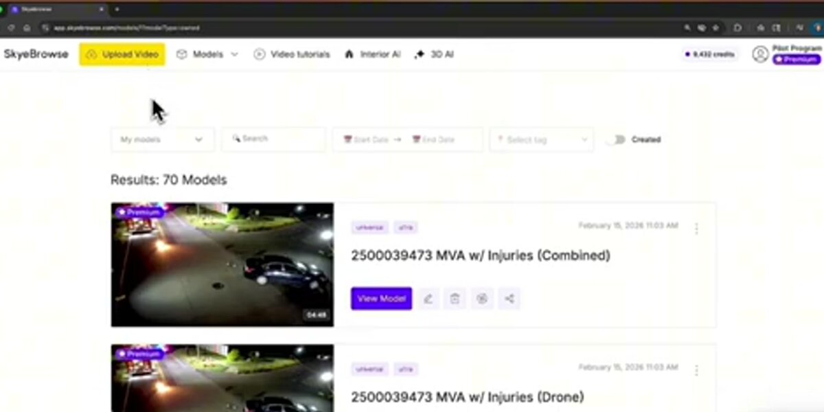
SkyeBrowse is a videogrammetry platform rather than a conventional photogrammetry tool. Instead of capturing, sorting, and aligning thousands of still images, operators fly a standard drone video pass over a scene, upload the .MP4 or .MOV file through a mobile app or browser, and receive a georeferenced 3D model and 2D orthomosaic in the cloud, typically within minutes. There is no GPU workstation required, no photo overlap calculation, and no image-by-image alignment to manage. This architecture is specifically designed for rapid-response use cases where a model must exist before the scene is cleared.
The distinction between photogrammetry and videogrammetry is more than a marketing label. Traditional SfM pipelines require operators to plan flight paths for optimal image overlap (typically 75-85% frontal, 60-70% side), export and organize hundreds to thousands of JPEG files, and run alignment passes that can take hours on consumer hardware. SkyeBrowse's cloud processing engine pulls frames directly from video at consistent intervals, handles telemetry pairing with .SRT (DJI) or .ASS (Autel) subtitle files for georeferencing, and queues models automatically.
Accuracy tiers at SkyeBrowse scale with processing tier, and because videogrammetry accuracy scales with capture distance, flying closer or walking a phone camera next to the object of interest reaches survey-grade results at every tier: Commercial and Pro (8K processing) reach 0.5 inch, and Public Safety & Enterprise (16K with AI moving-object removal) achieves 0.1 inch. In an independent accuracy study by AirBorne Works, SkyeBrowse video models came closest to Leica BLK360 laser-scan ground truth on 8 of 9 measurements, outperforming photo-based Pix4D Mapper and Leica BLK3D. Pricing scales the same way: Freemium is free for basic uploads, and Commercial, Pro, and Public Safety & Enterprise are priced per model at $24.99, $49.99, and $199. Models export as LAZ point clouds, GLB 3D meshes, and GeoTIFF orthomosaics, the same format ecosystem used by traditional platforms.
More than 1,200 agencies, most of them in public safety, use SkyeBrowse for crash reconstruction, crime scene documentation, and fire investigation. The differentiator is speed: a defensible, measurable 3D model exists before the crew leaves the scene, built on the same survey-grade accuracy tiers described above. For a deeper look at how SkyeBrowse stacks up against specific competitors, see the head-to-head comparisons with RealityCapture and OpenDroneMap.
FAQ
What is the best photogrammetry software?
The best photogrammetry software depends on your priorities. For survey-grade accuracy with drone photos, Pix4D and DroneDeploy are the industry standards. For research and maximum desktop control, Agisoft Metashape leads. For rapid model generation from drone video (no desktop GPU, no photo management), SkyeBrowse is the fastest option. For zero cost, OpenDroneMap (self-hosted) gives you unlimited processing with no license fees.
What is the best free photogrammetry software?
OpenDroneMap (via WebODM) is the most capable free and open-source photogrammetry option for drone mapping, supporting full orthomosaic and point cloud outputs with no photo limit. Meshroom is the strongest free open-source option for object and scene meshing on an NVIDIA GPU, RealityScan is free for businesses under $1 million in revenue, and 3DF Zephyr Free handles up to 50 photos with a simple desktop installer. Agisoft Metashape offers a fully functional 30-day trial. For cloud-based use, SkyeBrowse offers a free basic tier for video uploads. See our full breakdown of free drone mapping software options.
What is the difference between photogrammetry and videogrammetry?
Photogrammetry reconstructs 3D geometry by aligning overlapping still photographs using structure-from-motion algorithms. Videogrammetry, the approach used by SkyeBrowse, extracts frames directly from drone video, skipping the photo capture and file management steps. This cuts field time significantly and allows cloud processing to begin immediately after landing, and SkyeBrowse reaches survey-grade accuracy (0.1 inch on Public Safety & Enterprise) without ground control points.
Which photogrammetry software is best for drones?
The answer depends on use case. Pix4D and DroneDeploy lead for large-scale survey and construction requiring precise GCP workflows and multi-mission progress tracking. Agisoft Metashape is the preferred desktop choice for research, archaeology, and maximum accuracy. SkyeBrowse is the fastest option for public safety and rapid-response teams that capture video rather than photos. OpenDroneMap is the best free self-hosted alternative for budget-conscious operators.
What is the best photogrammetry software for beginners?
For beginners, cloud-based platforms are the easiest entry point. DroneDeploy and SkyeBrowse both offer guided upload workflows with no manual alignment or desktop configuration required: upload a file, receive a model. 3DF Zephyr Free is the simplest no-cost desktop option with a guided reconstruction wizard. Agisoft Metashape has a steeper learning curve but provides the most control as your skills advance. Most platforms offer free trials or tiered pricing, so testing before committing to a subscription is straightforward.
Is Meshroom free?
Yes. Meshroom is free, open-source photogrammetry software built on the AliceVision framework, with releases for Windows and Linux. Its dense reconstruction needs an NVIDIA GPU with CUDA support, and it outputs textured meshes rather than georeferenced orthomosaics, so drone mapping teams usually pair it with or choose OpenDroneMap instead.
What is Pix4D software?
Pix4D is a Swiss suite of photogrammetry software for drone and terrestrial mapping. PIX4Dmatic processes large drone datasets on a desktop and starts at $2,290 per year, PIX4Dmapper is the legacy desktop engine listed from $333 per month, PIX4Dcloud handles online processing, and PIX4Dcatch turns a phone into a capture device.
Is photogrammetry software hard to learn?
Cloud platforms like DroneDeploy and SkyeBrowse are designed for non-specialists and require minimal technical knowledge: upload a file, receive a model. Desktop tools like Agisoft Metashape have a steeper learning curve but offer more control over every processing parameter. OpenDroneMap requires comfort with command-line or Docker environments. Most platforms offer free tutorials; the ASPRS also publishes educational resources on photogrammetric methods for practitioners who want a deeper technical foundation.
Upload your first video free. Create a free SkyeBrowse account, upload a drone video, and get a 3D model processed in the cloud. Freemium organizations that have never had a paid plan can get their first full model for $5 (normally $24.99), with every Pro tool and export included and 90-day storage.