Fire pre-plan 3D mapping turns a target hazard into a measurable 3D model that crews can open on a phone before they arrive. It replaces the binder sketch with a model built from a few minutes of drone and phone video using videogrammetry, the process of reconstructing 3D geometry from ordinary video frames. This guide covers what a 3D pre-incident plan contains, how to capture a building inside and out, how to mark hydrants and fire department connections, and how to keep the plan current.
Key Takeaways
- A 3D pre-plan starts from video: one exterior drone flight and a slow interior walkthrough with a phone or 360 camera.
- SkyeBrowse places NFPA-170-style pre-plan icons (hydrants, FDCs, alarm panels, suppression equipment) directly on the model, on desktop or phone.
- Crews open the plan from a shared link, walk the approach at eye level, and step through auto-generated interior images.
- Public Safety & Enterprise costs $199 per model per year with unlimited users, 5-year storage, and 0.1 inch accuracy.
- Practice models make re-capturing a changed building cheap, so plans stay current.
Contents
- What is fire pre-plan 3D mapping and how does it differ from a paper pre-plan?
- What should a 3D pre-incident plan show?
- How do you capture a building and its exterior for a pre-plan?
- How do you place hydrants, FDCs, and hazard markers on the 3D model?
- How do crews use the pre-plan on scene?
- Which fire department mapping software supports pre-plans, and what does it cost?
- How often should a 3D pre-plan be refreshed?
- FAQ
What is fire pre-plan 3D mapping and how does it differ from a paper pre-plan?
Fire pre-plan 3D mapping is the practice of documenting a target hazard as a measurable 3D model with pre-plan symbols placed on it. A paper pre-plan shows a top-down sketch and a few photos. A 3D pre-plan shows the actual building, its roofline, its access points, and its fire protection equipment in place, so crews can read height, distance, and layout at a glance.
Pre-incident planning guidance from the former NFPA 1620, now consolidated into NFPA 1660, still asks departments to record construction, occupancy, fire protection systems, water supply, utilities, and special hazards. What changes is the medium. A sketch gets redrawn after every renovation; a model gets re-flown in an afternoon.
The bigger difference is spatial: an officer can measure a parapet height or canopy clearance instead of guessing from a sketch. Departments like Albemarle County Fire Rescue use 3D models to pre-plan historic, commercial, and rural structures.
What should a 3D pre-incident plan show?
A 3D pre-incident plan should show the building envelope and roof, every entry and access point, the water supply, and the fire protection systems firefighters will connect to or shut down. That means hydrants, the fire department connection (FDC), standpipes, sprinkler risers, the fire alarm control panel (FACP), utility shutoffs, and exposures. Add hazardous materials locations and any unusual construction.
Work from your department's existing pre-plan form so each field has a place on the model:
- Water supply: nearest hydrants, their distance to the FDC, and alternate supply.
- Fire protection systems: FDC, standpipe connections, sprinkler riser room, fire pump, and the FACP or annunciator.
- Access: main entrance, Knox box, stairwells, roof access, gates, and apparatus approach.
- Utilities: gas meter, electrical shutoff, and any solar or battery systems.
- Hazards and exposures: chemical storage, lightweight truss roofs, and neighboring buildings within reach.
Symbols matter because mutual aid companies need to read the plan without a legend. NFPA 170, the standard for fire safety and emergency symbols, lists pre-incident planning sketches among its intended uses, and the NAPSG Foundation maintains an all-hazards symbology library used across fire, law enforcement, and EMS.
How do you capture a building and its exterior for a pre-plan?
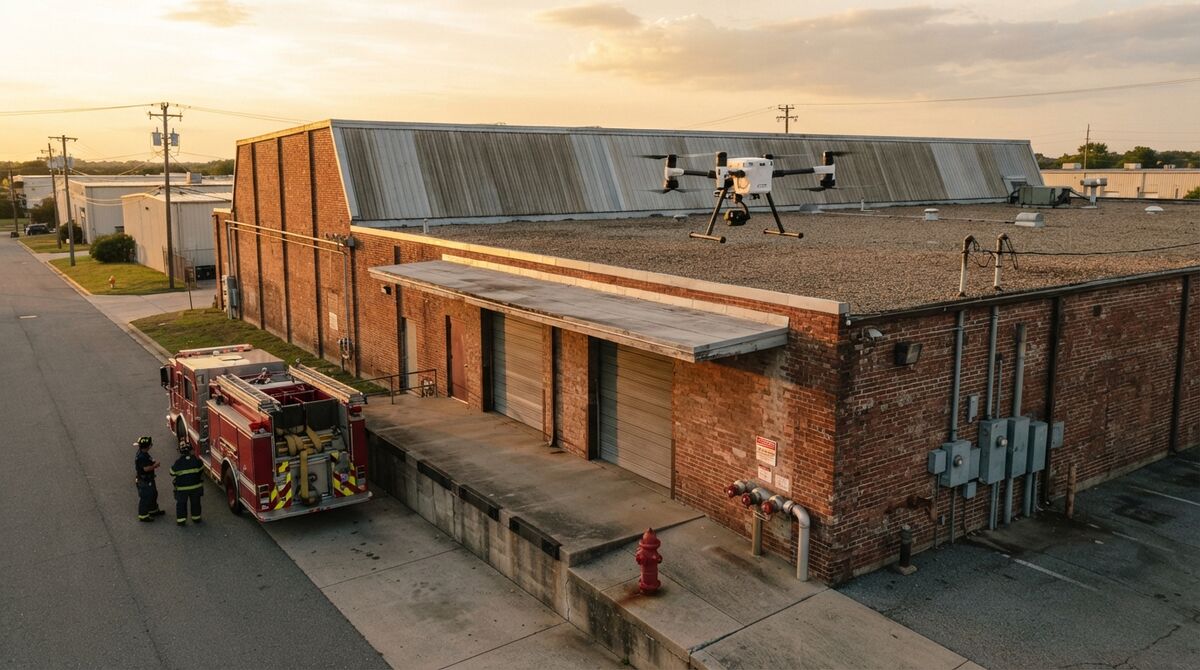
Capture the exterior with one automated drone flight, then walk the interior slowly with a phone or 360 camera. Smaller buildings need an automated orbit flight, while large footprints and high-rises suit a grid with a side scan for the facades. Upload both videos, keep the interior one on the Interior Mapping setting, and combine the models into one scene.
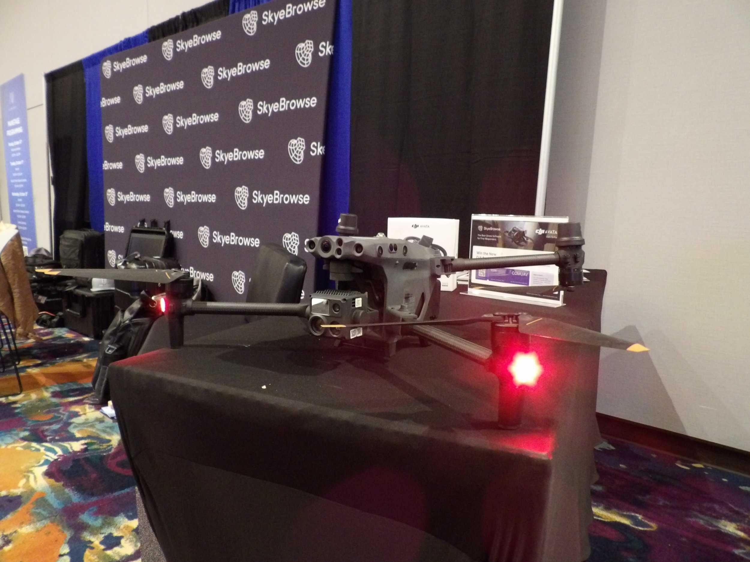
Exterior. The SkyeBrowse Flight App automates the flight on supported aircraft. Orbit mode flies two automated orbits for buildings on under an acre; WideBrowse runs a grid for larger sites, with Side Scan adding an orbital pass for facades and high-rises. Supported aircraft include the DJI M30/M30T, M3E/M3T, Matrice 4E/4T, and Matrice 400 on their compatible controllers; see the supported drones list. Any other drone can fly manually and send its video through Universal Upload, ideally with its .SRT telemetry file for georeferencing. See why the Matrice 4T suits public safety mapping.
Interior. Walk the building at a slow, steady pace with a phone (4K recommended, wide-angle lens) or a 360 camera. Turn on the Interior Mapping option at upload; Public Safety & Enterprise adds Enhanced Interior Mapping for more detailed indoor models. Walk the routes crews would take: entrance to FACP, riser room, stairwells, and roof access.
Combine. With 3D Overlay on Public Safety & Enterprise, the interior model sits inside the exterior model, so one link shows the roof, walls, and rooms together. You can also pin the existing floor plan or sprinkler drawing onto the model as an Image Overlay, another Public Safety & Enterprise tool. The same capture rules apply across SkyeBrowse drone mapping software work.
How do you place hydrants, FDCs, and hazard markers on the 3D model?
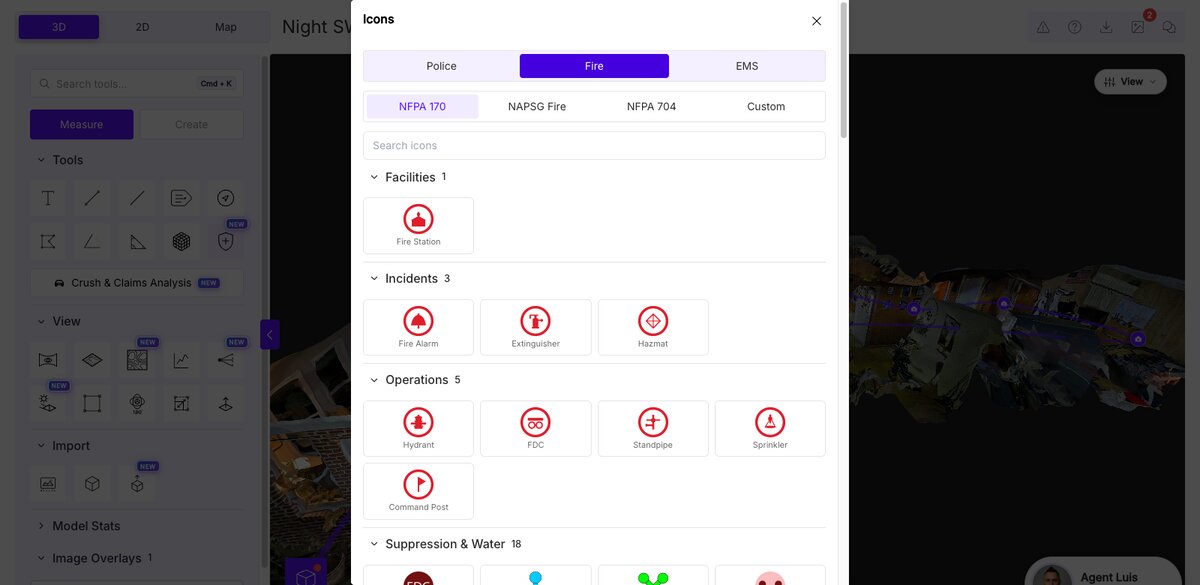
Open the model, choose Icons in the Measure tools, and pick a symbol from the Fire set. The NFPA-170-style pre-plan set covers hydrants, FDCs, standpipes, sprinklers, fire alarm panels, and suppression equipment, and the NAPSG library adds fire, law enforcement, EMS, and all-hazards symbols. Click or tap where the equipment sits and the icon anchors to that spot.
The picker is searchable, so typing "hydrant" finds the symbol fast. Every placed icon appears in the object tree, where you can show, hide, or remove it, and the undo button reverts a marker that lands on the wrong wall.
Placement works with touch, so a prevention officer can finish markup on a tablet during the walkthrough. Annotations carry details a symbol can't, like "FACP in the electrical room, second door left," and the Case Gallery attaches photos of the riser or panel. Icons were announced in the Public Safety Icons and mobile tools update and, like Case Gallery, are included with Public Safety & Enterprise.
How do crews use the pre-plan on scene?
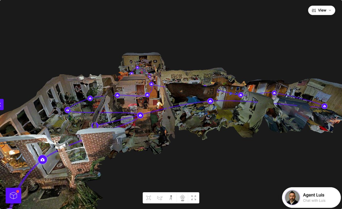
Crews open the pre-plan from a shared link on a phone, tablet, or mobile data terminal, with no software install. They can orbit the building, measure distances with a finger, walk the approach at eye level in Walk Mode, and step through interior images captured along the walkthrough path. Mutual aid companies open the same link.
Several viewer tools answer fireground questions:
- Walk Mode gives a first-person, ground-level view, so an engine officer can preview the walk from the curb to the FDC.
- Image Walkthroughs, on every plan, place clickable images along the capture path, showing exactly what the corridor to the riser room looks like.
- Line of Sight shows what is visible or blocked from a chosen point, such as an aerial device or command post position.
- Sun & Shadow previews light and shadow at any date and time.
Line of Sight and Sun & Shadow need a Pro model or Public Safety & Enterprise. Training teams can also view models in Enterprise VR. The fire department drone operations guide covers investigation and training uses.
Which fire department mapping software supports pre-plans, and what does it cost?
Fire department mapping software for pre-plans needs a measurable 3D model, standardized pre-plan symbols, phone-friendly sharing, and storage that outlasts the plan. SkyeBrowse Public Safety & Enterprise includes all four at $199 per model per year, with unlimited users, 5-year storage, and 0.1 inch accuracy from 16K Ultra processing.
Pricing is per model with no seat fees, which matters when whole shifts and prevention staff need access. Unused models roll over while the subscription stays active. Heavy pre-plan programs can choose an unlimited annual plan starting at $9,999 per year. Building details stay on AWS GovCloud hosting with FedRAMP Impact Level 2, and Public Safety & Enterprise adds full CJIS compliance.
Pro models ($49.99, or $39.99 billed annually) add Line of Sight, Sun & Shadow, exports, and 1-year storage, while Commercial models ($24.99) suit short-term work with 3-month storage; neither includes Icons. Current details live on the pricing page. Compare platforms and SAFER grant funding in the best 3D mapping software for fire departments. Agencies can also request the Pilot Program, a free trial of Public Safety & Enterprise of about two weeks, to build a few pre-plans before committing.
How often should a 3D pre-plan be refreshed?
Refresh a 3D pre-plan whenever the building changes: renovations, new tenants, new hazardous storage, or a change to the sprinkler or alarm system. Otherwise, we recommend a re-capture during the annual inspection cycle. Departments can tighten that cadence for high-risk occupancies.
Upload the new video as a practice model first. Practice models are unlimited on active Commercial and Public Safety & Enterprise subscriptions, don't count against your models, and auto-delete after a month. If the re-capture is good, click Keep to convert it into a regular model with no reprocessing. Five-year storage on Public Safety & Enterprise keeps older versions for comparison or for a post-fire investigation that needs the pre-fire condition.
Prioritize by risk: schools, warehouses, high-rises, and hazardous materials occupancies first. Campus agencies can borrow from campus security preplanning, and the public safety use cases page shows how the same models serve law enforcement partners.
FAQ
Can a fire department build pre-plans with a drone?
Yes. A short drone orbit or grid flight of the exterior plus a slow phone or 360 camera walk through the interior is enough for SkyeBrowse to build a measurable 3D model of a target hazard. Crews then mark hydrants, FDCs, alarm panels, and shutoffs on that model with standardized pre-plan icons.
What is the difference between a pre-plan and a pre-incident plan?
They mean the same thing. Pre-incident plan is the formal term used in NFPA guidance, now carried in NFPA 1660, and pre-plan is the everyday shorthand for the same document.
Do mutual aid companies need an account to open a 3D pre-plan?
No. Anyone with a shared SkyeBrowse public link can explore the model, including its image walkthrough cameras, in a phone or desktop browser. Public Safety & Enterprise also includes unlimited user licenses for crews who need full access.
Ready to build your first 3D pre-plans? Request a quote or ask about the Pilot Program for your department.