CJIS compliant drone mapping means every copy of a scene model, from the aircraft's memory card to the cloud viewer a prosecutor opens, is handled under the FBI's Criminal Justice Information Services (CJIS) Security Policy. That matters because drone mapping turns case footage into a 3D model through videogrammetry, the process of reconstructing measurable 3D geometry from ordinary video frames. This guide covers when drone data becomes criminal justice information, where it travels, what to ask vendors, and what it costs.
Key Takeaways
- The FBI doesn't certify vendors. Your agency owns CJIS compliance, and the vendor supports it by signing the CJIS Security Addendum and meeting the policy's controls.
- Drone data passes through at least seven hand-off points, from the SD card to the evidence system, and each one needs an owner and a control.
- SkyeBrowse is hosted on AWS GovCloud (US) at FedRAMP Impact Level 2, with full CJIS compliance on Public Safety & Enterprise.
- Commercial and Pro plans exclude CJIS, so an agency storing case models should buy Public Safety & Enterprise.
- Public Safety & Enterprise costs $199 per model per year with unlimited users and 5-year storage.
Contents
- What does CJIS compliant drone mapping mean?
- When does drone footage or a 3D scene model become criminal justice information?
- Where does drone mapping data travel, and which steps need controls?
- What hosting and access controls should a drone mapping vendor provide?
- Which SkyeBrowse plan is CJIS compliant?
- What should a drone mapping RFP ask about CJIS?
- How much does CJIS compliant drone mapping cost?
- FAQ
What does CJIS compliant drone mapping mean?
CJIS compliant drone mapping is a drone-to-3D workflow whose storage, access, and sharing meet the FBI CJIS Security Policy. The policy binds the agency and anyone who handles its criminal justice information. Vendors support the agency's compliance through a signed addendum and technical controls.
The FBI's CJIS Security Policy is the rulebook. Version 6.1, dated June 2026, is current, and its control areas follow the federal catalog in NIST SP 800-53: access control, audit logging, identification and authentication, encryption, personnel screening, and incident response.
The FBI doesn't certify vendors or products. Private vendors that store or process CJI for an agency sign the CJIS Security Addendum, and staff with access complete background checks and security awareness training. Your CJIS Systems Officer, working with the state CJIS Systems Agency, decides whether a vendor's controls are enough. The broader platform comparison and FBI audit preparation live in our CJIS-compliant mapping platform guide. This article stays on the drone program side.
When does drone footage or a 3D scene model become criminal justice information?
Drone footage generally becomes criminal justice information once it's tied to a case: a crash, crime scene, or use-of-force review with an incident number. The 3D model, measurements, annotations, and exports inherit that status. Your agency's written policy decides, so many programs treat every case-linked model as CJI.
The policy defines CJI broadly, and case and incident history data is one of its categories. A training flight over an empty parking lot is usually outside it. The same aircraft orbiting a homicide scene produces evidence the moment the recording starts.
Derived products matter as much as raw video. A drone crime scene mapping workflow produces a point cloud, a mesh, an orthomosaic (a scaled top-down image stitched from the video), measurements, and court diagrams. Each one describes the scene and the case, so each one needs the same handling as the source footage. Accident reconstruction models follow the same rule once a crash becomes a criminal matter.
Where does drone mapping data travel, and which steps need controls?
Drone mapping data moves through seven points: the aircraft's memory card, the controller, the upload workstation, cloud processing, cloud storage, sharing, and exports into evidence management. Each point needs a named owner and a control. Gaps usually appear at the ends of that chain.
Map the path before you pick software. A typical police UAS program looks like this:
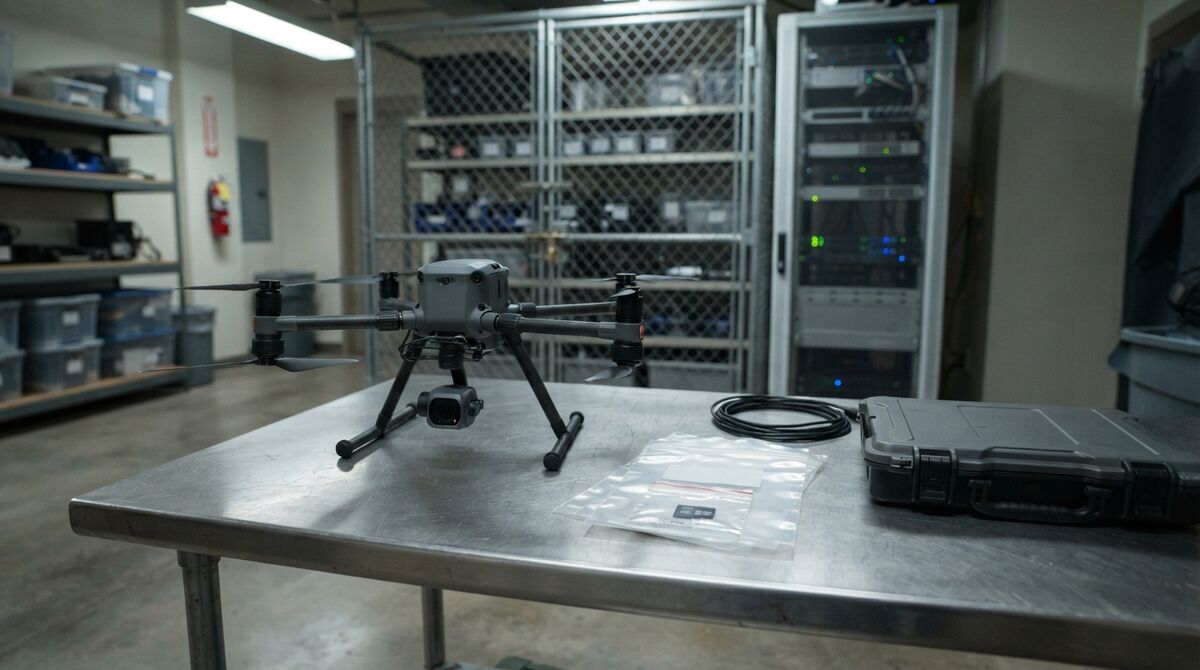
- Aircraft storage: the SD card holds the original .MP4 or .MOV. Treat it as evidence and follow your retention policy for the original file.
- Controller: flight apps and cached video live here; restrict who can take the controller home.
- Upload workstation: an agency-managed computer with multi-factor authentication (MFA) turned on.
- Processing: the vendor turns video into a 3D model; this is where hosting and personnel screening apply.
- Storage: retention has to match your evidence schedule, which often runs for years.
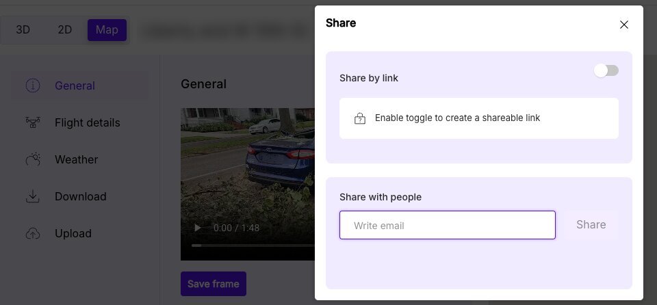
- Sharing: detectives, prosecutors, and outside agencies need access without public links.
- Exports and evidence management: files leaving the platform carry the chain of custody with them.
The FAA's public safety drone guidance governs how the aircraft flies. CJIS governs everything that happens to the data afterward.
What hosting and access controls should a drone mapping vendor provide?
A drone mapping vendor holding CJI should run on government-grade cloud hosting, log every access and share, support two-factor sign-in, and keep models as long as your retention schedule requires. SkyeBrowse meets these on Public Safety & Enterprise, hosted on AWS GovCloud (US) at FedRAMP Impact Level 2.
On Public Safety & Enterprise, SkyeBrowse maintains full CJIS compliance and a chain-of-custody log that records who opened a model, what each user did, and every share. Two-factor authentication is available. Models stay available for 5 years, so a case file doesn't lose its scene model while it waits for trial.
Exports fit the hand-off to evidence systems. Public Safety & Enterprise includes LAZ point clouds, GLB meshes, GeoTIFF orthomosaics, and the Axon Evidence.com integration. Models processed at 16K Ultra measure to 0.1 inch for courtroom presentation; see how court-ready 3D viewers compare. CJIS documentation is available on request for your security officer's review.
Which SkyeBrowse plan is CJIS compliant?
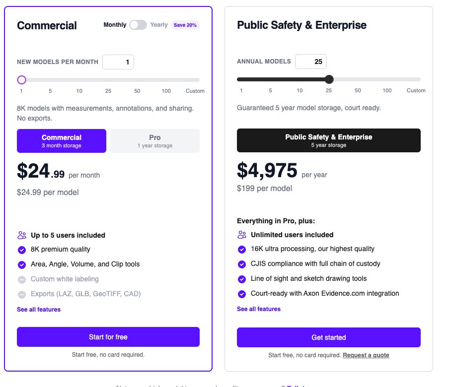
Public Safety & Enterprise is the SkyeBrowse plan with full CJIS compliance and chain of custody, at $199 per model per year. Commercial and Pro exclude CJIS. Freemium never included it, and neither did legacy Lite. Legacy Premium plans keep CJIS while they stay active.
That split keeps evidence work on the right tier. A construction or insurance team can map a site on Commercial for $24.99 per model, while an agency documenting a case needs Public Safety & Enterprise for the compliance, 5-year storage, Factual Diagrams, and Case Gallery photo annotations.
Agencies already run it this way. The Seward, Weatherford, and Huntington Beach police department pages each describe CJIS-ready workflows with audit trails and controlled sharing, and scene documentation cut from 3 hours to 10 minutes. Middletown Police Department documents crash scenes with one officer in an average of 7.5 minutes. More program examples are in our law enforcement drone guide and the public safety use cases page.
What should a drone mapping RFP ask about CJIS?
A drone mapping RFP should ask where data is hosted, whether the vendor signs the CJIS Security Addendum, how staff are screened, how data is encrypted, what gets logged, and how retention, deletion, and breach notice work. Ask every vendor the same questions in writing. Score the answers against your CJIS Systems Agency's requirements.
Copy these into your solicitation:
- Hosting: Which cloud and region store video, models, and backups?
- Security Addendum: Will you sign the CJIS Security Addendum and complete our state's vendor process?
- Personnel: Do employees with access complete fingerprint-based background checks and CJIS security awareness training?
- Encryption: Does encryption in transit and at rest meet Version 6.1 of the policy, which raised the minimum symmetric key strength to 256-bit?
- Audit logs: Are model access, user actions, and sharing logged, and can we export the log?
- Identity: Is multi-factor authentication available, and can we remove a user the day they leave?
- Retention and deletion: How long are models kept, and is deletion permanent?
- Incident response: How quickly do you notify the agency of a breach?
- Exports: Which formats leave the platform, and do they work with our evidence system?
Compare vendors on the answers, then see how police 3D mapping software and crime scene 3D mapping software stack up on features.
How much does CJIS compliant drone mapping cost?
On SkyeBrowse, CJIS compliant drone mapping costs $199 per model per year on Public Safety & Enterprise, with no seat fees. Agencies can start with a single model. Packages run from 5 models at $995 to 100 models at $19,900 per year, and unused models roll over while the subscription is active.
Count the crashes, crime scenes, and critical incidents your drone team documents each year, then add a buffer. Heavy users can request a quote for an unlimited annual plan priced by agency size, starting at $9,999 per year. A 3-year package takes 5% off, and DFR teams can see how per-call models add up in our DFR 3D mapping guide.
Procurement paperwork is ready: the W-9 and Sole Source Letter download from the vendor paperwork page. The Pilot Program gives qualifying agencies about two weeks of free Public Safety & Enterprise access to test real cases first. Full details are on the pricing page, and the wider platform is on our drone mapping page.
FAQ
Does drone mapping software need to be CJIS compliant?
It does whenever the drone video, 3D models, or exports it stores count as criminal justice information under your agency's policy. Many agencies apply CJIS controls to any scene model tied to a case number, so the safe default for a police drone program is a vendor that supports the CJIS Security Policy and will sign the CJIS Security Addendum.
Can a drone mapping vendor be FBI CJIS certified?
No. The FBI does not certify vendors or products. The CJIS Security Policy binds the agency, which verifies a vendor's controls with its CJIS Systems Agency and has the vendor sign the CJIS Security Addendum. Treat any "FBI certified" claim as a red flag.
Where does SkyeBrowse store drone mapping data?
SkyeBrowse keeps drone video and scene models in AWS GovCloud (US), hosted at FedRAMP Impact Level 2. Full CJIS compliance and chain-of-custody logging are maintained for Public Safety & Enterprise models, which are kept for 5 years.
Is CJIS included on the SkyeBrowse Commercial or Pro plans?
No. CJIS compliance and chain of custody are part of Public Safety & Enterprise only, priced at $199 per model per year. Agencies on a legacy Premium plan keep CJIS while that plan stays active.
Ready to put your drone program's models on CJIS-compliant hosting? Request a quote or ask about the Pilot Program.