A police drone is a small unmanned aircraft flown by a police or sheriff's department for an official law enforcement purpose: documenting crash and crime scenes, searching for missing people, giving officers an overhead view on tactical calls, and, in drone as first responder (DFR) programs, arriving at a 911 call before the first patrol car. This guide explains what police drones do, which aircraft departments buy, the FAA rules that govern a police drone program, the privacy limits agencies write into policy, and why 3D scene mapping has become a standard part of the program for crash and crime scene work.
Key Takeaways
- Police drones handle five core jobs: crash reconstruction, crime scene documentation, search and rescue, tactical overwatch, and DFR response to 911 calls.
- A department flies either under FAA Part 107 (each pilot certificated) or under a public aircraft certificate of authorization (COA); night flights are allowed under current Part 107 rules with training and anti-collision lighting.
- A written policy covering authorized uses, warrants, data retention and public transparency matters as much as the aircraft, and many agencies publish it before the first flight.
- 3D scene mapping turns a two-minute orbit into a measurable, court-ready model; SkyeBrowse customer Middletown PD replaced a five-officer, 2.5-hour laser scanner workflow with one officer and a drone video.
- Evidence software for police work should run on CJIS-compliant hosting with chain of custody; SkyeBrowse runs on AWS GovCloud (US) at FedRAMP Impact Level 2.
Contents
- What is a police drone?
- How do police departments use drones?
- What kind of drones do police use?
- What FAA rules apply to a police drone program?
- Can police drones see into your house?
- How does a department start a police drone program?
- What is a drone as first responder program?
- Why do police drone programs add 3D scene mapping?
- How much does a police drone program cost?
- FAQ
What is a police drone?
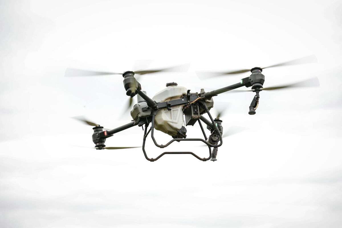
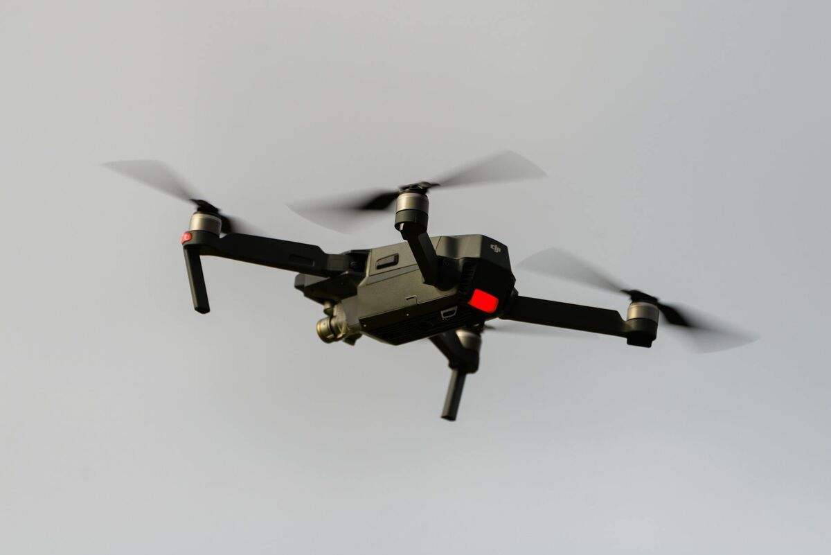
A police drone, also called a police UAV or small unmanned aircraft system (sUAS), is a remotely piloted aircraft owned or contracted by a law enforcement agency and flown for a policing purpose. Most are commercial enterprise drones with zoom and thermal cameras, operated by certificated officers under a written department policy.
The hardware itself is rarely unique. The same quadcopter a bridge inspector flies can become a police drone once it is registered to the agency, flown by a trained officer under FAA authority, and governed by a use policy that defines when it may launch and what happens to the footage. That combination of authority, policy and evidence handling is what separates a police UAV from a hobby aircraft.
The National Institute of Justice describes unmanned aircraft as a tool for situational awareness, scene documentation and search, with officer safety as a recurring benefit: the drone goes into the open field, the rooftop or the highway shoulder so a person does not have to.
How do police departments use drones?
Drones used by police cover five main missions: crash scene reconstruction, crime scene documentation, search and rescue for missing or fleeing people, tactical overwatch on barricades and warrant service, and drone as first responder flights to 911 calls. Many departments also fly for disaster assessment, crowd management at large events, and training.
Crash reconstruction is usually the fastest payback. Every hour a fatal crash scene stays closed costs patrol time and creates secondary crash risk. A drone orbit captured in a few minutes, processed into a 3D model, gives the reconstructionist distances, angles and rest positions without walking a total station across live lanes. Our guide to accident reconstruction drone mapping covers the capture pattern and the deliverables courts expect.
Crime scene documentation benefits from the overhead view and from speed. A drone records the full geometry of an outdoor scene before weather, traffic or onlookers change it, and a 3D model lets detectives return to the scene months later. See crime scene 3D mapping software for how agencies compare platforms for this work.
Search and rescue uses the drone's thermal camera to scan fields, woods and shorelines for a person's heat signature, and its RGB camera to map the search area. Our search and rescue drone guide covers how teams pair the two.
Tactical operations put a drone over a barricaded subject, a high-risk warrant or a hostage scene so the incident commander can see approaches and exits without exposing officers. A pre-mission 3D model of the target address lets a team rehearse routes and check sight lines before entry.
DFR response sends a docked or rooftop drone to a 911 call while officers are still driving, so the first eyes on scene belong to an aircraft. That program type is covered in its own section below.
What kind of drones do police use?
Most departments fly compact enterprise quadcopters with a zoom camera and a thermal sensor, plus a larger drone for heavy payloads or longer flights. Common choices include DJI Mavic 3 Enterprise and Matrice series aircraft, Skydio X10, BRINC models built for indoor and DFR use, and Autel EVO Max units.
Departments usually build a small fleet around missions. A compact thermal drone that fits in a patrol trunk covers most crash, crime scene and search calls. A larger aircraft with a high-zoom camera, spotlight or speaker handles long overwatch flights. Indoor-capable drones with cages or small frames go into structures during tactical calls, and dock-based aircraft serve DFR programs.
Procurement rules shape the list as much as performance does. Several states, including Florida, restrict which drone manufacturers public agencies may buy from, and grant-funded purchases often carry their own sourcing rules, so many agencies now evaluate US-built aircraft from Skydio, BRINC and others alongside DJI. Whatever the fleet, choose aircraft that record standard .MP4 or .MOV video with a GPS telemetry log, because that keeps the footage usable for 3D evidence later. SkyeBrowse accepts video from virtually any drone through Universal Upload, and the supported drones list shows which aircraft the SkyeBrowse Flight App can fly automatically. Our roundup of drones for crime scene mapping compares specific aircraft.
What FAA rules apply to a police drone program?
A police drone program flies under one of two FAA pathways: Part 107, where each officer earns a Remote Pilot Certificate, or a public aircraft certificate of authorization (COA), where the agency self-certifies its pilots. Either way, flights stay below 400 feet, within visual line of sight, and outside restricted airspace unless a waiver or authorization says otherwise.
The FAA's public safety and government page lays out both options. Part 107 is the faster start: officers pass the knowledge test and TSA vetting, the agency registers its aircraft, and each pilot flies under an individual certificate. A COA takes longer to obtain but lets the agency train and certify its own pilots and can cover a defined jurisdiction. Many departments hold both and pick per mission.
Night flying, once a waiver item, is now allowed under Part 107 when the pilot has completed the updated training and the drone shows anti-collision lighting visible for three statute miles. Flights over people, over moving vehicles, beyond visual line of sight and in controlled airspace still need specific authority: LAANC for most airport airspace, and a Part 107 waiver or COA provision for BVLOS operations such as DFR.
For emergencies, the FAA can issue a Special Governmental Interest (SGI) authorization quickly so an agency can fly in airspace that would otherwise need advance approval, such as a TFR around a disaster.
Can police drones see into your house?
Police drone cameras record what is visible from the air, so they cannot see through walls or roofs. Under the Fourth Amendment, using technology to learn what happens inside a home, such as thermal imaging, is generally a search that needs a warrant, and most department drone policies prohibit warrantless surveillance of private property.
The leading case is Kyllo v. United States, where the Supreme Court held that aiming a thermal imager at a home to detect activity inside was a search. Courts have allowed some aerial observation of areas visible from public airspace, and state laws add their own limits: several states require a warrant for drone surveillance with listed exceptions for emergencies, crash scenes and search and rescue. This section is general information, so agencies should have their legal counsel review state law before writing policy.
People often ask how to tell whether a drone overhead belongs to the police. Most drones must broadcast FAA Remote ID, which free phone apps can read. Many departments go further and publish their drone policy, flight logs, or a transparency portal listing every DFR call with its time and reason, which builds the community trust a program needs to survive budget season.
How does a department start a police drone program?
Start a police drone program in six steps: define the missions, write and publish the use policy, choose the FAA pathway (Part 107 or COA), buy a small fleet matched to the missions, train pilots and supervisors, and set up evidence-grade software for storing footage and 3D models. Pilot the program in one unit before a department-wide rollout.
- Define missions and success measures. List the calls the drone will fly, such as crash scenes, missing persons and tactical support, and decide what you will track: scene clearance time, officer hours saved, searches resolved.
- Write the policy and share it publicly. The IACP guidelines recommend covering authorized uses, prohibited uses, supervisor approval, data retention and public notice. Present it to the city council or community before launch.
- Pick the FAA pathway. Part 107 for fast startup, a COA for jurisdiction-wide public aircraft operations, waivers for BVLOS or DFR.
- Buy for the missions. Start with one or two thermal-equipped enterprise drones, spare batteries, and a charging plan for patrol vehicles.
- Train in two tiers. Pilots need Part 107 or COA training plus scenario flights; supervisors and dispatchers need to know when to request the drone and how to read its feed. SkyeBrowse offers virtual training at $499 per person and one-day in-person POST instructor training at $1,999 per student for the mapping side.
- Set up evidence handling. Footage and models are evidence, so keep them on CJIS-compliant software with access logs; personal devices and consumer cloud accounts break the chain of custody.
Track every flight from day one. A log of mission type, duration and outcome is what lets a program coordinator report results, defend the budget and spot policy gaps early.
What is a drone as first responder program?
A drone as first responder (DFR) program launches a drone to a 911 call from a dock, rooftop or station while officers are en route, streaming live video to dispatch and responding units. The drone often reaches the scene first, so officers arrive knowing what they face, and some calls are resolved without sending a unit at all.
DFR is the fastest-growing police drone program model, and it carries the heaviest regulatory load because most flights go beyond the pilot's visual line of sight. Agencies need FAA BVLOS authority, a real-time operations center, and clear rules on which call types trigger a launch. Our DFR (drone as first responder) guide covers dock hardware, FAA waivers and staffing.
DFR and scene mapping work together. The DFR flight provides live awareness; when the call becomes a crash or crime scene, the same aircraft or a patrol drone records an orbit for a 3D model. SkyeBrowse has announced a Paladin integration for near real-time 3D modeling in DFR workflows, a specialized partner path for agencies running Paladin docks.
Why do police drone programs add 3D scene mapping?
3D scene mapping turns a short drone video into a measurable model of a crash, crime or tactical scene, so investigators take measurements after the scene is cleared and juries can see the layout. It shortens road closures, reduces officers on scene, and produces evidence that holds up in court.
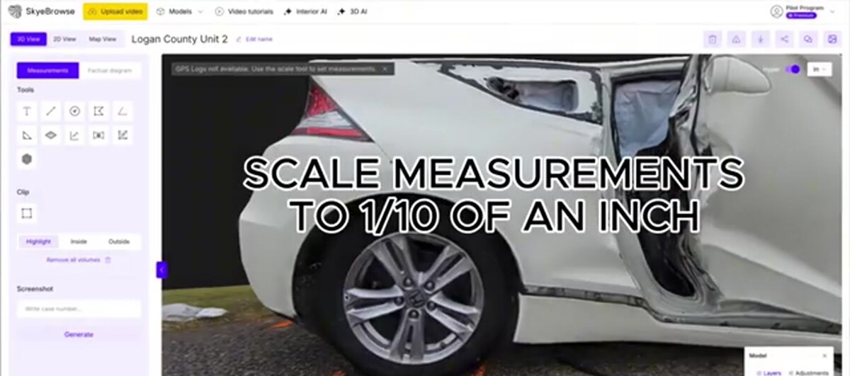
SkyeBrowse uses videogrammetry, which extracts 3D geometry from the frames of a continuous video instead of hundreds of separate photos. An officer flies an orbit with the SkyeBrowse Flight App or uploads any drone video through Universal Upload at app.skyebrowse.com, and the cloud returns a 3D model, a 2D orthomosaic (a scaled overhead map) and a point cloud in minutes. On Public Safety & Enterprise, models process in 16K at 0.1 inch accuracy, and AI Moving Object Removal strips moving objects such as passing traffic out of the model.
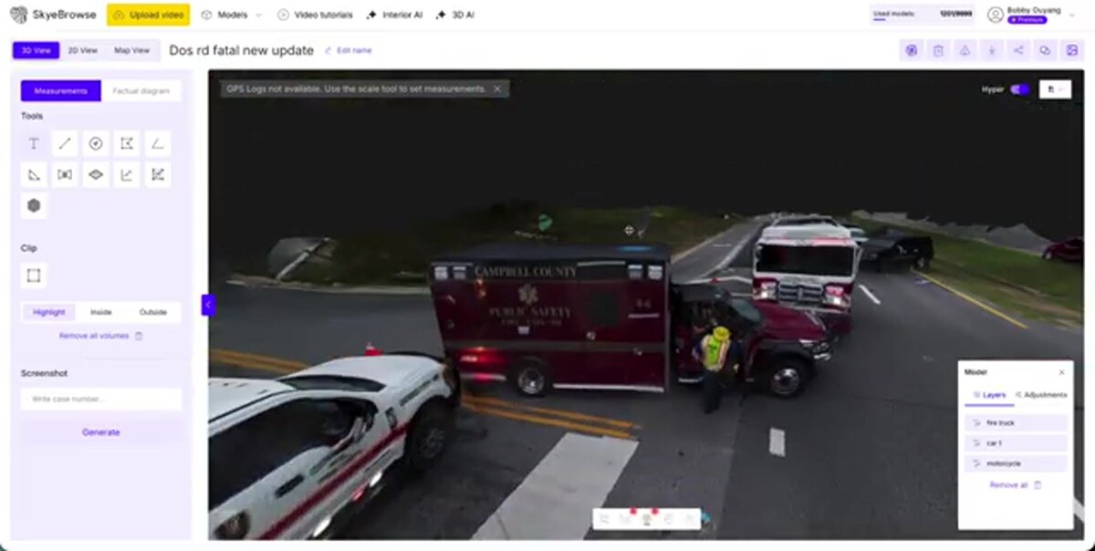
The operational difference shows up in the field. Middletown Police Department used to send five officers to spend an average of 2.5 hours documenting each crash with laser scanners; after switching to SkyeBrowse drone video, one officer documents a scene in an average of 7.5 minutes. Huntington Beach PD, Weatherford PD and Seward PD use the same workflow for crash and crime scenes, and the nighttime fatal crash model shown earlier includes Campbell County Public Safety units in its layers panel.
For court, Public Safety & Enterprise adds factual diagrams, public safety icons, a chain of custody log, and Axon Evidence.com integration, plus exports in LAZ, GLB and GeoTIFF for forensic and CAD tools. For tactical teams, Line of Sight shows what a subject can see from a window or rooftop, and the model doubles as a pre-plan for the next call at that address.
How much does a police drone program cost?
A small police drone program pays for three things: aircraft, training and software. Compact enterprise thermal drones cost a few thousand dollars each, DFR docks cost far more, and SkyeBrowse evidence processing is $199 per Public Safety & Enterprise model per year with unlimited users and no seat fees.
Hardware is the most variable line. A one-drone startup program can begin with a single thermal-equipped quadcopter and spare batteries, while a citywide DFR network with docks and an operations center is a multi-year capital project. Get current quotes from vendors; prices and grant eligibility change often.
Software pricing is simpler. SkyeBrowse charges per model rather than per user. Public Safety & Enterprise covers 16K processing at 0.1 inch accuracy, full CJIS compliance with chain of custody, 5-year model storage and unlimited users, so investigators, command staff and prosecutors can all open the same model. Agencies that expect heavy use can buy model packages or an unlimited annual plan by quote. Public safety and government agencies can apply for the Pilot Program, a free trial of about two weeks with full Public Safety & Enterprise access. Hosting runs on AWS GovCloud (US) at FedRAMP Impact Level 2; see our CJIS-compliant mapping platform comparison for what to ask any vendor.
FAQ
How far can a police drone fly?
Under standard FAA Part 107 rules, a police drone must stay within the remote pilot's visual line of sight and at or below 400 feet above ground level. DFR programs fly farther only under an FAA waiver or COA that sets the approved area, altitude and safety measures, such as visual observers or detect-and-avoid equipment.
How do you know if a drone is a police drone?
Most drones flying in US airspace must broadcast FAA Remote ID, which free phone apps can read to show the drone's position and its control station. Many departments also publish their drone policy, flight logs or a transparency portal listing every call the drone flew.
Can police drones see inside your house?
Standard police drone cameras record what is visible from the air, so they cannot see through walls or roofs. Courts treat sense-enhancing looks into a home, such as thermal imaging, as a search that generally needs a warrant, and most department policies bar warrantless surveillance of private property.
Is a police UAV different from a regular drone?
The airframe is often the same enterprise drone used by surveyors and inspectors. What makes it a police UAV is the operating authority (Part 107 or a public aircraft COA), the written use policy, and evidence-grade data handling with CJIS controls and chain of custody.
How much does it cost to start a police drone program?
A small program needs one or two enterprise drones, Part 107 training for each pilot, batteries and cases, and evidence software. SkyeBrowse Public Safety & Enterprise processing is $199 per model per year with unlimited users and CJIS compliance. Request a quote for model packages sized to your agency's call volume.
Try SkyeBrowse at your agency. Public safety and government agencies can apply for the Pilot Program, a free trial of about two weeks with full Public Safety & Enterprise access. To plan a purchase, request a quote.