Ground sample distance, or GSD, is the single most important accuracy metric in drone mapping: it defines how much real-world area one pixel in your aerial image represents. Whether you are a land surveyor chasing sub-centimeter precision or a construction manager tracking site progress, understanding ground sample distance tells you exactly what resolution your flight will deliver before you ever launch. This guide covers the GSD formula, GSD by altitude and by drone model, how sensor size changes GSD, ASPRS accuracy standards, and the GSD targets you need for every major use case.
Key Takeaways
- Ground sample distance is expressed in cm/pixel or mm/pixel; smaller numbers mean sharper, more accurate imagery.
- The GSD formula ties together four variables: sensor width, focal length, image width, and flight altitude. Changing any one of them shifts your resolution.
- Flying at 100 m with a DJI Mavic 3 Enterprise yields about 2.7 cm GSD, adequate for construction progress but not for legal boundary surveys.
- Sensor size matters through pixel pitch and lens length: at the same field of view and pixel count, a bigger sensor gives cleaner pixels, not smaller ones.
- ASPRS Positional Accuracy Standards tie directly to GSD: achieving Class 1 accuracy at the 5 cm horizontal level requires a GSD at or below 2.5 cm.
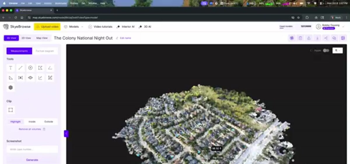
- SkyeBrowse turns ordinary drone or phone video into models at 0.5 inch accuracy (Commercial and Pro, 8K processing) or 0.1 inch (Public Safety & Enterprise, 16K Ultra), with no GSD math or grid mission required.
Contents
- What Is Ground Sample Distance?
- How Do You Calculate Ground Sample Distance?
- Why Does GSD Matter for Drone Mapping Accuracy?
- How Does Flight Altitude Affect GSD?
- How Does Sensor Size Affect Ground Sample Distance?
- What Are Common GSD Values for Popular Drones?
- What GSD Do You Need for Your Application?
- FAQ
What Is Ground Sample Distance?
Ground sample distance (GSD) is the real-world ground distance that one pixel represents, calculated as GSD = (sensor width × flight altitude) / (focal length × image width). A drone with a 17.3 mm sensor, a 12.29 mm lens, and a 5,280-pixel image width flying at 100 m, for example, produces a GSD of about 2.67 cm: each pixel covers a 2.67 cm square on the ground. Smaller GSD values produce sharper, more measurable imagery; larger values trade resolution for coverage area.
GSD is a function of the camera system and the altitude at which it flies, not a setting you choose directly. A camera with a small sensor or short focal length produces larger pixels at the same altitude as a camera with a larger sensor or longer lens. Ground sampling distance is sometimes used interchangeably with GSD; both refer to the same per-pixel ground measurement.
In practical terms, a GSD of 1 cm means you can detect features as small as 1–2 cm across in the orthomosaic or point cloud. A GSD of 10 cm makes individual bricks or survey stakes difficult to distinguish. Understanding this relationship is the starting point for any serious drone mapping workflow.
How Do You Calculate Ground Sample Distance?
To calculate ground sample distance, plug your camera's sensor width, focal length, and image width in pixels into the GSD formula along with your planned flight altitude. Keep all distance values in consistent units: millimeters for sensor width and focal length, meters for altitude, and pixels for image width. The formula returns meters per pixel; multiply by 100 to convert to centimeters.
Working through an example with a DJI Mavic 3 Enterprise:
- Sensor width: 17.3 mm
- Focal length: 12.29 mm (24 mm full-frame equivalent on a 4/3 sensor)
- Image width: 5280 pixels
- Flight altitude: 100 m (100,000 mm)
GSD = (17.3 × 100,000) / (12.29 × 5280) = 1,730,000 / 64,891 = 26.66 mm/pixel = 2.67 cm/pixel
To run the numbers for your own drone, pull the sensor width, real (not 35 mm equivalent) focal length, and image width from the manufacturer's spec sheet. Divide the result by 2.54 to express GSD in inches per pixel. The USGS National Uncrewed Systems Office also provides guidance on image resolution requirements for government mapping programs that cross-references GSD with final map scale and accuracy class.
For the lateral GSD (across the flight path) versus the longitudinal GSD (along the flight path), substitute image height and the corresponding sensor dimension. Most mapping software reports a single GSD value averaged across both axes.
Why Does GSD Matter for Drone Mapping Accuracy?
GSD is the theoretical resolution ceiling for any derived product: orthomosaics, digital surface models, and point clouds cannot contain spatial detail finer than the GSD of the source imagery. As the photogrammetry definition makes explicit — measurement from recorded images — post-processing can sharpen edges but cannot recover ground detail that was never captured. This means your GSD sets the upper bound on what measurements you can reliably extract from a dataset.
The link between GSD and positional accuracy is codified in the ASPRS Positional Accuracy Standards for Digital Geospatial Data. Under those standards, the horizontal accuracy of an orthophoto product is approximately 2× the GSD for well-controlled datasets. A GSD of 2.5 cm therefore supports 5 cm horizontal accuracy, the threshold for ASPRS Class 1 at the 1:200 map scale.
For drone surveying work that will be submitted to a client, regulator, or court, the GSD of the source imagery is often a required disclosure. Flying too high and delivering a coarse GSD can invalidate the accuracy claim even if ground control points (GCPs) were used correctly. GCPs improve absolute positional accuracy but cannot compensate for insufficient image resolution.
For orthomosaic deliverables specifically, software like Pix4D and Agisoft Metashape recommend a GSD of 3 cm or better for survey-grade outputs, which translates to flying most consumer drones at 80–120 m above ground level depending on the sensor.
How Does Flight Altitude Affect GSD?
GSD scales linearly with flight altitude. Every additional meter of altitude adds a proportional amount to the ground footprint of each pixel. Flying at 200 m produces exactly double the GSD of flying at 100 m with the same camera: you cover more ground per flight, but at the cost of spatial resolution.
The table below shows calculated GSD values at common flight altitudes for four popular DJI mapping cameras. Values assume a nadir (straight-down) camera over flat ground; terrain that rises toward the drone shrinks GSD locally, and terrain that falls away enlarges it. In the US, 120 m (400 ft) AGL is the Part 107 altitude ceiling away from structures.
| Drone | Sensor Width (mm) | Focal Length (mm) | Image Width (px) | 30 m AGL | 50 m AGL | 75 m AGL | 100 m AGL | 120 m AGL |
|---|---|---|---|---|---|---|---|---|
| DJI Mini 4 Pro (12 MP) | 9.6 | 6.7 | 4032 | 1.07 cm | 1.78 cm | 2.67 cm | 3.55 cm | 4.26 cm |
| DJI Mavic 3 Enterprise | 17.3 | 12.29 | 5280 | 0.80 cm | 1.33 cm | 2.00 cm | 2.67 cm | 3.20 cm |
| DJI Phantom 4 RTK | 13.2 | 8.8 | 5472 | 0.82 cm | 1.37 cm | 2.06 cm | 2.74 cm | 3.29 cm |
| DJI Matrice 350 RTK + Zenmuse P1 (35 mm) | 35.9 | 35.0 | 8192 | 0.38 cm | 0.63 cm | 0.94 cm | 1.25 cm | 1.50 cm |
What the table tells you:
- The DJI Mini 4 Pro in 12 MP mode reaches the 3 cm boundary (typically considered the minimum for construction-grade accuracy) only below about 85 m AGL.
- The Mavic 3 Enterprise and Phantom 4 RTK track each other closely and hit 2 cm GSD at about 75 m, making both practical choices for most survey workflows.
- The Matrice 350 RTK with DJI's 45 MP full-frame Zenmuse P1 stays under 2 cm GSD all the way to the 120 m ceiling, the best combination of coverage and resolution at scale.
Flying lower than necessary increases flight time, battery consumption, and the number of images that need processing. The right approach is to identify the GSD your deliverable requires and then find the minimum altitude that achieves it, not simply flying as low as possible.
How Does Sensor Size Affect Ground Sample Distance?
Sensor size affects ground sample distance through pixel pitch, the physical width of one pixel on the sensor, found by dividing sensor width by image width in pixels. GSD equals pixel pitch times altitude divided by focal length, so a larger sensor only produces a finer GSD when it carries more pixels or a longer lens. Its bigger payoff is light: larger pixels collect more of it, which allows faster shutter speeds and cleaner images, so more of the calculated GSD survives as usable detail.
Rewriting the formula around pixel pitch makes the trade-off visible: GSD = (pixel pitch × altitude) / focal length. Here is how the cameras from the altitude table compare:
| Camera | Sensor Width | Image Width | Pixel Pitch | Focal Length |
|---|---|---|---|---|
| DJI Mini 4 Pro (12 MP) | 9.6 mm | 4,032 px | 2.38 µm | 6.7 mm |
| DJI Phantom 4 RTK | 13.2 mm | 5,472 px | 2.41 µm | 8.8 mm |
| DJI Mavic 3 Enterprise | 17.3 mm | 5,280 px | 3.28 µm | 12.29 mm |
| DJI Zenmuse P1 (full frame) | 35.9 mm | 8,192 px | 4.38 µm | 35 mm |
The Zenmuse P1 has the largest pixels in the group, yet it produces the finest GSD because its 35 mm lens is about five times longer than the Mini 4 Pro's 6.7 mm lens. Put another way, two cameras with the same field of view and the same pixel count deliver the same GSD at the same altitude, whatever their sensor size. What the bigger sensor changes is how clean each of those pixels is.
That cleanliness matters in the field. A mapping drone moving at 8 m/s with a 1/500 s shutter travels 1.6 cm during each exposure, which already smears detail at a 1.3 cm GSD. A larger sensor gathers enough light to run at 1/1000 s (0.8 cm of travel) without pushing ISO into visible noise, which is why full-frame payloads hold their detail at dusk, under overcast skies, and on night scenes where small sensors struggle.
Video changes the per-frame numbers too. A 4K frame is 3,840 pixels wide, so a Mavic 3 Enterprise recording 4K across the full sensor width resolves about 3.7 cm per pixel at 100 m, compared with 2.7 cm in a full-resolution still. Videogrammetry offsets that by drawing on many overlapping frames and by flying closer: the same 4K frame at 30 m resolves about 1.1 cm per pixel. The ASPRS Positional Accuracy Standards judge the finished product, so what counts is the accuracy the final model achieves, whatever the capture method.
What Are Common GSD Values for Popular Drones?
At 100 m above ground level, most prosumer and enterprise mapping drones produce a GSD between about 2.3 and 3.6 cm per pixel, while full-frame payloads such as the DJI Zenmuse P1 reach 0.9 to 1.3 cm. To hit a 2 cm GSD, most 1-inch and 4/3-inch cameras need to fly at roughly 75 to 90 m. The values below are calculated from each manufacturer's published sensor and lens specs.
| Drone | Sensor | Focal Length | Image Width | GSD at 100 m | Altitude for 2 cm GSD |
|---|---|---|---|---|---|
| DJI Mini 4 Pro (12 MP mode) | 1/1.3-in (9.6 × 7.2 mm) | 6.7 mm | 4,032 px | 3.55 cm | 56 m |
| DJI Mini 4 Pro (48 MP mode) | 1/1.3-in (9.6 × 7.2 mm) | 6.7 mm | 8,064 px | 1.78 cm | 113 m |
| DJI Mavic 3 Enterprise | 4/3-in (17.3 × 13.0 mm) | 12.29 mm | 5,280 px | 2.67 cm | 75 m |
| DJI Phantom 4 RTK | 1-in (13.2 × 8.8 mm) | 8.8 mm | 5,472 px | 2.74 cm | 73 m |
| Autel EVO II Pro V3 | 1-in (13.2 × 8.8 mm) | 10.6 mm (29 mm equivalent) | 5,472 px | 2.28 cm | 88 m |
| DJI Matrice 350 RTK + Zenmuse P1 (35 mm) | Full frame (35.9 × 24.0 mm) | 35 mm | 8,192 px | 1.25 cm | Any legal altitude (1.50 cm at 120 m) |
| DJI Matrice 350 RTK + Zenmuse P1 (50 mm) | Full frame (35.9 × 24.0 mm) | 50 mm | 8,192 px | 0.88 cm | Any legal altitude (1.05 cm at 120 m) |
Two caveats apply. The Mini 4 Pro's 48 MP mode uses a Quad Bayer sensor that groups pixels in fours, so its real-world detail usually lands between the 12 MP and 48 MP figures. And these are still-photo values: video frames from the same cameras are narrower in pixels, so per-frame GSD is coarser unless you fly lower.
Any of these drones can feed a video-based workflow. SkyeBrowse accepts .MP4 and .MOV footage from nearly any camera through Universal Upload, and its Flight App automates capture on specific models listed on the supported drones page.
What GSD Do You Need for Your Application?
GSD requirements vary significantly by industry and deliverable type. General site monitoring tolerates 5–10 cm GSD, while legal survey work demands 1–2 cm, and close-range inspection of structural details or evidence documentation often targets sub-centimeter resolution. Matching your GSD target to your application before flight prevents costly re-flights.
Use the following reference ranges when planning missions:
Construction progress monitoring (5–10 cm GSD): Change detection between weekly captures, earthwork volume estimates, and site communication models do not require sub-centimeter detail. Most drones flown at 100–150 m AGL cover large sites efficiently while staying within this range.
As-built surveys and construction layout (2–5 cm GSD): Confirming poured concrete matches design drawings, checking setback compliance, or documenting foundation dimensions requires enough resolution to distinguish 5 cm features reliably. Target the lower end of this range when the deliverable will be compared against BIM models.
Land and boundary surveying (1–2 cm GSD): Survey-grade drone mapping for legal boundary work, subdivision plats, and topographic datasets submitted to government agencies must meet ASPRS Class 1 or Class 2 thresholds. At the 1 cm GSD level, absolute horizontal accuracy of 2–3 cm is achievable with well-distributed GCPs or a survey-grade RTK/PPK drone.
Infrastructure inspection and forensic documentation (sub-1 cm GSD): Bridge inspections requiring crack width measurement, utility tower surveys, and forensic scene documentation for legal proceedings demand the finest available resolution. At sub-centimeter GSD, cracks as narrow as 2–3 mm become detectable in orthophoto products.
The table below translates those targets into a starting altitude and sensor class for a DJI Mavic 3 Enterprise, the most common enterprise mapping platform referenced earlier in this guide:
| Application | Target GSD | Approx. Altitude (Mavic 3E) | Sensor Class |
|---|---|---|---|
| Site monitoring | 5–10 cm | Any legal altitude (3.2 cm at 120 m) | 1/1.3-in or larger |
| As-built/construction layout | 2–5 cm | 75–190 m | 4/3-in (Mavic 3E, Mini 4 Pro) |
| Land/boundary survey | 1–2 cm | 35–75 m | 4/3-in with RTK/PPK, or larger sensor |
| Infrastructure/forensic inspection | Sub-1 cm | Close-range or fly-closer capture | Full-frame, or SkyeBrowse videogrammetry |
For teams that need to hit consistent accuracy targets across all these workflows without manually recalculating GSD for every site, SkyeBrowse offers an alternative approach. Rather than requiring pilots to plan grid missions around a calculated GSD, SkyeBrowse processes standard drone video through a cloud-based videogrammetry engine (a technology that reconstructs 3D geometry directly from continuous video frames rather than individual stills). Public Safety & Enterprise models use 16K Ultra processing for 0.1 inch accuracy, which covers inspection and forensic work without a purpose-built mapping drone. Commercial and Pro models use 8K processing for 0.5 inch accuracy, enough for most construction and survey-grade needs. In both cases accuracy tightens as the camera gets closer to the subject, so a low pass or a walk-around with a phone reaches survey-grade detail on the features that matter. The SkyeBrowse tutorials cover capture patterns for each of these workflows.
FAQ
What is a good GSD for drone mapping?
It depends on the application. General mapping and progress monitoring work well at 5–10 cm GSD. Construction layout and as-built surveys typically target 2–5 cm. Legal boundary surveys and ASPRS Class 1 compliance require 1–2 cm GSD or better. Sub-centimeter GSD is standard for infrastructure inspection and forensic documentation.
How does flight altitude affect ground sample distance?
GSD scales linearly with altitude. If you double your flight altitude, you double your GSD; each pixel represents twice as much ground. Flying lower always improves resolution, but increases flight time and the number of images required to cover the same area.
What GSD does SkyeBrowse achieve?
SkyeBrowse reports accuracy rather than a fixed GSD, because the result depends on how close the camera gets to the subject. Commercial and Pro models use 8K processing for 0.5 inch accuracy, and Public Safety & Enterprise models use 16K Ultra processing for 0.1 inch accuracy. Both accept standard drone or phone video, so the pilot does not need to pre-calculate GSD or plan a grid mission. In an independent accuracy study by AirBorne Works, SkyeBrowse video models came closest to Leica BLK360 laser-scan ground truth on 8 of 9 measurements, outperforming photo-based Pix4D Mapper and Leica BLK3D.
Can I improve GSD without flying lower?
Yes, within limits. Switching to a camera with a larger sensor or longer focal length reduces GSD at the same altitude. RTK/PPK positioning improves absolute accuracy but does not change the optical GSD. Flying in lower wind conditions and at slower speeds reduces motion blur, which can effectively improve usable resolution even if the calculated GSD stays constant.
Do I need a Part 107 license to fly at low altitude for high-GSD mapping?
Any commercial drone operation, including survey and mapping flights, requires a FAA Part 107 Remote Pilot Certificate regardless of altitude. Part 107 does not set specific altitude minimums for mapping missions, but all operations must remain below 400 ft AGL (approximately 120 m) unless you are within a 400 ft radius of a structure.
Upload your first video free. Create a free SkyeBrowse account, upload a drone video, and get a 3D model processed in the cloud. Freemium organizations that have never had a paid plan can get their first full Commercial model for $5 (normally $24.99), with every Pro tool and export included and 90-day storage.