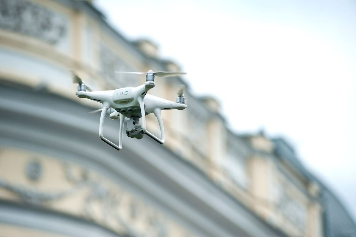
DJI Air 3S mapping turns a popular travel-photography drone into a genuinely capable 3D capture tool. The Air 3S carries a 1-inch 50MP main sensor, the largest DJI has ever put in the Air line, and records stable 4K video that a videogrammetry platform can reconstruct into a measurable 3D model. Videogrammetry builds 3D geometry from video frames instead of hundreds of triggered still photos, so the Air 3S workflow is simple: fly two smooth orbits, upload the footage, and let the cloud do the math. This guide covers what the Air 3S can and can't do for mapping, the exact capture workflow, accuracy expectations, and how it stacks up against the older Air 3.
Key Takeaways
- The DJI Air 3S pairs a 1-inch 50MP wide camera (8192 by 6144 stills) with a 70mm medium tele, and shoots 4K video up to 120fps, strong hardware for video-based mapping.
- Neither the Air 3 nor the Air 3S is on the SkyeBrowse Flight App supported list: fly the orbit manually in DJI Fly and upload through Universal Upload.
- Accuracy scales with processing tier and capture distance: about 0.5 inch on SkyeBrowse Commercial and Pro models (8K processing) and 0.1 inch on Public Safety & Enterprise.
- At 40 meters altitude the Air 3S wide camera resolves roughly 0.73 cm per pixel, enough to read shingle damage and site detail.
- The 1-inch sensor gives the Air 3S a real low-light edge over the Air 3, whose dual cameras both use smaller 1/1.3-inch sensors.
Contents
- Can the DJI Air 3S do mapping?
- What accuracy can you expect from Air 3S photogrammetry?
- How do you map with the Air 3S in SkyeBrowse?
- How does the Air 3S compare to the Air 3 for mapping?
- Is the DJI Air 3S good for roof inspection?
- FAQ
Can the DJI Air 3S do mapping?
Yes. The Air 3S records stable 4K video on a 1-inch 50MP sensor, which is all a videogrammetry engine needs to build a measurable 3D model. It isn't on the SkyeBrowse Flight App supported list, so there's no automated orbit mode for it. Instead you fly the capture pattern manually in DJI Fly and upload the footage through Universal Upload.
The hardware is well suited to the job. Per the DJI Air 3S specifications, the main camera uses a 1-inch CMOS sensor with 50 effective megapixels, a 24mm-equivalent f/1.8 lens, and stills up to 8192 by 6144 pixels, backed by a second 70mm medium tele camera and up to 45 minutes of flight time. Because SkyeBrowse reconstructs 3D models from continuous video rather than photo sets, the missing automation matters less than you'd think: two smooth manual orbits produce the entire dataset. Support varies drone by drone across DJI's consumer lineup, from full automation on some models to manual capture on others, and the drone mapping app roundup explains which aircraft fall where. Always confirm current status on the SkyeBrowse supported drones page.
What accuracy can you expect from Air 3S photogrammetry?
The Air 3S carries no RTK module, yet accuracy comes down to processing tier and capture distance. Freemium gives you a basic-resolution model to check coverage, Commercial and Pro models sharpen the same footage to about 0.5 inch with 8K processing, and Public Safety & Enterprise reaches about 0.1 inch. Flying closer to the subject tightens the reconstruction at every tier.
Photogrammetry, the technique of measuring real-world geometry from overlapping images, gives you two numbers to care about. Relative accuracy, the measurement between two points inside the model, is where the Air 3S shines because the 1-inch sensor holds detail even in soft light. Absolute accuracy, how precisely the model sits on real-world coordinates, depends on georeferencing. Survey aircraft solve it with RTK, real-time kinematic corrections that refine satellite positioning down to centimeters; the Air 3S instead writes an .SRT telemetry file when video captions are enabled, and uploading that log alongside the video georeferences the model automatically. Jobs that require certified absolute coordinates still call for ground control points, and the American Society for Photogrammetry and Remote Sensing publishes the positional accuracy standards that govern those deliverables. The table below shows ground sample distance, the real-world size of one pixel, for the Air 3S wide camera by altitude.
| Altitude | Ground sample distance | Practical read |
|---|---|---|
| 40 m | 0.73 cm/px | Roof shingles, site features |
| 60 m | 1.10 cm/px | General site documentation |
| 80 m | 1.46 cm/px | Wide-area context only |
Run the numbers for any altitude or lens with the GSD calculator.
How do you map with the Air 3S in SkyeBrowse?
Circle the scene twice at a steady pace with the gimbal angled down toward the subject, stay on the wide camera, and keep stick inputs gentle. Then upload the .MP4 and its .SRT telemetry file through Universal Upload in the SkyeBrowse web app. The cloud builds the 3D model in minutes with no desktop software involved.
Start by enabling video captions in the DJI Fly camera settings so every flight writes the .SRT log. Launch, climb to an altitude that keeps your ground sample distance tight for the subject, and fly a steady circle around the scene, then a second circle at a slightly different altitude or radius. Slow is the whole trick: fast yaw and abrupt stick inputs blur frames, and sharp frames are what the reconstruction feeds on. Lock the camera on the 24mm wide lens for the mapping pass. Back on the ground, pair the video with its .SRT file in the upload dialog and the drone mapping software processes it in the cloud, so there's no workstation render queue. The full walkthrough, including multi-battery captures for bigger scenes, lives in how to make a 3D model with a drone.

How does the Air 3S compare to the Air 3 for mapping?
The Air 3S is the better mapping camera. Its 1-inch 50MP main sensor gathers more light and resolves slightly finer detail than the Air 3's 1/1.3-inch wide camera, which pays off at dawn, dusk, and under overcast skies. Both drones use the same manual-orbit plus Universal Upload workflow, so the choice comes down to sensor quality, not software support.
Spec for spec, the two aircraft are close everywhere except the sensor that matters for mapping, per DJI's published Air 3 and Air 3S pages:
| Spec | DJI Air 3 | DJI Air 3S |
|---|---|---|
| Wide camera | 1/1.3-inch CMOS, 48MP | 1-inch CMOS, 50MP |
| Wide lens | 24mm equiv, f/1.7 | 24mm equiv, f/1.8 |
| Max still size | 8064 x 6048 | 8192 x 6144 |
| Medium tele | 70mm, 1/1.3-inch 48MP | 70mm, 1/1.3-inch 48MP |
| Max video | 4K/100fps | 4K/120fps |
| Takeoff weight | 720 g | 724 g |
| Max flight time | 46 min | 45 min |
| GSD at 40 m (wide) | 0.74 cm/px | 0.73 cm/px |
If you already own an Air 3, it maps well and there's no need to upgrade for geometry alone. Buying today for mapping work, the Air 3S's larger sensor is the stronger pick. Operators who need automated grid missions, RTK positioning, or a mechanical shutter should look at enterprise aircraft instead; the mapper drone guide ranks those options, and the DJI Mavic 4 Pro mapping guide covers DJI's flagship camera platform. At the other end of the size scale, the DJI Mini 4 Pro workflow shows what a sub-250g airframe can do.
Is the DJI Air 3S good for roof inspection?
Yes. The Air 3S flies a full roof orbit in a single short flight, and its 1-inch sensor resolves shingle-level damage at a safe standoff. A videogrammetry pass converts that orbit into a measurable 3D roof model, so you pull pitch, area, and edge dimensions without a ladder. The 70mm tele camera adds close-up detail shots from even further back.
For a typical residential roof, orbit twice at 30 to 40 meters with the camera tilted down and let the cloud rebuild every slope as measurable geometry. An adjuster or contractor gets dimensions and damage documentation from one flight instead of a climb, and the model stays on record as before-and-after evidence for a claim. The medium tele earns its keep on inspection work: frame-filling detail of a damaged ridge cap from 70 meters out means less time maneuvering near the structure. Anyone flying roofs for pay in the United States needs an FAA Part 107 certificate, and the FAA's commercial operator requirements outline the process. For pricing the work itself, see the drone roof inspection guide.
FAQ
Can the DJI Air 3S be used for mapping?
Yes. The Air 3S records stable 4K video on a 1-inch 50MP sensor, which is everything a videogrammetry platform like SkyeBrowse needs to build a measurable 3D model. Circle the subject twice with the camera angled down toward it, then upload the .MP4 with its .SRT log at app.skyebrowse.com and the model processes in minutes.
Does the DJI Air 3S work with the SkyeBrowse Flight App?
No. Neither the Air 3 nor the Air 3S is on the SkyeBrowse Flight App supported list, so automated orbit and grid missions aren't available. You fly the capture manually in DJI Fly and upload through Universal Upload, which accepts .MP4 or .MOV video from nearly any drone.
How accurate is DJI Air 3S photogrammetry?
The Air 3S carries no RTK hardware, but accuracy comes from processing tier and capture distance: about 0.5 inch on SkyeBrowse Commercial and Pro models (8K processing) and 0.1 inch on Public Safety & Enterprise. That covers roof measurements, site documentation, and scene reconstruction, and flying closer to the subject tightens detail further.
Upload your first video free. Create a free SkyeBrowse account, upload a drone video, and get a 3D model processed in the cloud. Freemium organizations that have never had a paid plan can get their first full Commercial model for $5 (normally $24.99), with every Commercial tool, every export, and 90-day storage.