Phantom 4 mapping built the commercial drone survey industry, and the aircraft that started it is now discontinued while thousands still fly every week. Photogrammetry, the science of reconstructing measurable 3D geometry from overlapping imagery, was made accessible to ordinary crews largely because the Phantom 4 Pro put a sharp 1-inch camera on an affordable airframe. This guide answers whether Phantom 4 mapping still makes sense in 2026, how to build 3D models with one today, the ground sampling distance it delivers, and the realistic migration path when your fleet finally ages out.
Key Takeaways
- The Phantom 4 Pro carries a 1-inch 20MP sensor with a mechanical shutter, which still produces distortion-free photogrammetry in 2026.
- Certain DJI Phantom models remain on the SkyeBrowse Flight App supported list; any Phantom 4 can also map through Universal Upload of recorded video.
- The Phantom 4 RTK reaches roughly 2.74 cm per pixel GSD at 100 meters and delivers survey-grade positioning with its onboard RTK module.
- The line is discontinued, so the practical constraint is aging batteries and scarce spare parts rather than image quality.
- The modern successors are the DJI Matrice 4E for enterprise survey and the DJI Mini 4 Pro for budget mapping.
Contents
- Is the DJI Phantom 4 still good for mapping in 2026?
- Does SkyeBrowse support the Phantom 4 for mapping?
- What is the Phantom 4 mapping workflow and GSD?
- How real is the Phantom 4 parts and battery problem?
- What replaces the Phantom 4 RTK?
- FAQ
Is the DJI Phantom 4 still good for mapping in 2026?
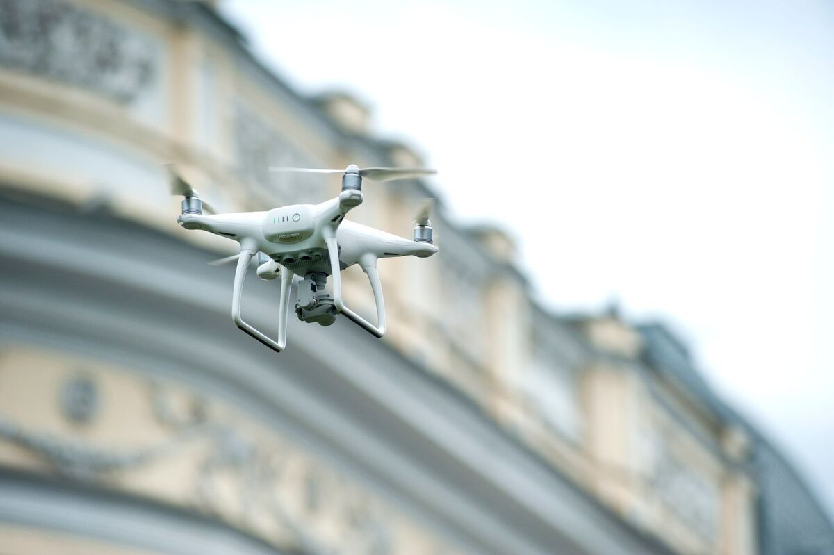
Yes. The Phantom 4 Pro carries a 1-inch 20MP camera with a mechanical shutter, and that combination still produces excellent photogrammetry. The camera isn't the limitation. The real questions are battery health and spare-parts supply now that DJI has discontinued the line.
The Phantom 4 Pro was the first DJI drone with a mechanical shutter, which captures every frame in an instant instead of scanning it line by line. That eliminates the rolling-shutter distortion that can warp models built from a moving aircraft (DJI Phantom 4 Pro V2.0). A well-maintained Phantom 4 today produces reconstructions that hold up against far newer drones.
Government mapping programs still reference Phantom 4 class aircraft in their unmanned systems data collection, a sign the platform remains fit for serious survey work (USGS). If your airframe flies straight and your batteries hold charge, there's no image-quality reason to retire it yet.
Does SkyeBrowse support the Phantom 4 for mapping?
Certain DJI Phantom models are on the SkyeBrowse Flight App supported list with the required compatible controller, which enables automated orbit capture. Any Phantom 4 can also map through Universal Upload: record video and upload it to app.skyebrowse.com. Check the official supported drones page for your exact model and controller.
There are two paths, and the right one depends on your specific Phantom variant and controller. If your model is on the supported list, the SkyeBrowse Flight App can fly an automated orbit and record the capture for you. If it isn't, you fly a manual pattern, record video, and use Universal Upload, which accepts any .MP4 or .MOV clip from any drone.
Because Phantom variants and controller combinations differ, verify yours on the supported drones list rather than assuming. Either path lands in the same cloud pipeline, so the model quality doesn't depend on which capture method you use. A broader primer on the end-to-end process lives in our drone mapping guide.
What is the Phantom 4 mapping workflow and GSD?
Fly two slow orbits at about 45 degrees of camera tilt for a small subject, add a grid pass for larger sites, and record the whole flight as video. Enable the video caption setting so a .SRT telemetry file saves for auto-georeferencing. The Phantom 4 Pro reaches roughly 0.82 cm per pixel at 30 meters and about 2.74 cm per pixel at 100 meters.
Ground sampling distance is the ground size of a single pixel, and it sets model detail. Using the verified 1-inch sensor (13.2 mm wide), the 8.8 mm focal length, and the 5472-pixel wide 20MP image, the Phantom 4 Pro produces the resolutions below. The Phantom 4 RTK shares this camera and adds onboard RTK for survey-grade absolute positioning.
| Altitude | Approx. GSD (Phantom 4 Pro 20MP) |
|---|---|
| 30 m | 0.82 cm/pixel |
| 50 m | 1.37 cm/pixel |
| 100 m | 2.74 cm/pixel |
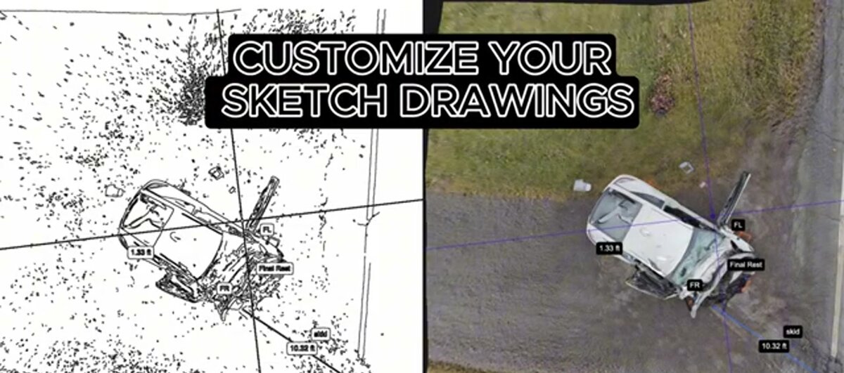
To recompute for your altitude, use the GSD calculator. Recommended capture settings are a locked manual exposure, fixed white balance, slow and smooth flight, no zoom changes, and enough overlap that each part of the scene appears in many frames. Keep the camera off open sky, since blank frames give the reconstruction nothing to match. Once processed, you get a measurable 3D model, orthomosaic, and point cloud in minutes, with no desktop workstation.
How real is the Phantom 4 parts and battery problem?
It is the main reason to plan a migration. DJI has ended production of the Phantom line, so intelligent flight batteries, gimbals, and controllers are increasingly scarce and expensive. The camera still performs, but a grounded drone waiting on an out-of-stock part can't fly a job.
Batteries are the first constraint. Lithium packs degrade with cycles and age regardless of care, and fresh Phantom 4 batteries are harder to source each year. A crew that depends on a single Phantom 4 is one dead pack or cracked gimbal ribbon away from downtime with no fast replacement.
The pragmatic approach is to keep flying healthy airframes while budgeting for a successor before the fleet becomes unreliable. Treat every remaining battery as a countdown, and buy spares while they exist. That way the transition happens on your schedule, not on the day a part fails mid-project.
What replaces the Phantom 4 RTK?
For enterprise survey work the DJI Matrice 4E is the modern successor, with integrated RTK and a 4/3 mapping camera that flies fully automated missions. For a budget mapping drone the DJI Mini 4 Pro is a lightweight, sub-250-gram replacement that captures video good enough for 3D models. Match the successor to your accuracy needs.
If you flew the Phantom 4 RTK for its centimeter positioning, the direct heir is the DJI Matrice 4E. It carries RTK for 1 cm horizontal accuracy, a 20MP 4/3 mechanical-shutter mapping camera, and full SkyeBrowse Flight App support including WideBrowse grid mode, so the automated workflow is more capable than anything the Phantom 4 offered.
If you flew a standard Phantom 4 for general documentation and want to spend far less, the DJI Mini 4 Pro is a lightweight option that stays under the 250-gram registration threshold in many regions while still capturing usable mapping video. Whichever you choose, your SkyeBrowse account and cloud workflow carry over unchanged, so it's only the aircraft that changes, not how you turn video into 3D models.
FAQ
Is the DJI Phantom 4 still good for mapping in 2026?
Yes. The Phantom 4 Pro 1-inch 20MP camera with a mechanical shutter still produces excellent photogrammetry, and thousands remain in daily service. The main risks are parts and battery availability now that the line is discontinued.
Does SkyeBrowse support the Phantom 4 for mapping?
Certain DJI Phantom models are on the SkyeBrowse Flight App supported list with the required compatible controller. Any Phantom 4 can also map through Universal Upload by recording video and uploading it. Check the supported drones list for your exact model.
What replaces the Phantom 4 RTK?
For enterprise survey work the DJI Matrice 4E is the modern successor with integrated RTK and a 4/3 mapping camera. For a budget mapping drone the DJI Mini 4 Pro is a lightweight replacement that captures usable video for 3D models.