Public Safety 3D Mapping Software for Police, Fire, and First Responders
SkyeBrowse turns drone, phone, 360 camera, and body worn camera video into survey-grade 3D models of crime scenes, crash sites, fire pre-plans, and tactical environments. Most models process in minutes after upload, with no ground control points or specialist training required. Over 1,200 agencies worldwide use it to document scenes, reopen roads faster, and present evidence in court.
How do investigators document a crime scene in 3D?
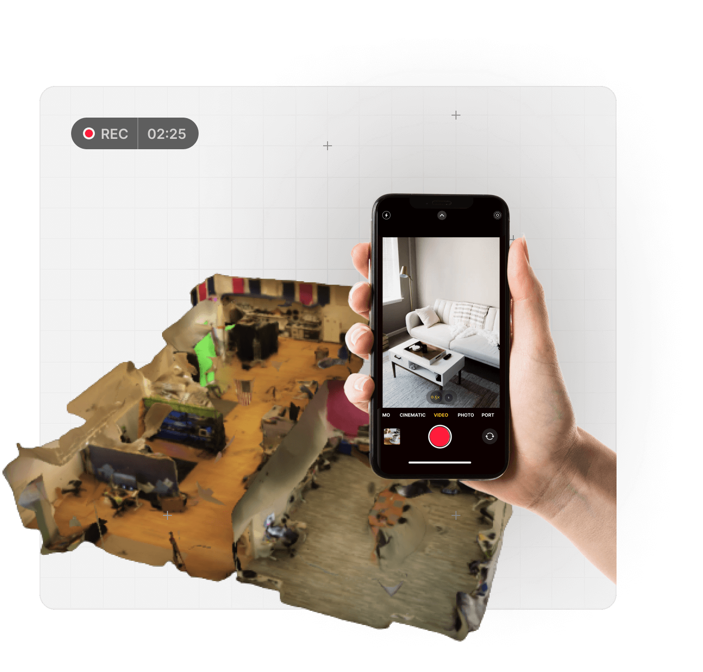
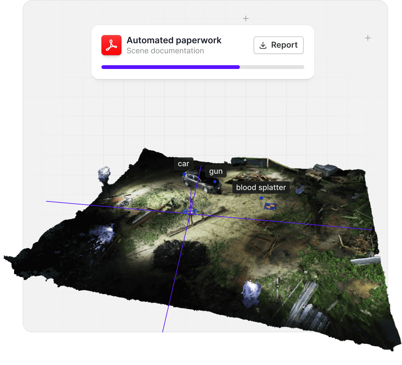
Fly a two orbit SkyeBrowse mission over an outdoor scene, or walk an indoor scene with a phone, 360 camera, or body worn camera and upload the video with the Interior Mapping toggle. The cloud builds a measurable 3D model in minutes, so the scene is preserved before it is released.
Investigators then measure distances, angles, and areas, drop annotations, attach evidence photos with the Case Gallery, and walk the model at eye level in Walk Mode. Anyone with a shared link can review the same scene later without returning to it.
How does 3D mapping speed up accident reconstruction?
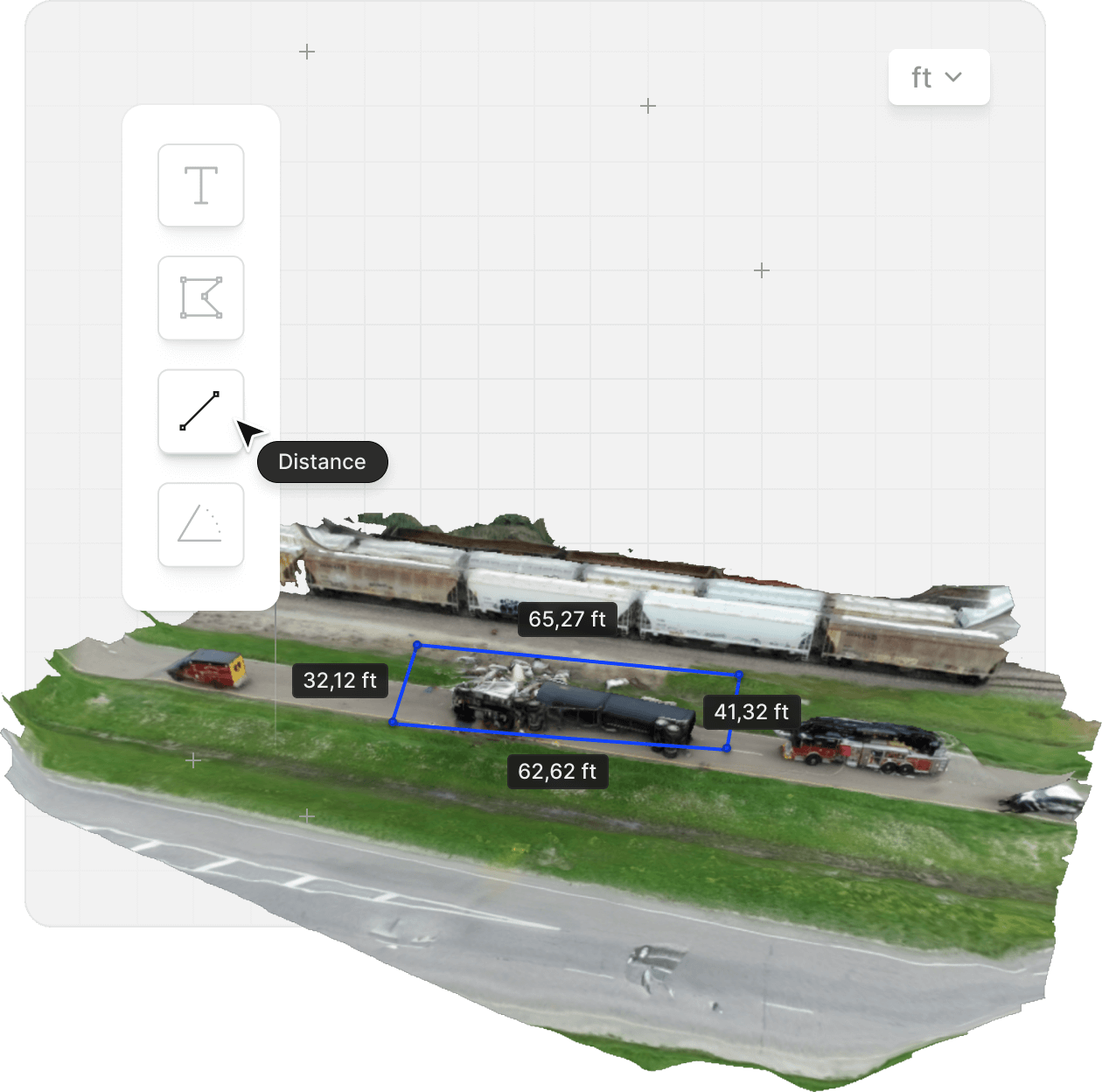
A single continuous drone video replaces hours of total station work. Processing runs at roughly one minute per minute of video, so the roadway reopens sooner and the full scene stays available for measurements taken days or months later.
Georeference the model with the drone's GPS subtitle file, measure skid marks and rest positions, and export a Factual Diagram PDF with a top-down overview, annotation callouts, scale bar, and compass. SkyeBrowse was founded after a motorcycle crash exposed how slow reconstruction can be, and accident reconstruction remains the core workflow.
Can fire departments use it for pre-planning and interior mapping?
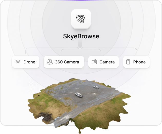
Yes. Walk a building with an Insta360 or other 360 camera, upload the native file with the Interior Mapping toggle, and get a model of hallways, stairwells, and utility rooms. Fly the exterior with a drone and stack both in one scene with 3D Overlay, so crews see roof, walls, and interior rooms in a single viewer.
The Public Safety Icons tool places NFPA 170 style pre-plan symbols such as hydrants, fire alarm control panels, and suppression equipment directly on the model, along with NAPSG all-hazards fire, law enforcement, and EMS symbology. Thermal Mapping supports post-fire scene documentation.
Does it support tactical planning and Drone as First Responder programs?
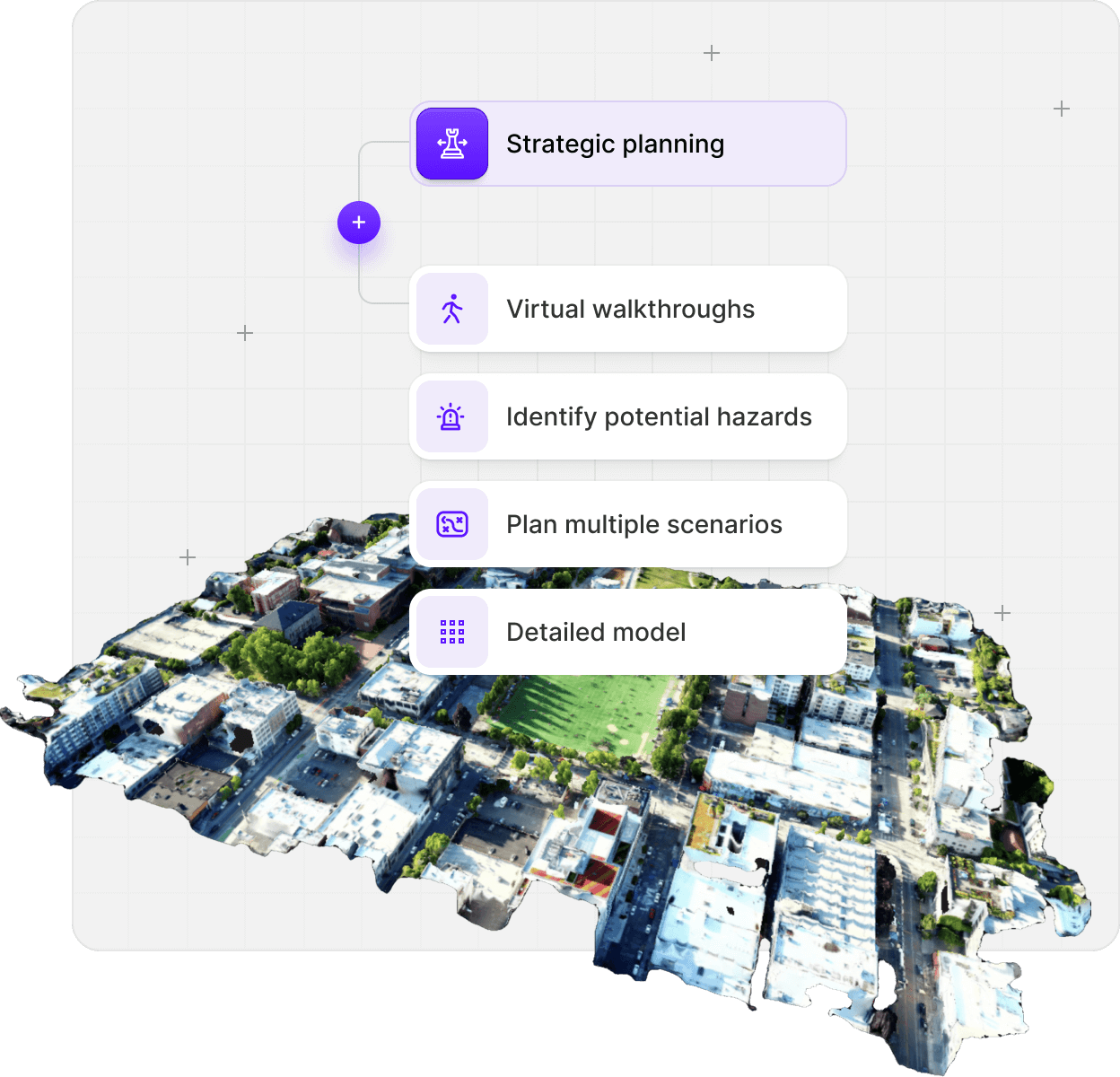
Map schools, venues, and critical facilities before an incident so command staff can plan entries, staging, and perimeters on a model instead of a floor plan. Line of Sight shows what an observer can and cannot see from any point, and its Security Coverage planner suggests camera or officer placements that close the gaps.
For live operations, TacBrowse maps team member locations inside the generated 3D model, and an announced Paladin integration brings near real-time 3D modeling into Drone as First Responder workflows. Both are specialized workflows on top of the standard upload path.
Will the 3D model hold up in court?
Public Safety & Enterprise models process at 16K with 0.1 inch accuracy, validated in studies against photogrammetry and laser scanning. The Factual Diagram tool produces a court-ready PDF from a reference point, measurements, annotations, a top-down overview, and a sketch page. AI Factual Diagram drafts a neutral factual description of the scene and stays out of fault, speed, or cause.
Chain of custody logging records model access, user actions, and sharing, with 2FA available. The platform runs on AWS in the US at FedRAMP Impact Level 2, full CJIS compliance is maintained for Public Safety & Enterprise subscribers, and models export to Axon Evidence.com along with LAZ, GLB, OBJ, GeoTIFF, and CAD.
Which viewer tools are built for public safety?
Every tool below is included with Public Safety & Enterprise models. Measurement, annotation, and orthomosaic tools are available on all paid plans.
Line of Sight
Green shows what an observer can see and red what is blocked, from up to two observer points with adjustable direction, range, and field of view. Used in the Utah Valley University investigation to help investigators determine the shooter's position.
Read the case studyPublic Safety Icons
Searchable NAPSG all-hazards fire, law enforcement, and EMS symbols plus an NFPA 170 style pre-plan set, placed directly on the model and managed from the object tree.
Sun & Shadow
Set any date and time to see how sunlight and shadows fell across the scene, then play to animate the day. Weather-aware lighting pulls actual conditions for the model's location.
Walk Mode
First-person navigation with WASD keys and an adjustable eye height, so a witness or jury view can be reproduced from ground level.
Case Gallery
Attach one or many evidence photos to an annotation and review every image uploaded to the model in one gallery with zoom and pan.
Factual Diagram and Sketch Drawing
Generate a court-ready factual diagram PDF and clean top-down or current-view sketches with scale bar, compass, and annotation callouts.
AI Floor Plans and AI Site Plan
One click floor plans for interior models and a CAD-ready site plan traced from the orthophoto, exportable as DXF or GeoJSON.
Image Walkthroughs
Frames from the capture video appear inside the model along the flight or walking path, including full 360 views from 360 camera footage.
What does SkyeBrowse cost for a public safety agency?
Agencies buy models, not licenses. Estimate the number of scenes you expect to document in a year, then request a quote for that amount.
- $199 per model per year on the Public Safety & Enterprise plan, billed annually, starting at a single model.
- Unlimited users. Investigators, drone teams, command staff, prosecutors, and analysts share one agency account with no seat fees.
- Unused models roll into the next annual term while the subscription stays active, and finished models are stored for 5 years.
- Unlimited practice models for onboarding and training. They do not count against the agency's model balance and delete after one month.
- Pilot Program: a free trial of about two weeks with full Public Safety & Enterprise access for public safety and government agencies.
Full plan comparison, including Freemium, Commercial, and Pro models: SkyeBrowse pricing. The W-9 and sole source letter are public downloads at skyebrowse.com/quote-info.
Which agencies already use SkyeBrowse?
Police departments, fire rescue, and DFR programs have published how they document scenes with SkyeBrowse.
- How Seward Police Department uses SkyeBrowse
- How Huntington Beach Police Department uses SkyeBrowse
- How Weatherford Police Department uses SkyeBrowse
- How Albemarle County Fire Rescue uses SkyeBrowse
- Middletown Police Department saved $4.7 million
- Drones as a First Responder case study
- Hurricane Helene disaster response case study
- Line of Sight for protective security
Read real reviews from our satisfied customers

I was very impressed by the ease of use. Great measurement accuracy and excellent customer service.
DFW Airport Police
So far it's really easy to use and much more user friendly than Pix4D
Oceanside Fire Department
This is a game changer. I wish this was developed 3 to 4 years ago.
Los Angeles District Attourney's Office
Public safety 3D mapping questions
Answers to the questions agencies ask before a pilot or purchase.
Request Quote


