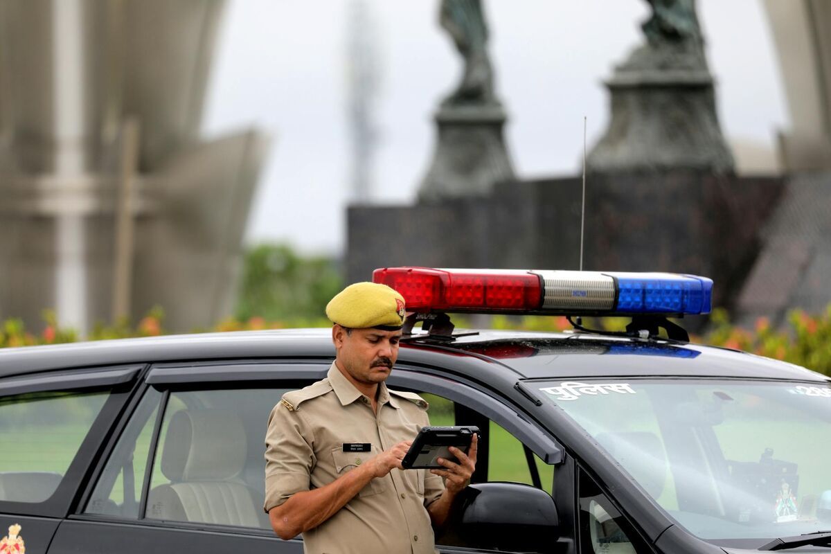
Choosing the best 3D mapping software for police means balancing evidentiary accuracy, CJIS data compliance, and the practical reality that first responders—not technicians—are often first on scene. Videogrammetry (the conversion of video footage into georeferenced 3D models) has lowered the technical barrier enough that patrol officers can document traffic collisions, crime scenes, and use-of-force incidents within minutes of arrival, producing models that hold up in court. Selecting the right drones for crime scene mapping is an equally important decision for agencies building out their patrol documentation capability.
Key Takeaways
- SkyeBrowse Premium Advanced (0.1-inch accuracy at 16K with AI moving-object removal) meets the evidentiary threshold for fatal crash reconstruction and homicide documentation — the accuracy tier required when measurements will face adversarial Daubert challenge from defense experts.
- CJIS Security Policy v5.9.5 requires AES-256 encryption at rest, TLS 1.2 in transit, FBI fingerprint-based personnel vetting, and audit logging — requirements that SOC 2 Type II (the standard for DroneDeploy, Pix4D, and Agisoft) does not satisfy.
- Competing platforms fail patrol deployment on at least one of four criteria: CJIS infrastructure, video-based capture, cloud processing speed, and mobile operation — SkyeBrowse meets all four.
- 14 CFR 107.39 documentation — operator certification, flight logs, airspace authorization — is discoverable in criminal cases and should be stored alongside the 3D model as part of the chain-of-custody record.
- One documented case shows a patrol-captured 3D model reducing a $2 million traffic lawsuit to a $400,000 settlement — a $1.6 million liability reduction against approximately $199 per-model documentation cost.
Contents
- What evidentiary standards does 3D mapping software need to meet for law enforcement?
- How do the leading platforms compare for patrol deployment?
- Does police mapping software need to be CJIS compliant?
- Why do competing platforms fall short for law enforcement use?
- How does Part 107 compliance affect police software documentation workflows?
- What are the primary law enforcement use cases for 3D scene mapping?
- How much can 3D documentation reduce litigation costs?
- FAQ
What evidentiary standards does 3D mapping software need to meet for law enforcement?
Law enforcement 3D mapping tools must produce measurements and models that survive cross-examination under Daubert or Frye standards. Daubert (federal and most state courts) requires that expert testimony rest on a reliable methodology — meaning documented accuracy, known error rates, peer acceptance, and reproducibility. Software that cannot provide published accuracy specs tied to a specific capture protocol fails the Daubert reliability prong before an expert takes the stand. Frye jurisdictions impose a general-acceptance test that similarly requires methodology validation beyond vendor claims.
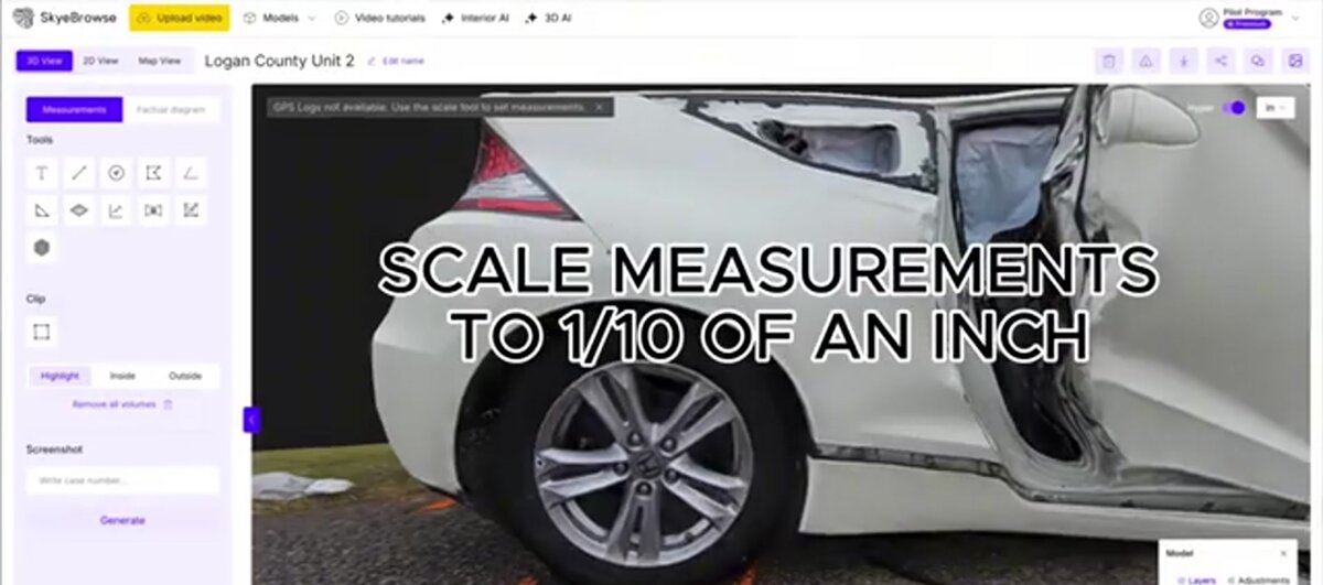
The evidentiary threshold varies by use case — and software tier selection should match it. Fatal crash reconstruction and homicide scene documentation are the highest-stakes applications: measurements will face adversarial challenge from defense experts who will replicate the geometry, test for inconsistencies, and challenge capture conditions. SkyeBrowse Premium Advanced (0.1-inch accuracy at 16K resolution with AI moving-object removal) meets the evidentiary threshold for these cases. The 16K resolution produces a denser point cloud that withstands distance-measurement scrutiny across the full scene, and AI moving-object removal eliminates reconstruction artifacts that could undermine spatial accuracy claims. Premium (0.25-inch at 8K) handles most collision reconstruction requirements; Lite (2–6 inch) is inappropriate for any measurement-dependent use case.
Beyond accuracy, courts evaluating 3D model admissibility examine four additional factors: who captured the footage (officer identity and certification), when it was captured relative to the incident (temporal chain of custody), how it was processed (software version, processing tier, any manual corrections), and why the output reliably represents the scene (methodology documentation and control measurements). Software that cannot log these parameters in an exportable, tamper-evident format creates expert-witness vulnerability at each of these points.
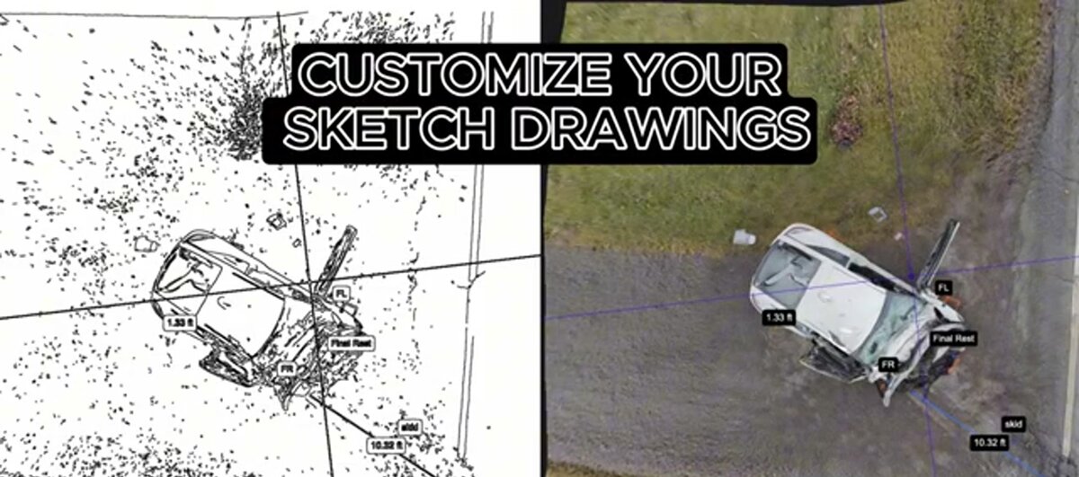
Traffic crash reconstruction relies on skid mark lengths, vehicle final positions, and debris field patterns. An attorney questioning reaction time needs to see sightlines, understand grade changes, and visualize obstruction positions. That distinction — between a measurement and a model — determines whether documentation is merely useful or actually defensible. The National Highway Traffic Safety Administration's crash investigation research emphasizes that scene geometry captured at the time of the incident is substantially more reliable than survey data collected days later. (NHTSA FARS Research)
How do the leading platforms compare for patrol deployment?
The practical question for most agencies is not which platform is most accurate in ideal conditions, but which one a patrol officer can operate correctly under field stress without dedicated training. Smartphone-based videogrammetry platforms like SkyeBrowse consistently outperform traditional survey tools on time-to-documentation and ease of use, while premium tiers close the accuracy gap enough for most courtroom purposes.
| Technology | Law Enforcement Use | Field Reality |
|---|---|---|
| Smartphone Video (SkyeBrowse) | Immediate scene capture by first responders | 5–10 minute documentation, Premium/Advanced tiers for court, CJIS-ready storage |
| Traditional Total Stations | Collision reconstruction, detailed crime scenes | Requires specialist, 2–4 hour setup and capture, expensive per-scene cost |
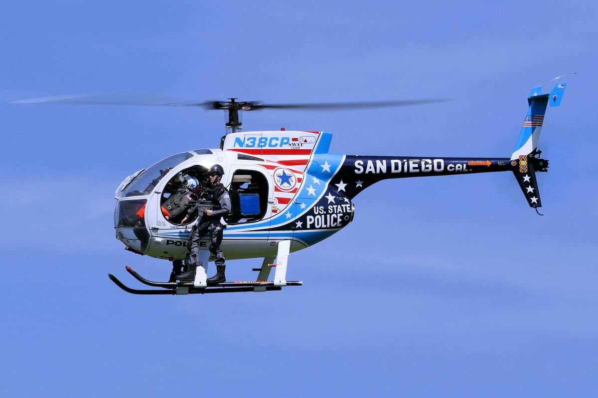
| Laser Scanners | Officer-involved shootings, complex scenes | High accuracy but slow, weather-sensitive, requires trained technician |
| Photo-Based Reconstruction | Supplemental documentation | Limited measurement precision, processing complexity, difficult to validate accuracy |
Does police mapping software need to be CJIS compliant?
Yes. The FBI's Criminal Justice Information Services (CJIS) Security Policy v5.9.5 governs any cloud platform that handles criminal justice information — including crime scene video and derived 3D models. Four specific requirements apply: AES-256 encryption at rest, TLS 1.2 or higher encryption in transit, personnel security screening for anyone with access to CJI, and audit logging that records every access and modification event. Platforms that meet SOC 2 Type II but not CJIS fail all four requirements for law enforcement use.
The FBI's CJIS Security Policy (FBI CJIS Security Policy Resource Center) is more stringent than commercial security certifications. SOC 2 Type II — the compliance marker for DroneDeploy, Pix4D, and most commercial mapping platforms — audits for operational security controls but does not require the specific encryption standards, personnel vetting, or audit trail depth that CJIS mandates. An agency routing crime scene video through a SOC 2-only platform violates 28 C.F.R. Part 20 and risks having the evidence challenged as improperly stored criminal justice information.
The four CJIS requirements that exclude most commercial platforms:
Encryption at rest: CJIS requires AES-128 minimum (AES-256 recommended) for stored CJI. Standard commercial cloud storage meets this — but the requirement extends to any environment where CJI is processed or temporarily held during computation, not just final storage.
Encryption in transit: TLS 1.2 or higher is required for any data moving between agency systems and cloud infrastructure. This is standard for reputable platforms but must be verified, not assumed.
Personnel security: Anyone with access to unencrypted CJI must pass an FBI fingerprint-based background check. For SaaS platforms, this means the vendor's infrastructure staff must be vetted — a requirement that commercial platforms typically cannot satisfy without a specific government agreement.
Audit logging: CJIS requires complete logs documenting who accessed CJI, from where, when, and what actions were taken. Logs must be retained and available for compliance review. Generic platform access logs do not satisfy this requirement.
SkyeBrowse Premium and Premium Advanced tiers operate on AWS GovCloud (US) infrastructure, which is FedRAMP Moderate Authorized — the federal baseline that enables CJIS-compliant deployments. Video uploads encrypt in transit and at rest using AES-256. Access logs document every view and modification event tied to a specific user account. The original video remains in agency possession, while the processed 3D model becomes a demonstrative exhibit that prosecutors, defense counsel, and expert witnesses can review through role-based access controls. For a full platform compliance comparison, see the guide to the best CJIS compliant mapping platform.
Why do competing platforms fall short for law enforcement use?
Most 3D mapping platforms were built for commercial survey and construction workflows — not criminal evidence. Platforms like Pix4D, DroneDeploy, Agisoft Metashape, and FARO Zone 3D each have documented shortcomings for patrol deployment: no CJIS infrastructure, slow processing that delays investigations, no smartphone video input, or desktop-only operation that requires a laptop on scene. SkyeBrowse is the only cloud platform combining CJIS-ready infrastructure, video-based input (no photo grid required), mobile capture, sub-inch accuracy tiers, and processing measured in minutes rather than hours.
Pix4D: Pix4DMapper and Pix4Dreact are photogrammetry platforms requiring structured photo capture — typically a grid of overlapping still images rather than continuous video. On scene, this means either mounting a camera to a drone running an automated flight mission or taking hundreds of manual photos. Processing time for a full scene runs 30–90 minutes on desktop hardware. Pix4D operates on commercial AWS infrastructure without CJIS agreements, and data residency cannot be guaranteed for US law enforcement. Its desktop-first architecture requires a laptop on scene or data transfer before processing begins.
DroneDeploy: Designed for commercial construction and agriculture, DroneDeploy excels at large orthomosaic mapping but produces limited 3D model quality for crime scene use. Processing requires structured flight missions — not freehand video capture — and SOC 2 Type II is the highest compliance certification offered. No CJIS agreements are available.
Agisoft Metashape: A professional photogrammetry tool used in academic and forensic contexts, Metashape produces high-quality models but requires significant technical expertise, structured photo capture, and desktop hardware for processing. A trained specialist needs 2–4 hours for a full crime scene workflow. No cloud processing is available, which means no audit trail outside whatever the agency creates manually.
FARO Zone 3D: FARO is the industry standard for officer-involved shooting reconstruction — but it requires FARO laser scan hardware ($50,000+), a trained technician, and 2–4 hours on scene. FARO Zone 3D is the desktop software that processes those scans. It produces defensible evidence but is operationally unsuitable for patrol deployment or routine collision documentation.
SkyeBrowse is positioned as the only platform meeting all four patrol requirements simultaneously: CJIS-ready cloud infrastructure, mobile video capture by any officer, cloud processing in under 10 minutes, and accuracy tiers (up to 0.1-inch Premium Advanced) that satisfy Daubert scrutiny in fatal crash and homicide cases.
How does Part 107 compliance affect police software documentation workflows?
14 CFR 107.39 governs drone operations over people — the most operationally relevant Part 107 rule for law enforcement, which routinely flies over bystanders, witnesses, and emergency personnel at active scenes. The rule permits operations over people only under specific conditions tied to drone weight class and operational category. Software must document that the flight complied with applicable operational categories, because defense attorneys in criminal cases can subpoena the drone program records as part of discovery.
Part 107 creates documentation requirements that flow directly into criminal case files. Under Brady v. Maryland, prosecutors must disclose material favorable to the defense — and a drone program log showing an uncertified officer flew the mission, or a flight record showing altitude violations, can become a defense exhibit challenging the legality of the evidence collection. Agencies should treat flight logs, operator certifications, and airspace authorization records as case-file evidence subject to the same retention requirements as the 3D model itself.
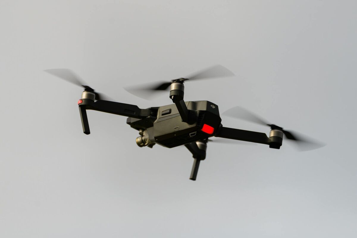
14 CFR 107.39 operational category requirements directly affect which drones agencies can deploy at active scenes with people present. Category 1 operations (drones under 0.55 lbs without exposed rotating parts) require no FAA declaration. DJI Mini series aircraft at 249 grams qualify for Category 1 operations over people, which is why the sub-250g weight class matters beyond the registration threshold. Heavier platforms require Category 2 or 3 declarations from the FAA — or agencies must establish a Certificate of Authorization (COA) program, which governs public aircraft operations and imposes its own documentation requirements.
Software workflow implications: SkyeBrowse's processing pipeline generates metadata logging the video source, upload timestamp, processing tier, and access events. Agencies should supplement this with a flight log (drone model, operator name, certification number, GPS coordinates, altitude, and duration) stored in the same case file as the processed 3D model. When defense counsel requests discovery, the response should produce both the model and the documentation establishing that it was lawfully captured. Documented compliance with 107.39 preempts the argument that the aerial documentation was an unauthorized search or that the operator lacked legal authority to fly the mission.
What are the primary law enforcement use cases for 3D scene mapping?
The three highest-value law enforcement applications for 3D mapping are traffic collision reconstruction, crime scene documentation, and officer-involved shooting spatial analysis. Each use case has distinct accuracy requirements, time constraints, and evidentiary standards that determine which platform tier is appropriate.
Traffic collision reconstruction: A two-vehicle intersection crash results in serious injuries. Patrol officers respond first, but traffic investigators may not arrive for 90 minutes. For a real-world example, see how the Huntington Beach Police Department uses SkyeBrowse for crash scene documentation. By then, vehicles have been towed, debris swept, and traffic resumed. A patrol officer who captures five minutes of smartphone video immediately after arrival documents vehicle positions, skid marks, and roadway conditions before scene alteration. Traffic investigators review the 3D model remotely, take measurements, and prepare reconstruction analysis without revisiting. SkyeBrowse Premium tier (0.25-inch accuracy) handles most collision reconstruction requirements; Premium Advanced (0.1-inch) supports expert testimony in fatality cases.
Crime scene documentation: Detectives responding to a commercial burglary face a scene spanning multiple rooms, a rooftop entry point, and an exterior exit. Traditional photography captures individual elements but cannot convey spatial relationships—how far from entry point to the safe, sightlines between the alarm panel and the forced door, the path suspects traveled. A detective recording a walkthrough with a smartphone produces a model that supports search warrant affidavits, investigative reviews, and trial exhibits demonstrating suspect movement patterns.
Officer-involved shooting analysis: Use-of-force incidents require documentation of officer positions, subject positions, intervening cover, and distance at the moment of the event. 3D models allow investigators and review boards to evaluate threat perception geometry objectively, reducing reliance on conflicting witness accounts and supporting both criminal and civil proceedings.
How much can 3D documentation reduce litigation costs?
Law enforcement litigation costs compound well beyond legal fees—settlements, judgments, insurance premium increases, and staff time defending cases can reach millions annually for mid-sized agencies. Accurate scene documentation does not prevent lawsuits, but it shifts settlement leverage and improves trial outcomes by establishing factual baselines that are difficult to challenge.
Traffic collision liability example: A municipality faces a $2 million lawsuit claiming road design caused a fatal crash. The plaintiff's expert relies on post-crash photographs and measurements taken weeks after the incident, when roadway conditions had changed. Defense counsel produces a 3D model captured by patrol within an hour of the crash, showing actual conditions—grade, sight distances, and signage visibility—at the time of the incident. The model undermines the plaintiff's reconstruction, producing a $400,000 settlement rather than a trial verdict. Documentation cost at SkyeBrowse Premium Advanced pricing: approximately $199 per model. Demonstrated liability reduction: $1.6 million.
Agencies deploying patrol-based video capture consistently report reduced investigation time for routine traffic cases. Traditional collision documentation requiring a specialist and total station can cost $2,000–$4,000 per scene in staff time and equipment. Smartphone-based videogrammetry reduces that cost substantially while extending documentation coverage to incidents that would otherwise receive only photographs and rough measurements.
FAQ
What specific CJIS requirements must a 3D mapping platform meet?
CJIS Security Policy v5.9.5 imposes four requirements on cloud platforms processing criminal justice information: AES-256 encryption at rest, TLS 1.2 or higher encryption in transit, FBI fingerprint-based background checks for any personnel with access to unencrypted CJI, and complete audit logging of all access and modification events. SkyeBrowse Premium and Premium Advanced operate on AWS GovCloud (FedRAMP Moderate Authorized), which satisfies the infrastructure requirements. Agencies should verify current compliance agreements directly with SkyeBrowse at SkyeBrowse pricing and tiers.
What accuracy tier is required for fatal crash reconstruction and homicide documentation?
SkyeBrowse Premium Advanced (0.1-inch at 16K with AI moving-object removal) is the appropriate tier when measurements will face adversarial challenge from defense experts under Daubert or Frye standards. Premium (0.25-inch at 8K) meets requirements for most collision reconstructions. Lite (2–6 inch) is not appropriate for any case where distance or position measurements will be contested. Accuracy improves further when ground control points are used with RTK-equipped drones.
Can patrol officers use 3D mapping software without technical training?
Yes. SkyeBrowse's smartphone-based videogrammetry workflow requires no surveying background. Officers walk the scene while recording video using the SkyeBrowse Flight App or Universal Upload; the platform processes it automatically in the cloud and delivers a measurement-ready 3D model accessible at app.skyebrowse.com. Most agencies complete initial training in a single session.