Professional land surveyors face a specific challenge when adopting drone mapping software: the platform must meet state licensing standards for positional accuracy, support ground control point integration, and produce deliverables that import cleanly into CAD and GIS workflows. Not every drone land surveying tool qualifies. The best options balance field speed with the accuracy verification that professional certification requires. For the field-side fundamentals of aerial drone surveying, including flight planning, capture settings, and deliverable types, see our full surveying guide; this page focuses on the software layer.

Contents
- What Accuracy Do Professional Surveyors Need from Drone Mapping Software?
- How Do the Leading Drone Mapping Platforms Compare for Survey Work?
- Which Survey Types Benefit Most from Drone Mapping?
- What About State Board Compliance and Professional Liability?
- How Does Ground Control Integration Work?
What Accuracy Do Professional Surveyors Need from Drone Mapping Software?
For certified survey deliverables, drone land surveying software must achieve ALTA/NSPS positional accuracy of 0.07 feet at property corners and 0.15 feet at building positions. Topographic surveys supporting engineering design typically require 0.25–0.5 foot vertical accuracy. Platforms that support GCP integration and documented processing methodology are the only ones suitable for work a licensed surveyor can certify.
ALTA/NSPS standards require 0.07-foot positional accuracy for property corners and 0.15 feet for building positions. Topographic surveys for engineering design typically need 0.25-0.5 foot vertical accuracy to support 1-foot contour intervals. Any drone mapping software used for certified survey deliverables must meet or exceed these thresholds.
Professional liability adds weight to accuracy requirements. A surveyor certifying boundary positions or topographic data assumes legal responsibility for the numbers. A 0.5-foot elevation error in a grading plan can cause drainage failures costing hundreds of thousands to fix — with the surveyor potentially liable. Drone-derived data must pass the same verification workflows as total station measurements, which means the software needs to support GCP integration, independent field checks, and documented processing methodology.
How Do the Leading Drone Mapping Platforms Compare for Survey Work?
The major UAV survey platforms differ significantly in how they balance processing speed, accuracy, cost, and compatibility with licensed survey workflows. RTK/PPK systems eliminate most ground control but carry a $20K–$50K equipment premium, while videogrammetry-based tools like SkyeBrowse process footage at near real-time speeds and accept video from any survey drone. Matching the platform to project type and deliverable requirements is the key decision surveyors need to make before committing to a workflow.
Each platform handles the accuracy-to-speed tradeoff differently. The right choice depends on project type, volume, and how much processing control the surveyor needs.
| Platform | Survey Application | Accuracy Path |
|---|---|---|
| SkyeBrowse | Rapid topo, construction monitoring, existing conditions | Premium Advanced (0.1-inch) with GCP integration meets professional standards |
| Traditional Photogrammetry Suites | Large topographic surveys, corridor mapping | Proven accuracy but complex processing, requires specialist training |
| RTK/PPK Drone Systems | Direct georeferencing, reduced ground control | $20K-$50K equipment investment, survey-grade but processing-heavy |
| Total Station/GPS | Boundary, construction staking, as-builts | Gold standard accuracy but limited productivity on large-area surveys |
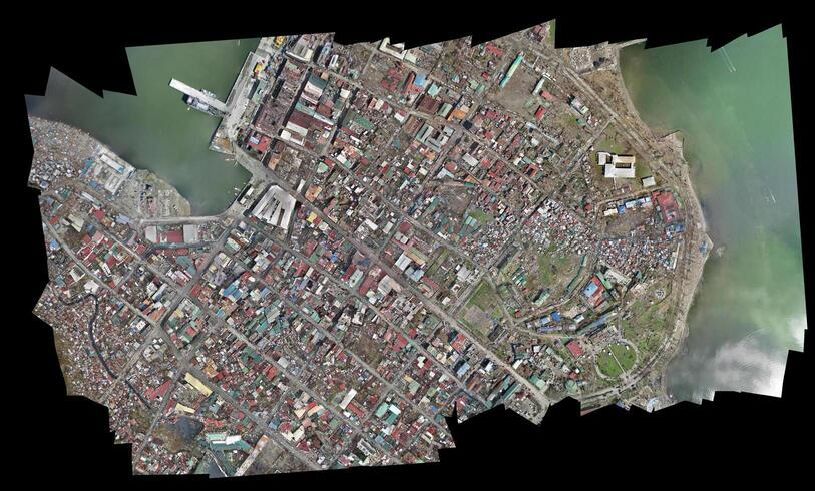
SkyeBrowse processes video at roughly 1:1 speed through videogrammetry — a 10-minute site flyover returns a model in about 10 minutes. Universal Upload accepts .MP4/.MOV from any drone, and exports include LAZ point clouds, GLB meshes, and GeoTIFF orthomosaics that import directly into Civil 3D, Trimble Business Center, or any GIS platform.
Which Survey Types Benefit Most from Drone Mapping?
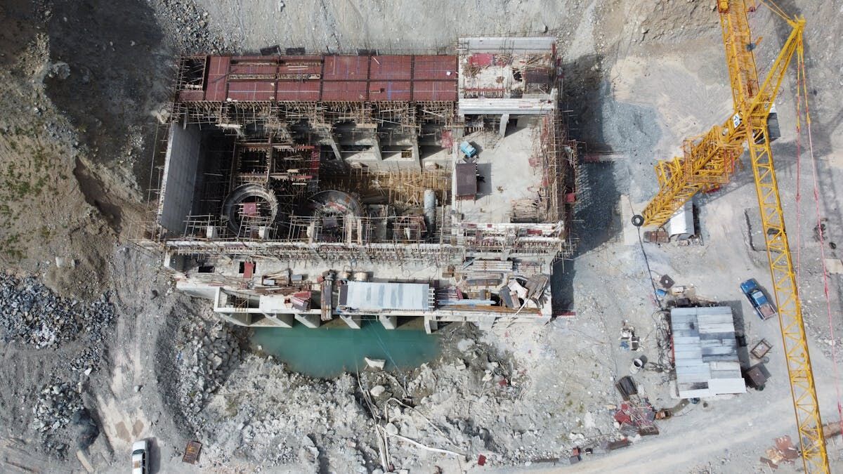
Topographic surveys, construction progress monitoring, and ALTA improvement documentation all gain meaningful efficiency from drone topography workflows. Boundary surveys still rely primarily on total station and GPS for legal monumentation, but drone data supplements them with existing-conditions context and site feature documentation. The drone survey cost advantage is most pronounced on large-area topo projects where traditional ground crews would require weeks of field time.
Topographic surveys for design see the largest efficiency gains. A 40-acre commercial development requiring traditional ground survey takes 3-4 weeks of field time and costs $25,000-$35,000. By contrast, drone survey cost for an equivalent project — establish 6-8 GCPs with RTK GPS (4 hours), fly the site (2 hours), process and field-verify (4 hours) — runs $12,000-$18,000 with total field time compressed to 10-12 hours. That is a 40-50% cost reduction while maintaining the accuracy standards that drone land surveying for certified deliverables demands.
Construction progress monitoring benefits from repeatability. Fly the same pattern monthly, compare models against design surfaces, and catch grading deviations before they compound. The temporal record also supports dispute resolution when contractors question survey data.
Boundary surveys remain primarily total station and GPS work — legal monumentation and corner evidence require direct field measurement. However, drone data supplements boundary surveys by providing existing conditions context, locating improvements for ALTA surveys, and documenting site features that support boundary analysis.
What About State Board Compliance and Professional Liability?
State licensing boards treat UAV land surveying data the same as any other survey method — accuracy standards are non-negotiable and professional liability attaches to the certifying surveyor regardless of how data was collected. A defensible UAV survey workflow documents processing methodology, uses independently surveyed ground control, and retains field verification records for E&O defense. Choosing a platform that supports this audit trail is as important as its raw accuracy specifications.
State licensing boards hold that drone-derived data must meet the same accuracy standards as traditional survey methods when certified by a licensed surveyor. The surveyor must establish a validation workflow that proves compliance.
A defensible workflow includes: (1) documented processing methodology, (2) ground control integration with coordinates surveyed at higher accuracy than the required output, (3) independent field verification comparing model-derived elevations against RTK GPS checks, and (4) written QA procedures showing repeatable quality control. Include these elements in survey notes and retain processing documentation for E&O defense.
Match processing tier to project requirements. If a topographic survey uses Premium tier processing (0.25-inch accuracy), do not represent it as achieving the 0.1-inch accuracy that Premium Advanced provides. Clear accuracy documentation in survey deliverables and certifications protects the surveyor's professional standing.
How Does Ground Control Integration Work?
Ground control points (GCPs) are the mechanism that elevates a survey drone capture from reference-grade imagery to certifiable survey data. Surveyors set 5–10 RTK GPS-surveyed targets across the site, ensure they appear in the drone footage, then supply coordinates alongside the video during processing. The resulting model is constrained to real-world coordinates, and independent field checks confirm the output meets the required accuracy standard.
Survey-grade photogrammetric processing typically uses 5-10 control points distributed across the project area. Each point must be visible in the captured footage, surveyed with RTK GPS at 0.02-0.05 foot accuracy, and marked with targets the processing software can identify.

Efficient workflow: scout the site during reconnaissance, set targets at locations providing good distribution and visibility from flight altitude, survey control points with RTK GPS, fly the drone capture ensuring control points appear in footage, then upload video and coordinates for processing. Accuracy verification follows — export spot elevations from the model at field check locations and compare against RTK measurements. Differences averaging 0.10-0.15 feet demonstrate compliance with engineering survey standards.
Get a SkyeBrowse Quote
Professional land surveying demands mapping tools that meet state licensing standards while improving field efficiency. If your survey practice needs rapid topographic data, construction progress documentation, or ALTA improvement location capture, SkyeBrowse provides the accuracy tiers and GCP integration workflows that professional surveying requires.