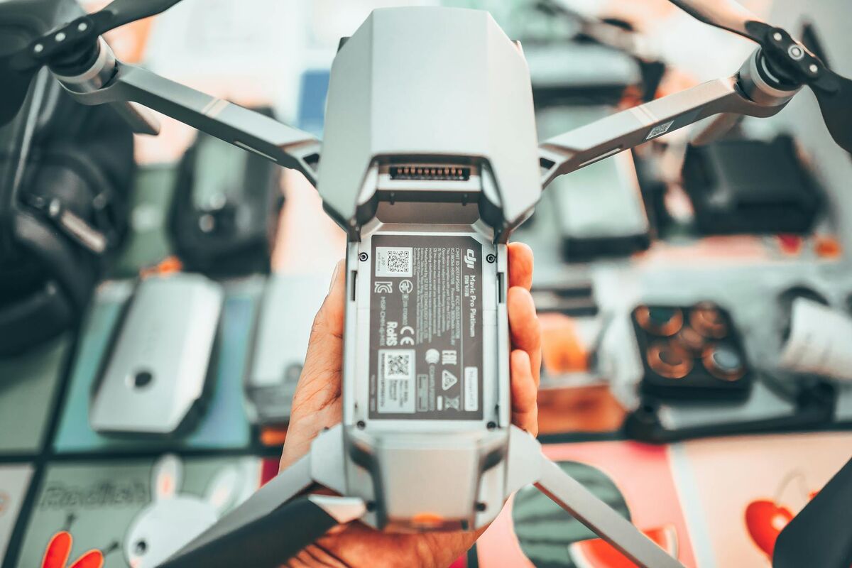
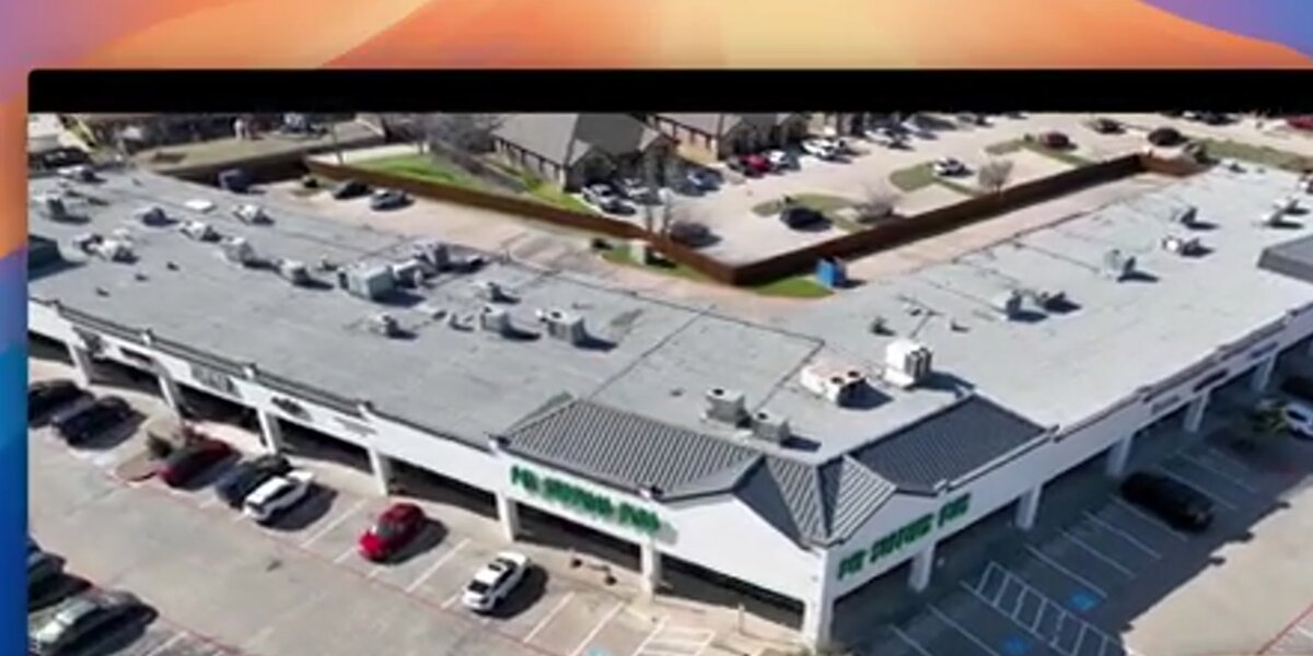
Drone roof inspection software converts footage from a brief aerial flight into a measurable 3D roof model, no ladder, no slope-walking, no return visit. For a wider look at the workflow beyond software selection, see our guide to drone roof inspection. The right platform eliminates dangerous manual surface access, speeds up insurance claims, and delivers defensible measurements before the inspector leaves the property. This guide compares the leading roof inspection software options, drone-flown and imagery-based alike, with every price point checked directly on the vendor's site in July 2026.
Key Takeaways
- Drone roof inspection software replaces manual slope-climbing with aerial capture, reducing OSHA fall-exposure risk and inspection time for both residential and commercial properties.
- SkyeBrowse's videogrammetry engine (video-to-3D) delivers a measurable 3D roof model in minutes from a single drone video, no ground control points (GCPs) required.
- Premium accuracy tiers reach about 0.25 inch, making drone-generated roof measurements suitable for insurance claims documentation and litigation support.
- Not every roof measurement tool requires a drone: Hover works from smartphone photos alone, while EagleView, Nearmap, and GAF QuickMeasure work from pre-captured aerial or satellite imagery.
- Per-model credit pricing (from $99) suits variable-volume contractors; annual subscriptions from Hover, DroneDeploy, and iRoofing suit teams running dozens of inspections per week.
Contents
- What is the best drone roof inspection software?
- How does drone roof inspection software work?
- What are the top roof inspection software tools compared on input method?
- What outputs and accuracy tiers does each platform deliver?
- What accuracy do you need for insurance and contractor work?
- What should roofing contractors look for in a roof measurement platform?
- How much does roof inspection software cost in 2026?
- How did we evaluate these roof inspection platforms?
- FAQ
What is the best drone roof inspection software?
SkyeBrowse is the fastest drone roof inspection software for contractors and adjusters who need a shareable 3D model the same day. A single orbital video flight, typically under five minutes, produces a georeferenced 3D model with measurable geometry, with no ground control points required. For large-scale commercial mapping, DroneDeploy is the enterprise alternative. For contractors who would rather skip the drone entirely, Hover measures directly from smartphone photos, and iRoofing bundles DIY measurement tools with an imagery subscription. For remote or satellite-based assessments where a drone flight is impractical, EagleView, Nearmap, and GAF QuickMeasure are established choices.
The right software depends on three variables: how quickly you need results, the level of measurement accuracy required, and whether you are flying your own drone, snapping smartphone photos, or purchasing pre-captured aerial imagery. Contractor-flown platforms like SkyeBrowse and DroneDeploy capture current site conditions immediately after a storm or damage event; satellite and aerial imagery platforms refresh on a scheduled basis and cannot show damage that occurred after their last pass.
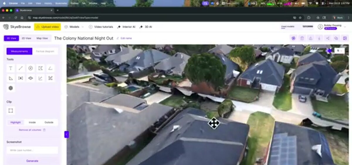
SkyeBrowse stands out among drone roof inspection software options because it accepts standard drone video (.MP4 or .MOV) rather than requiring a controlled photo grid. That means roofing contractors and insurance adjusters can use a drone they already own without changing their flight patterns. The cloud-based processing at app.skyebrowse.com handles the heavy computation, so no specialized workstation is needed in the field.
How does drone roof inspection software work?
Drone roof inspection software processes aerial video or photos into a 3D model or 2D orthomosaic, see our orthomosaic vs 3D model breakdown for which output fits a given claim or bid. The drone flies an orbit or grid pattern over the roof, recording footage that is uploaded to a cloud platform. The software extracts depth and geometry from overlapping frames, a technique called videogrammetry or photogrammetry, producing a measurable model contractors and adjusters can annotate, measure, and share without returning to the site.
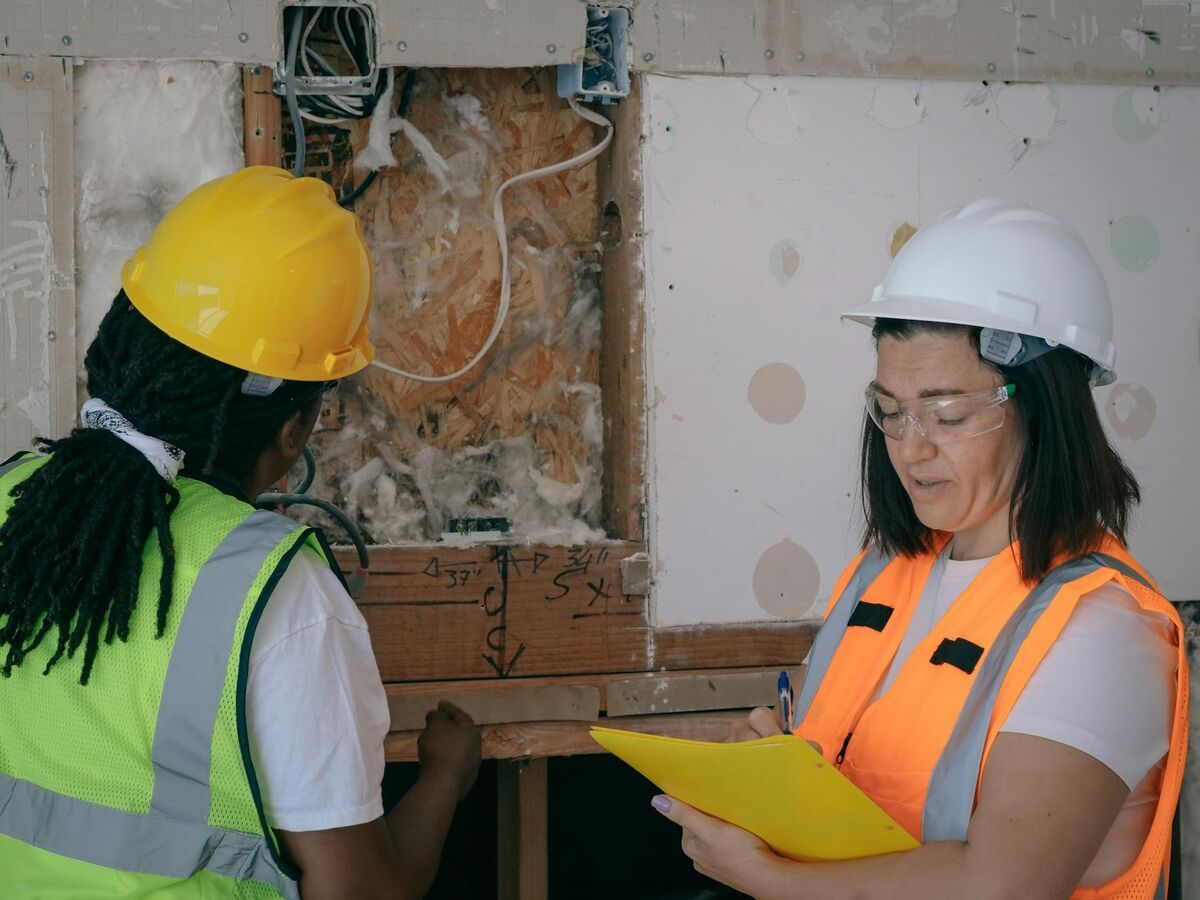
Traditional roof inspections require technicians to physically walk the surface, a practice the National Roofing Contractors Association (NRCA) acknowledges carries significant fall risk, especially on steep-slope systems. OSHA's fall protection standards for construction require guardrails, safety nets, or personal fall arrest systems on roofs with unprotected edges above six feet. Drone-based software removes personnel from the fall zone entirely for the data-gathering phase.
There are two main processing approaches: photogrammetry (overlapping still photos analyzed for depth and geometry) and videogrammetry (continuous video frames processed as a dense image sequence). Both methods extract 3D point clouds and surface meshes. Videogrammetry typically requires less pre-flight planning and supports faster ground-to-model turnaround because the video stream generates hundreds of overlapping frames automatically during a standard fly-around.
The output of either approach is a georeferenced 3D model or orthomosaic that can be measured inside the browser without any additional software. Contractors pull pitch angles, ridge lengths, and total square footage from the same model they share with adjusters. For a broader look at how this same workflow applies to building exteriors, see our guide on drone facade inspection.
What are the top roof inspection software tools compared on input method?
Roof inspection platforms split into three input categories: contractor-flown drone video or photos, smartphone photos with no drone at all, and pre-captured satellite or aerial imagery that requires no flight from the user. Each category trades speed and control for cost and complexity in a different way.
| Platform | Primary Input | Who Captures It |
|---|---|---|
| SkyeBrowse | Drone video (.MP4/.MOV) | Contractor or adjuster-flown |
| DroneDeploy | Drone photos, video, 360 and fixed cameras | Contractor-flown |
| Hover | Smartphone photos (guided capture app) | Contractor or homeowner, no drone |
| iRoofing | Satellite, aerial, drone, or blueprint imagery | Contractor-supplied or DIY measurement |
| EagleView | Proprietary aerial imagery (3.5 billion-plus image library) | EagleView-captured, ordered on demand |
| Nearmap | Aerial imagery from Nearmap's own aircraft (HyperCamera3) | Nearmap-captured, subscription access |
| GAF QuickMeasure | Satellite and aerial imagery | Ordered on demand, no flight required |
| Loveland Innovations (Zeitview) | Drone or multi-modal imagery, existing or newly captured | Contractor-supplied or Zeitview-flown |
Table verified as of July 2026 against each vendor's own site.
Pix4Dfields, sometimes grouped with drone mapping platforms, is built specifically for agricultural crop analysis (NDVI, zone management) and does not offer a roofing product, so it is excluded from this comparison.
What outputs and accuracy tiers does each platform deliver?
Every platform in this comparison outputs some form of measurement report, but the deliverable format varies widely: a browser-measurable 3D model, a static PDF, an interactive rendering, or a line-item estimate. Accuracy also varies by capture method, contractor-flown drone platforms with tiered processing generally offer the widest accuracy range to match the job.
| Platform | Output | Reported Accuracy |
|---|---|---|
| SkyeBrowse | Measurable 3D model, 2D orthomosaic, LAZ/GLB/GeoTIFF exports | 2-6 in (Lite) / about 0.25 in (Premium, 8K) / about 0.1 in (Premium Advanced, 16K) |
| DroneDeploy | Orthomosaic, 3D model, panoramas, video, volumetric and thermal data (Advanced) | Sub-inch with ground control points |
| Hover | Exterior and interior measurements, itemized estimate | Not independently published; smartphone-photo based |
| iRoofing | DIY measurements, estimate, pitchbook, material catalog | Varies by source imagery (satellite, aerial, drone, or blueprint) |
| EagleView | PDF or interactive measurement report; EagleView One (launched 2025) adds an interactive 3D property model | About 1 in, per vendor marketing |
| Nearmap | High-resolution imagery with AI-flagged roof conditions and historical comparison | Roughly 1.57-2.95 in per pixel resolution |
| GAF QuickMeasure | Measurement report, Bill of Materials, interactive 3D rendering | Not independently published |
| Loveland Innovations (Zeitview) | Asset inventory database, damage and risk assessment report | Not independently published |
Table verified as of July 2026. Figures marked "not independently published" reflect vendors that do not publish a specification on their own site; treat those as directional rather than certified.
EagleView and Nearmap are strong options when a drone flight is not possible, bad weather, restricted airspace, or a tight timeline. However, their imagery is not captured on demand, so damage from a storm yesterday will not appear until the provider's next pass (Nearmap refreshes most markets up to three times a year). For post-storm claims and time-sensitive inspections, contractor-flown drone platforms or a smartphone-based tool like Hover are the only ways to capture current site conditions the same day.
What accuracy do you need for insurance and contractor work?
Insurance adjusters typically need accuracy within 1 to 4 inches to document damage and calculate replacement costs. Roofing contractors bidding material quantities work comfortably at 2 to 6 inch accuracy. Legal and litigation support, including disputed claims or construction defect cases, may require documented sub-inch accuracy with georeferenced outputs. Choosing a platform with multiple accuracy tiers lets you match processing cost to the job's actual requirement.
The gap between accuracy tiers matters more on large commercial roofs than residential ones. A 4-inch error on a 5,000-square-foot flat roof can translate to several hundred square feet of variance in area estimates. Contractors handling both residential and commercial work benefit from a platform that offers tiered processing rather than a single fixed accuracy level.
For drone roof inspection cost breakdowns, including how processing fees compare to manual inspection labor, see our guide on drone roof inspection cost.
FAA Part 107 certification is required for any commercial drone flight in the U.S., including insurance-commissioned inspections. Software that skips the drone entirely, Hover's smartphone capture, or EagleView, Nearmap, and GAF QuickMeasure's pre-captured imagery, sidesteps this requirement since no flight takes place. Many roofing and insurance firms partner with licensed drone operators rather than obtaining the certification themselves when they do need contractor-flown capture.
What should roofing contractors look for in a roof measurement platform?
The five most important criteria are processing speed, accuracy tier options, hardware compatibility, output formats, and per-job cost. Contractors running high inspection volume need a platform that delivers results the same day, not the next morning. Hardware agnosticism matters because drone fleets get replaced; locking into software that only works with one manufacturer creates upgrade friction.
Processing speed separates workable platforms from productivity tools. If a team inspects 10 roofs per day, a two-hour processing queue creates a backlog. SkyeBrowse's video-based processing completes most residential roofs in minutes; estimates can go out the same afternoon.
Hardware compatibility matters because drone fleets get upgraded. SkyeBrowse supports a wide range of DJI and Autel drones (see skyebrowse.com/supported-drones), and any drone recording standard .MP4 or .MOV with embedded telemetry works with the Universal Upload option.
Output formats and per-job economics both need to match your existing workflow. Contractors sharing measurements with a general contractor need a browser-shareable link; those integrating with Xactimate need a structured data export. For pricing, subscriptions (Hover Pro, DroneDeploy, iRoofing) suit high-volume teams, while SkyeBrowse's $99 per Premium model credit works well for variable-volume contractors who want to avoid fixed overhead in the off-season.
For a broader look at how drones fit into 3D spatial documentation across property types, see our overview of drone 3D mapping workflows. The NRCA's published guidance on drone use in roofing also covers operational considerations for contractors integrating aerial capture into their inspection process.

How much does roof inspection software cost in 2026?
Roof inspection software pricing falls into three models: per-report fees, per-model or per-project credits, and annual subscriptions. The right structure depends on your inspection volume; high-volume teams favor subscriptions, while variable-volume contractors and single-event adjusters benefit from pay-per-model pricing.
| Platform | Pricing (as of July 2026) |
|---|---|
| SkyeBrowse | Lite $59/mo or $468/yr; Premium $99/model credit; Premium Advanced $199/model credit |
| DroneDeploy | Flight & Analysis Plan $4,188/yr; Ag Lite $1,908/yr; Advanced tier custom quote |
| Hover | Starter pay-as-you-go $59-139/project by complexity; Pro $999/yr with $39-119/project |
| iRoofing | $107-149/mo for 3 users depending on commitment length, includes $75/mo HD imagery credit (150 credits) |
| EagleView | Not published by vendor; per-report pricing (third-party-tracked) runs roughly $15-38 standard, up to $87 premium; EagleView One subscription is quote-based |
| Nearmap | Not published; subscription or quote-based |
| GAF QuickMeasure | Reports from $18, no subscription required; +$10 add-on for hail and wind history |
| Loveland Innovations (Zeitview) | Not published; demo and quote required |
Table verified as of July 2026. Rows marked "not published" reflect vendors that keep pricing behind a sales conversation; figures sourced from third-party pricing trackers are marked accordingly and should be confirmed directly with the vendor before budgeting.
Per-credit models like SkyeBrowse ($99 for Premium, $199 for Premium Advanced) let contractors pay only for what they process; there is no monthly minimum in the off-season. Annual subscriptions like Hover Pro and DroneDeploy make more financial sense above a certain weekly inspection threshold.
It is worth calculating the break-even point for your team. A contractor processing 8 drone models per month pays $792/month on SkyeBrowse Premium credits. If a competing platform's annual subscription works out to under $792/month, the subscription wins on economics alone, provided the accuracy tier and processing speed meet your requirements. For photogrammetry-based alternatives and how their pricing compares, see our guide on best photogrammetry software.
How did we evaluate these roof inspection platforms?
Every platform in this guide was assessed on five published criteria: input method, output format, accuracy specification, hardware or capture requirements, and current pricing. Figures were checked directly against each vendor's own pricing or product page in July 2026 where the vendor publishes them; SkyeBrowse's specifications are drawn from kb.md, our internal source of truth for product facts.
We did not run side-by-side accuracy tests or process identical roofs through every platform; several of these tools (EagleView, Nearmap, Loveland Innovations) do not sell direct self-serve access that would make an apples-to-apples test possible without a sales contract. Where a vendor does not publish pricing or accuracy on its own site, we say so explicitly rather than presenting a third-party estimate as an official figure. GAF QuickMeasure and Hover pricing came directly from their own pricing pages; EagleView's per-report figures are third-party-sourced because EagleView does not publish a rate card. Because per-report and subscription pricing for several vendors here changes without notice, this guide is scheduled for quarterly re-verification, and readers evaluating a specific vendor for a contract should confirm current numbers directly before budgeting.
FAQ
What is the best drone roof inspection software?
SkyeBrowse is a leading choice for contractors and adjusters who need fast turnaround: video uploaded from the field becomes a shareable 3D model in minutes, with no ground control points required. For enterprise-scale commercial mapping projects, DroneDeploy offers deep feature sets. For teams that would rather skip flying a drone, Hover works from smartphone photos and iRoofing bundles DIY measurement with an imagery subscription. For remote or satellite-based assessments without a drone flight, EagleView, Nearmap, and GAF QuickMeasure are established alternatives.
How does drone roof inspection software work?
A drone flies an orbit or grid pattern over the roof and records video. That footage is uploaded to a cloud platform, such as app.skyebrowse.com, where a processing engine extracts depth and geometry from overlapping frames using videogrammetry or photogrammetry. The output is a georeferenced 3D model or orthomosaic the contractor can measure, annotate, and share through a browser link without any additional desktop software.
How much does drone roof inspection software cost?
As of July 2026, pricing ranges from about $18 per report (GAF QuickMeasure, no subscription) and roughly $15-38 for a third-party-tracked EagleView standard report, up to $99-199 per processed drone model (SkyeBrowse Premium and Premium Advanced), to annual subscriptions from around $1,000/year (Hover Pro) to over $4,000/year (DroneDeploy). High-volume teams benefit from subscriptions; variable-volume contractors benefit from per-credit pricing. See our full drone roof inspection cost breakdown for a detailed comparison.
Do I need a Part 107 license to use drone roof inspection software?
Yes, if you are flying the drone yourself. The FAA requires a Part 107 Remote Pilot Certificate for any commercial drone operation in the United States, including inspections conducted for hire. Software that works from smartphone photos (Hover) or pre-captured imagery (EagleView, Nearmap, GAF QuickMeasure) does not require a pilot certificate. Many roofing and insurance firms partner with licensed drone operators rather than obtaining the certification themselves.
How accurate is drone roof measurement software?
Accuracy depends on the platform and processing tier. Standard video-based processing typically achieves 2 to 6 inches. High-resolution processing with calibration inputs can reach 0.25 inch or better. For insurance claims and legal use, select a platform that documents its accuracy specifications and supports georeferenced exports so measurements can be independently verified.