Aerial mapping is the process of collecting imagery or sensor data from above a scene and converting it into accurate spatial products — including 2D orthomosaics, digital elevation models (DEMs), point clouds, and 3D models. Traditionally this required manned aircraft or satellite passes; today, small unmanned aerial systems (UAS) deliver the same outputs faster and at a fraction of the cost. This guide covers every layer of aerial mapping: the capture methods, the data products, the industries that rely on them, and how modern aerial mapping software simplifies the end-to-end workflow. Whether you are evaluating aerial mapping software for a construction firm or a public safety agency, the principles below apply across platforms and capture methods.
Key Takeaways
- Aerial mapping uses drones to create orthomosaics, DEMs, point clouds, and 3D models from above
- Three capture methods: photogrammetry (still photos), videogrammetry (continuous video), and LiDAR (laser scanning)
- Accuracy ranges from general reference (2–6 inches) to survey-grade (0.1 inch) depending on processing tier and capture method
- SkyeBrowse's videogrammetry approach eliminates grid mission planning — just fly an orbit and upload the video
Contents
- What is aerial mapping and how does it work?
- What are the main methods used in aerial mapping?
- What data products does aerial mapping produce?
- Which industries rely on aerial mapping services?
- How does aerial mapping accuracy work, and what affects it?
- How does SkyeBrowse simplify aerial mapping with video?
- FAQ
What is aerial mapping and how does it work?
Aerial mapping collects overlapping images or sensor readings from a drone or aircraft flying over a scene, then uses specialized software to reconstruct the geometry of the ground into a georeferenced, measurable spatial dataset. The core principle is that multiple photos of the same object from different angles, when combined with camera position data, allow the software to calculate real-world coordinates for every visible surface point.
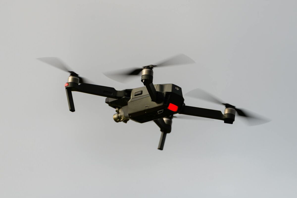
A typical drone aerial mapping mission involves three phases. First, a pilot flies the drone on either a pre-planned grid mission or a freehand orbit, capturing photos or video with a known flight altitude and camera angle. Second, telemetry data — GPS coordinates, altitude, and gimbal angle — is recorded alongside each frame, giving the software a rough position for every image. Third, the imagery and telemetry are uploaded to processing software that runs a structure-from-motion (SfM) algorithm, matching thousands of overlapping pixels across frames to triangulate 3D point positions and produce a dense point cloud.
The USGS National Geospatial Program maintains standards for aerial survey data used in government and infrastructure applications, and many commercial drone workflows are designed to meet or exceed those benchmarks. The FAA's UAS Integration framework governs the Part 107 remote pilot certifications required for commercial aerial mapping in U.S. airspace.
For a deeper introduction to drone-specific workflows, see our drone mapping guide.
What are the main methods used in aerial mapping?
The three primary methods are photogrammetry, videogrammetry, and LiDAR. Photogrammetry uses still images captured in a structured pattern; videogrammetry extracts frames from continuous drone video; LiDAR fires laser pulses to measure direct distances and build point clouds. Each method produces similar outputs but differs in equipment cost, capture workflow, and ideal use case.
Photogrammetry is the most widely used aerial mapping method for commercial drones. The drone flies a grid or crosshatch pattern at a consistent altitude, capturing images with 70–80% front and side overlap. Software like Agisoft Metashape, Pix4D, or cloud-based platforms ingests those images and runs SfM and multi-view stereo (MVS) algorithms to produce orthomosaics, DEMs, and 3D meshes. The structured capture is reliable but requires pre-mission planning and is less flexible for irregular scenes. A newer approach, videogrammetry, extracts frames from continuous video instead, eliminating the need for a pre-planned grid mission — SkyeBrowse pioneered this for public safety, enabling responders to fly a natural orbit and get a 3D map in minutes.
LiDAR (Light Detection and Ranging) attaches a laser scanner to the drone to emit pulses and measure time-of-flight to the ground. LiDAR penetrates vegetation canopy and works in low-light conditions, making it valuable for forestry, corridor mapping, and elevation modeling under tree cover. It is substantially more expensive than camera-based methods and requires heavier payload drones. For most construction, public safety, and inspection workflows, photogrammetry or videogrammetry offers sufficient accuracy at far lower cost. See our drone LiDAR guide for a full breakdown of when laser scanning justifies the added cost.

What data products does aerial mapping produce?
Aerial mapping produces four main deliverable types: orthomosaics (geometrically corrected 2D aerial images), digital elevation models (DEMs, which capture terrain height), point clouds (collections of 3D coordinate measurements), and textured 3D meshes. In practice, these outputs map to specific workflows: orthomosaics for site plans and progress tracking, point clouds for volumetric analysis and earthwork calculations, and 3D meshes for stakeholder presentations, courtroom evidence, and immersive inspections.
An orthomosaic (or orthophoto) is a stitched, geometrically corrected aerial image where every pixel has a real-world map coordinate. Unlike a raw aerial photo, an orthomosaic is free of perspective distortion, meaning distances and areas can be measured directly. GeoTIFF is the standard export format for GIS integration. Our orthomosaic guide covers how these are generated and interpreted.
A digital elevation model (DEM) captures surface height across a mapped area. Two sub-types matter: a Digital Surface Model (DSM) captures the top of all objects including buildings and trees; a Digital Terrain Model (DTM) filters those out to show bare earth. DEMs are essential for earthwork volume calculations, flood modeling, and infrastructure design. The USGS 3D Elevation Program maintains the national DEM baseline for the United States.
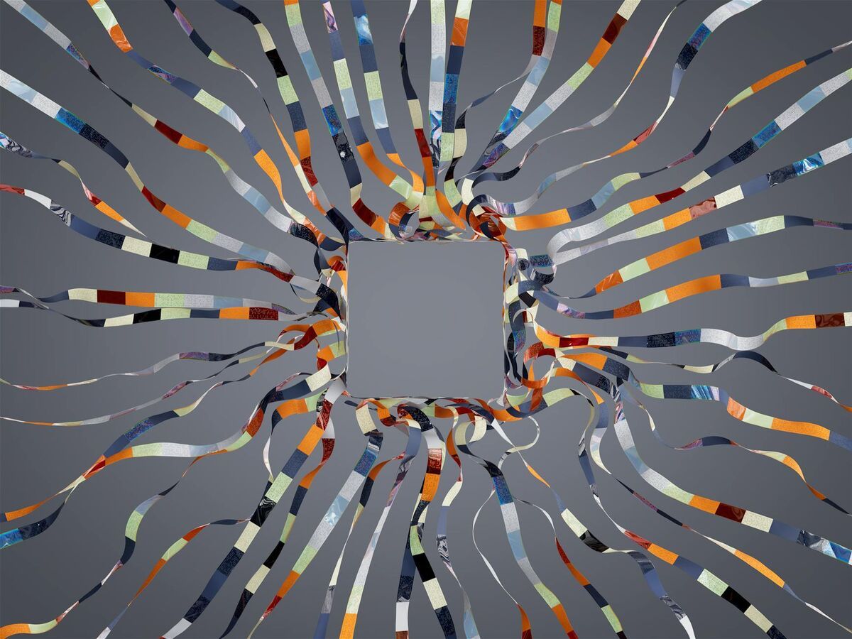
A point cloud is the raw 3D coordinate output before it is converted into a mesh or surface. Point clouds are exported in LAZ or LAS format and can be loaded into CAD, GIS, or forensic analysis tools. A 3D mesh (GLB, OBJ, or similar format) is a surface draped over the point cloud with photographic texture applied — it is the deliverable used for immersive walkthroughs, courtroom presentations, and virtual site inspections.
Which industries rely on aerial mapping services?
Construction, public safety, insurance, surveying, agriculture, and utilities all rely on aerial mapping services. Each sector values different outputs: construction teams track earthwork volumes with DEMs; law enforcement documents crash scenes with 3D models; insurance adjusters use orthomosaics for damage assessment; surveyors use point clouds for boundary and topographic work.
Construction and engineering teams use drone mapping for site progress monitoring, cut-and-fill volume calculations, as-built documentation, and BIM coordination. Weekly orthomosaics of a jobsite make it easy to compare planned versus actual earthwork and catch deviations early. See our guide to construction progress monitoring for a detailed look at how drone flights integrate with project management workflows.
Public safety agencies — police, fire, and emergency management — use aerial mapping for accident reconstruction, crime scene documentation, tactical planning, disaster response, and search-and-rescue operations. Speed is critical in these workflows; video-based platforms that process in minutes rather than hours are particularly valued. Over 1,200 agencies worldwide use SkyeBrowse for exactly this reason.
Insurance and property professionals use aerial mapping to document roof damage, hail impact patterns, and catastrophic loss events. Orthomosaics and 3D models provide objective, court-admissible evidence for claims disputes. Drone-based coverage replaces dangerous ladder climbs and reduces inspection time per property from hours to minutes.
Agriculture uses aerial mapping for crop health monitoring via multispectral NDVI maps, irrigation planning, and field boundary delineation. Utilities use drone inspection services for transmission line inspections, pipeline corridor mapping, and infrastructure asset management. See our drone mapping software guide for a breakdown of platform options across these sectors.
How does aerial mapping accuracy work, and what affects it?
Accuracy ranges from general reference (2–6 inches) to survey-grade (0.1 inch) depending on processing tier and capture method. The three main levers are ground sampling distance (GSD — the real-world size of one image pixel), the number and placement of ground control points (GCPs), and the processing algorithm's quality settings.
Flying lower increases GSD and therefore resolution, but also increases flight time for large areas. A drone flying at 100 meters with a 20MP camera typically achieves a GSD of 2–4 cm/pixel. Flying at 50 meters roughly doubles the resolution. The USGS 3D Elevation Program maintains national elevation accuracy benchmarks that inform many commercial drone mapping workflows.
Without GCPs, accuracy is limited by the onboard GPS — typically 1–3 meters horizontal. Adding 4–6 well-distributed GCPs can reduce horizontal error to 2–5 cm on a professional mapping mission. Some drone platforms use Real-Time Kinematic (RTK) or Post-Processing Kinematic (PPK) GPS receivers to achieve centimeter-level georeferencing without physical markers. SkyeBrowse accepts DJI .SRT and Autel .ASS telemetry files to improve georeferencing even when flying without GCPs.
For a complete walkthrough of when and how to place ground control points, see our GCP guide.
How does SkyeBrowse simplify aerial mapping with video?
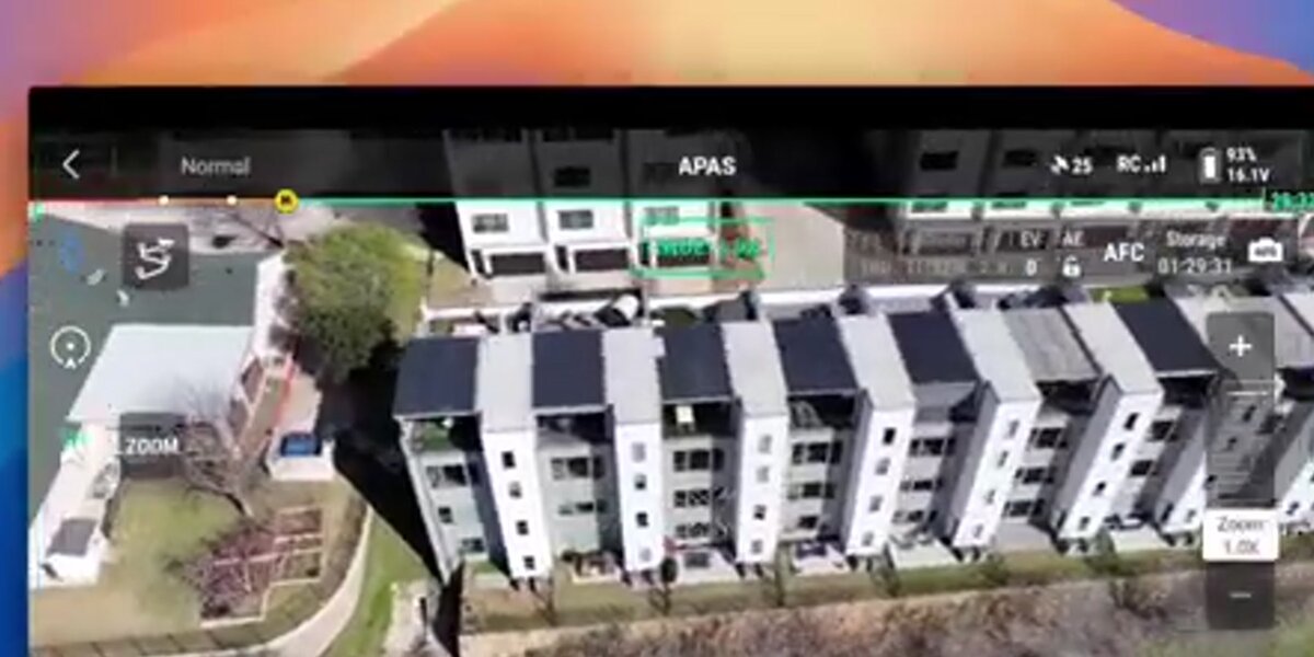
SkyeBrowse is a cloud-based videogrammetry platform that turns ordinary drone video into georeferenced 3D maps and orthomosaics without requiring a planned grid mission. Pilots upload .MP4 or .MOV footage alongside telemetry data to app.skyebrowse.com, and the platform returns an interactive 3D model, orthomosaic GeoTIFF, and LAZ point cloud — typically within minutes for a standard scene.
The key operational advantage is flexibility. Traditional aerial mapping software requires a structured nadir (straight-down) flight grid that must be planned before launch. SkyeBrowse's videogrammetry engine processes video captured at any angle — nadir, oblique, or a combination — making it practical for emergency scenes where there is no time to program waypoints, for complex structures that benefit from multi-angle capture, and for any operator who needs results faster than a full photogrammetry pipeline allows.
SkyeBrowse offers three processing tiers calibrated to different accuracy needs. The Lite tier (2–6 inch accuracy) is suitable for situational awareness and general documentation. The Premium tier (0.25 inch, 8K resolution) meets the demands of professional survey and reconstruction work. The Premium Advanced tier (0.1 inch, 16K resolution with AI moving-object removal) is designed for forensic-grade deliverables where the highest precision matters.
Exports include GeoTIFF orthomosaics for GIS workflows, GLB meshes for 3D visualization, and LAZ point clouds for CAD and BIM. The platform runs on AWS GovCloud with FedRAMP Moderate Authorization, making it suitable for government agencies with strict data residency requirements. Pricing starts at $99 per model credit for Premium processing; volume and agency plans are available at skyebrowse.com/pricing-premium.
FAQ
What is aerial mapping used for?
Aerial mapping is used across construction, public safety, agriculture, insurance, surveying, and environmental management. Common outputs include orthomosaics for site progress tracking, DEMs for earthwork calculations, and 3D models for accident reconstruction, disaster response, and infrastructure inspection. See our drone mapping guide for industry-specific workflow details.
How accurate is drone aerial mapping?
Accuracy ranges from general reference (2–6 inches) to survey-grade (0.1 inch) depending on processing tier and capture method. Without GCPs, typical consumer drone missions sit at the lower end of that range. Adding 4–6 well-distributed GCPs or using an RTK drone pushes accuracy to 2–5 cm. SkyeBrowse's Premium Advanced tier achieves approximately 0.1 inch accuracy — see the ground control points guide for GCP placement strategy.
What is the difference between photogrammetry and videogrammetry in aerial mapping?
Photogrammetry reconstructs 3D geometry from overlapping photos captured on a grid flight. A newer approach, videogrammetry, extracts frames from continuous video instead — SkyeBrowse uses this to let responders fly a freehand orbit and get a 3D model in minutes. For a full technical breakdown of how the two methods compare on accuracy, workflow, and coverage area, see our aerial photogrammetry guide.