Drone Mapping Software Video to 2D maps and 3D models in minutes
Fly any drone, upload the video, and get a survey-grade orthomosaic and 3D model without ground control points or specialists. Free to start.
- Quick results
- No credit card required
- Cancel anytime
Trusted by agencies that keep our country safe







What is drone mapping and how does SkyeBrowse do it?
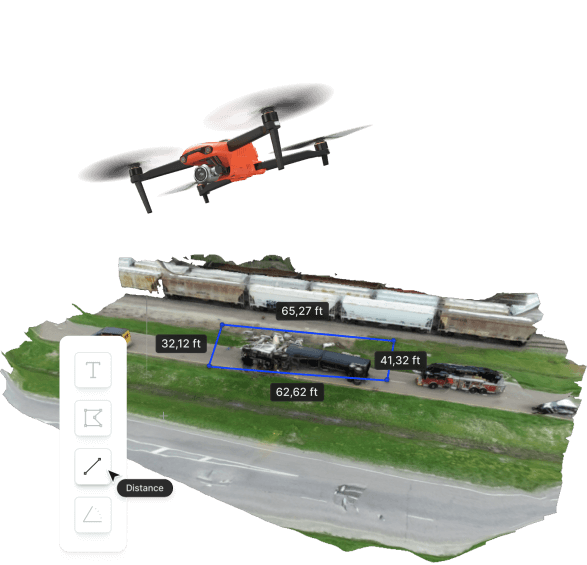
Drone mapping is the process of flying a drone over a site, capturing imagery of it from the air, and processing that imagery into a measurable output: a 2D orthomosaic map, a 3D model, or both. The map preserves real distances, so anything you measure on screen matches what you would measure on the ground.
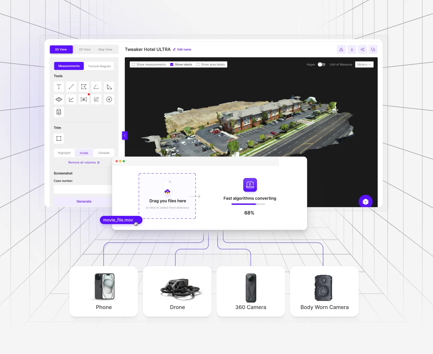
SkyeBrowse is drone mapping software that builds those outputs from video instead of photos. Fly one continuous pass, upload the MP4 or MOV file to the cloud, and the platform returns a textured 3D model with an auto-generated top-down orthomosaic. Processing runs at about one minute per minute of video, so most models are ready in under 5 to 10 minutes after upload. Everything happens in the browser at app.skyebrowse.com with no desktop software to install.
The platform grew out of university research into faster accident reconstruction and is now used by more than 1,200 public safety and enterprise agencies. The mission behind it is to make specialist-grade mapping something any drone pilot can do on the first flight.
New to the field? Start with the complete drone mapping guide for capture methods, regulations, and cost expectations, then come back here for how the software works.
How is videogrammetry different from photogrammetry?
Most drone mapping software uses photogrammetry. SkyeBrowse uses a patented videogrammetry process. Both reconstruct a scene from overlapping views, and the difference is in what you capture and how long you wait.
Photogrammetry
Hundreds or thousands of overlapping still photos.
- Capture is slower because every photo needs the right overlap.
- Processing takes hours or days on a workstation or paid cloud queue.
- Survey-grade results usually depend on ground control points, a trained specialist, and post-processing.
Videogrammetry
Frames pulled from a single continuous video.
- Capture is one flight and one file, from an automated mission or a manual pass.
- Cloud processing finishes in minutes, roughly one minute per minute of video.
- Validated in studies to meet or exceed photogrammetry and laser scanning accuracy without ground control points.
Because the source is video, the platform only processes video for model generation. Photos can be attached to a model as annotations for extra documentation, and the auto-generated image walkthrough lets you step through frames of the original footage inside the 3D scene.
Can I map with any drone?
Yes. Universal Upload accepts MP4, MOV, INSV, and OSV video from any source: DJI, Autel, Skydio, and Parrot drones flown manually, plus smartphones, action cameras, 360 cameras, and body worn cameras. If a drone records video, it can produce a SkyeBrowse map. Turn on GPS subtitle recording in the drone settings and upload the SRT or ASS file with the video to georeference the model automatically.
For supported aircraft, the SkyeBrowse Flight App automates the capture. SkyeBrowse mode flies a two-orbit pattern for scenes under an acre, and WideBrowse mode flies a grid for larger areas. Fully supported drones include:
- DJI Matrice 4E and 4T, Matrice 400, and M4TD with the DJI RC Pro
- DJI Matrice 30, 30T, 300 RTK, and 350 RTK
- DJI Mavic 3 Enterprise and Mavic 3 Thermal
- DJI Mini 3 Pro and Mini 4 Pro with the DJI RC Pro
- DJI Mavic 2 series, Phantom 4 series, and M210
- Autel Evo II V1 and V2 on the iOS app
Some consumer models such as the DJI Mini 2, Mini 2 SE, Mavic Air, and Air 2S run Orbit missions only, and drones outside the list fly manually with the native app before uploading. Compatibility depends on the controller and operating system as much as the aircraft, so confirm your setup on the supported drones list before a job. Shopping for a mapping drone? Read our guide to choosing a surveying drone and the DJI Matrice 4E and 4T mapping workflow.
What outputs does drone mapping software produce?
One upload produces the deliverables a mapping job usually needs. Every plan includes the orthomosaic and basic measurement tools, and paid tiers unlock the rest on the same model.
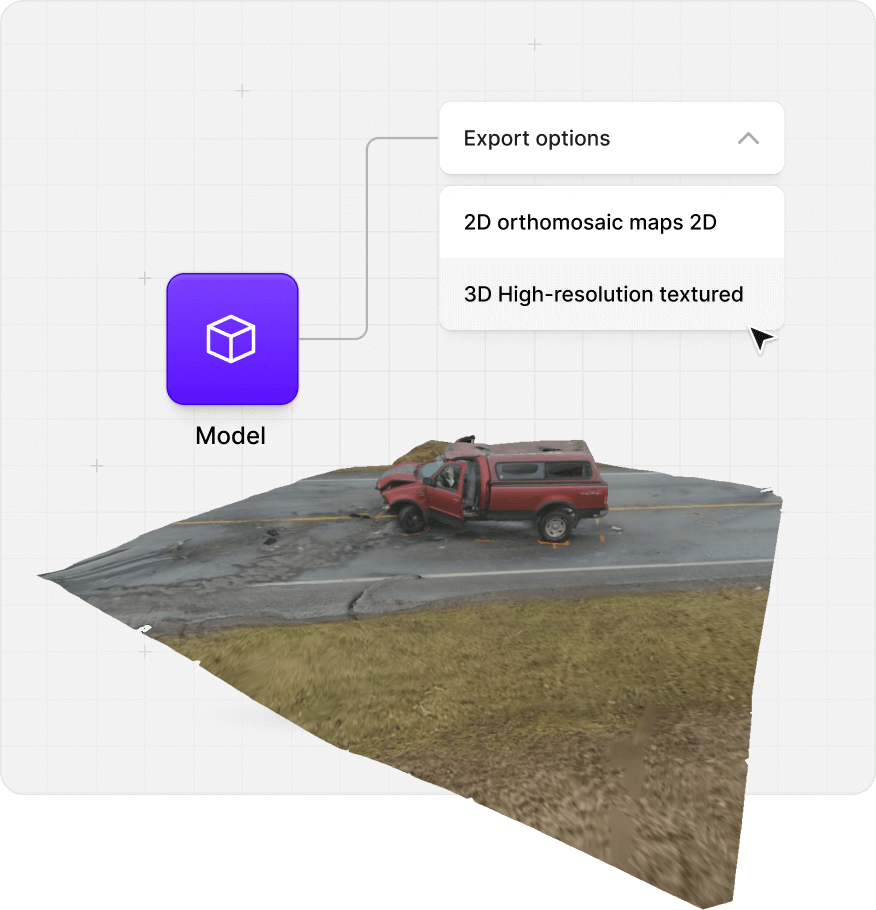
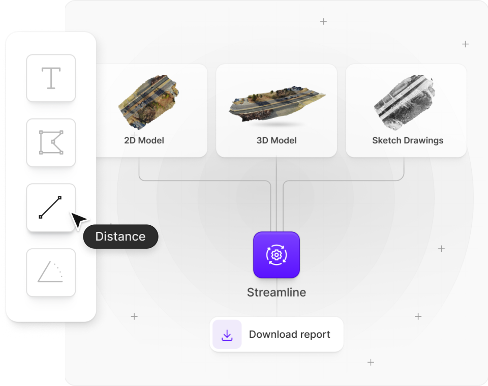
- 2D orthomosaic map. A top-down, distortion-corrected map is generated automatically for every model on every plan. Export it as GeoTIFF for GIS software.
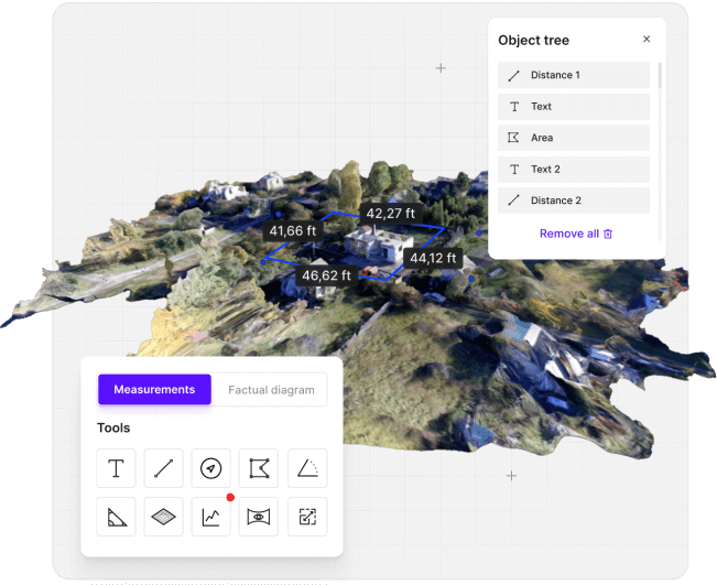
- Textured 3D model. Orbit, pan, use Bird View for aerial movement, or Walk Mode to move through the scene at eye level. Measure distance, area, angle, and volume directly on the surface.
- Elevation tools. Topographic contour lines with adjustable spacing, an elevation heat map, and slope and profile analysis on the Public Safety & Enterprise plan. SkyeBrowse produces a DSM; export LAZ for ground classification in third-party software.
- Exports. LAZ point clouds, GLB, OBJ, and USDZ meshes, GeoTIFF, and CAD-ready DXF or GeoJSON from AI Site Plan on Pro and Public Safety & Enterprise models.
- Deliverables. AI floor plans and AI site plans on Pro and Public Safety & Enterprise models, sketch drawings and factual diagram PDFs on Public Safety & Enterprise, plus flythrough videos, screenshots, and public share links that open in any browser.
Viewing, measuring, sharing, and exporting never consume a model. Only final processing does, and a failed model is returned to your balance.
How accurate is drone mapping?
Accuracy in drone mapping comes down to two things: how well the model preserves relative distances inside the scene, and how closely it is tied to real-world coordinates. SkyeBrowse delivers survey-grade, court-admissible relative and absolute accuracy without ground control points, and the level scales with the plan you process on.
| Plan | Accuracy | Processing | Model storage |
|---|---|---|---|
| Freemium | Basic resolution | Standard | 30 days, 2 concurrent models |
| Commercial and Pro models | 0.5 inch | 8K premium | 3 months (Commercial) or 1 year (Pro) |
| Public Safety & Enterprise | 0.1 inch | 16K ultra | 5 years guaranteed |
| Lite (legacy, closed to new signups) | About 2 to 6 inches | Standard | Never archived while subscribed |
RTK-enabled drones improve positional accuracy, and a measuring tape or other known-size object placed in the scene gives an easy verification check, but neither is required to reach survey-grade results. Models without GPS data can be scaled manually with the Scale tool. For the field methods behind these numbers, including RTK versus PPK, see the surveying drone guide.
How do you map large areas with a drone?
An orbit covers a single structure or a scene under an acre. Anything bigger calls for a grid. WideBrowse in the Flight App plans and flies the grid automatically on fully supported drones, with three options for harder sites:
- Cross Grids: a perpendicular second pass for better lateral coverage and detail on structured sites.
- Side Scan: an orbital pass that captures facades and high-rise verticals with precision.
- Previous Flights: reuse the location and settings of a completed mission to repeat a survey.
Larger sites can also be split across multiple videos in one model: up to 3 videos of 10GB each on Commercial and Pro, and up to 10 videos of 100GB each on Public Safety & Enterprise. The 3D Overlay tool combines separate models, such as a roof and an interior, into a single scene. Drones limited to Orbit mode by SDK restrictions, like the Mini 2 and Air 2S, map large areas with a manual grid flight and Universal Upload. Read more about large area mapping.
Who uses drone mapping?
The same upload serves very different jobs. The plan and viewer tools decide what the finished model is for.
Public safety
Accident reconstruction, crime scene documentation, fire pre-plans, and court presentation with chain of custody and CJIS compliance on the Public Safety & Enterprise plan.
Public safety drone mapping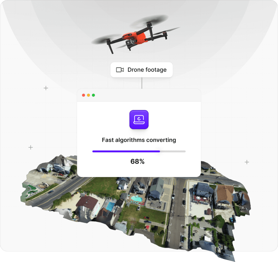
Inspections
Roofs, facades, towers, and infrastructure captured in one flight, then measured for distance, area, and angle inside the browser.
Inspections drone mapping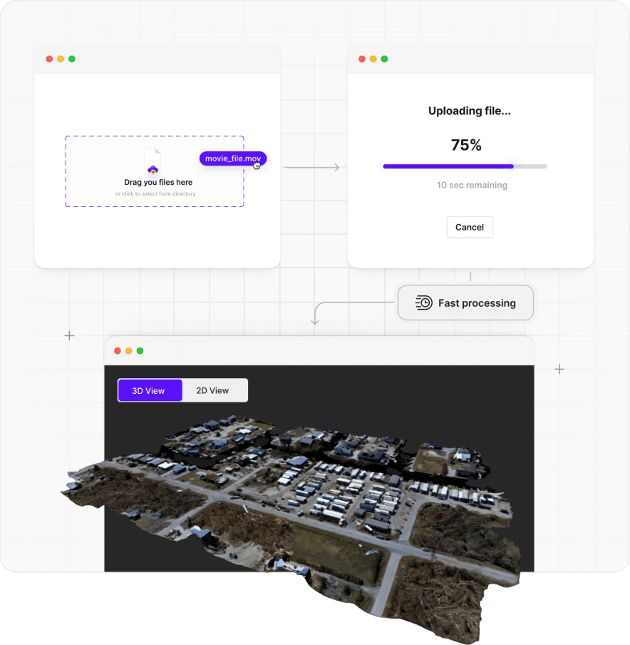
Large area mapping
WideBrowse grid flights and multi-video models cover sites larger than an acre, with orthomosaics and elevation tools for the whole area.
Large area mapping drone mapping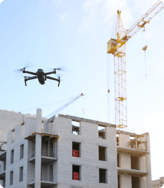
Construction
Progress documentation, stockpile volumes, and earthwork quantities measured directly on the model and exported to CAD and GIS.
Construction drone mappingHow much does drone mapping software cost?
SkyeBrowse prices by finished model rather than by seat, so a whole team can share one plan. Unused models roll over while the subscription stays active, and practice models never count.
Freemium
Free
Unlimited uploads, 2 concurrent models, 30-day storage, 2GB per upload. Orthomosaic, distance, draw, annotate, and image walkthroughs. No exports.
Commercial model
$24.99 per model
$19.99 billed annually. 8K processing at 0.5 inch accuracy, 3 months of storage, up to 3 videos per model, up to 5 users. Exports and AI tools excluded.
Pro model
$49.99 per model
$39.99 billed annually. Everything in Commercial plus 1 year of storage, all exports, AI Floor Plan, AI Site Plan, Line of Sight, Sun & Shadow, topographic maps, and co-branding.
Public Safety & Enterprise
$199 per model per year
16K processing at 0.1 inch accuracy, 5-year storage, up to 10 videos per model, unlimited users, full CJIS compliance and chain of custody, factual diagrams, and every tool.
Free accounts that have never paid can process their first Commercial model for $5. Agencies comparing options can request a Pilot Program trial of Public Safety & Enterprise. Full feature comparison on the pricing page.
Drone mapping FAQ
What is drone mapping used for?
Drone mapping turns aerial footage into a measurable 2D map or 3D model of a site. Public safety agencies use it for accident reconstruction, crime scene documentation, fire pre-plans, search and rescue, and court presentation. Construction, insurance, and inspection teams use it for progress tracking, stockpile volumes, roof and facade inspections, and claims documentation.
How much does drone mapping software cost?
SkyeBrowse starts free. The Freemium plan includes unlimited uploads, 2 concurrent models, and the basic viewer tools. Paid plans are priced per model with no seat fees: a Commercial model is $24.99 ($19.99 billed annually), a Pro model with exports and AI tools is $49.99 ($39.99 billed annually), and Public Safety & Enterprise is $199 per model per year. Eligible free accounts can process their first Commercial model for $5.
What is the best drone for mapping?
Any drone that records MP4 or MOV video works with SkyeBrowse through Universal Upload, including DJI, Autel, Skydio, and Parrot aircraft flown manually. For automated Orbit and WideBrowse grid missions, the SkyeBrowse Flight App fully supports drones such as the DJI Matrice 4E and 4T, Matrice 30 and 30T, Matrice 300 and 350 RTK, Mavic 3 Enterprise and Thermal, Mini 4 Pro with the DJI RC Pro, and the Autel Evo II V1 and V2 on iOS. RTK drones improve positional accuracy but are not required for survey-grade results. Check the supported drones list before buying.
Is there free drone mapping software?
Yes. A free SkyeBrowse account processes unlimited drone or phone videos into 3D models with an auto-generated orthomosaic, distance measurement, drawing, annotations, and image walkthroughs. Free models are kept for 30 days, limited to 2 at a time and a 2GB file per upload, and cannot be exported. Paid models add higher accuracy, longer storage, and exports.
How accurate is drone mapping without ground control points?
SkyeBrowse reaches survey-grade relative and absolute accuracy without ground control points through its videogrammetry algorithms, validated in studies against traditional photogrammetry and laser scanning. Commercial and Pro models are processed at 8K with 0.5 inch accuracy. Public Safety & Enterprise models are processed at 16K with 0.1 inch accuracy. Uploading the drone's GPS subtitle file georeferences the model, and a known-size object in the scene gives an extra verification check.
Should I buy drone mapping software or hire a drone mapping service?
A service delivers a finished map for one visit and depends on the provider's schedule. Software puts the capability in your own team: fly the scene the moment it happens, upload the video, and have a measurable model in minutes at a fixed per-model price. Agencies that respond to incidents, and firms that map the same sites repeatedly, usually save time and money by processing in-house. SkyeBrowse also offers a Pilot Program trial and quotes for agencies comparing the two.
Can I use drone video for 3D mapping instead of photos?
Yes. SkyeBrowse is built around video. Record one continuous MP4 or MOV flight, upload it, and the cloud processes about one minute of video per minute, with most models ready in under 5 to 10 minutes. Photos are not used to build the model, although you can attach them as annotations.
Does drone mapping software work with a phone or indoors?
Universal Upload accepts video from smartphones, action cameras, 360 cameras in INSV or OSV format, and body worn cameras, so a scene can be captured without a drone. An Interior Mapping toggle optimizes processing for indoor spaces, and Pro and Public Safety & Enterprise models can generate an AI floor plan in seconds.
Keep reading about drone mapping
- The complete drone mapping guide
Capture methods, accuracy expectations, regulations, and what drone mapping costs.
- Free drone mapping software compared
Free plan limits, output quality, and upgrade costs across the main tools.
- Choosing a surveying drone
Which specs matter for mapping, RTK versus PPK, and the leading aircraft.
- DJI Matrice 4E and 4T mapping workflow
Flight App support, 4E versus 4T, and how the Matrice 4 compares to the M350 RTK.
Map your first site today
Create a free account, upload one drone or phone video, and open a measurable 3D model in minutes. Agencies that need CJIS compliance and 0.1 inch accuracy can request a quote for Public Safety & Enterprise.
Read real reviews from our satisfied customers

I was very impressed by the ease of use. Great measurement accuracy and excellent customer service.
DFW Airport Police
So far it's really easy to use and much more user friendly than Pix4D
Oceanside Fire Department
This is a game changer. I wish this was developed 3 to 4 years ago.
Los Angeles District Attourney's Office


